

Most Popular Walks this Month
Enjoy the walks by being guided by the app


-
4.2 miles/6.8 km - Easy
Constantine to Scott's Quay
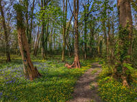
Constantine to Scott's Quay
4.2 miles/6.8 km - Easy
A circular walk at Constantine through woods and to the creek on the Helford river where a bustling quarrying and mining industry operated in Victorian times but have now been reclaimed by nature.
-
5 miles/8 km - Easy-moderate
St Austell, Clay Trails and Menacuddle Well

St Austell, Clay Trails and Menacuddle Well
5 miles/8 km - Easy-moderate
A circular walk in china clay country, including a trail laid on the trackbed of a mineral railway from St Austell to the Cornish Alps and one of Cornwall's most picturesque holy wells.
-
3.4 miles/5.5 km - Easy-moderate
Luxulyan Valley circular

Luxulyan Valley circular
3.4 miles/5.5 km - Easy-moderate
A circular walk following the leats and horse-drawn tramways through the World Heritage site of the Luxulyan Valley to the massive viaduct which carried the tramways towards Newquay and water to winch the trams up the valley with a huge waterwheel, recommended in guidebooks as early as the 1920s "as one of the most glorious walks in all Cornwall".
-
6.1 miles/9.8 km - Moderate
St Just-in-Roseland to St Mawes

St Just-in-Roseland to St Mawes
6.1 miles/9.8 km - Moderate
A circular walk on the Roseland peninsula to St Mawes from the subtropical gardens of St Just church, along Carrick Roads where Europe's only fishery entirely under sail catch oysters using the traditional methods that have sustained their stocks.
-
3.8 miles/6.1 km - Moderate
Helford and Frenchman's Creek

Helford and Frenchman's Creek
3.8 miles/6.1 km - Moderate
A circular walk through the wooded valleys of the Helford River including the most famous - Frenchman's Creek - which is still as pristine as when it inspired Daphne du Maurier's novel
-
5.2 miles/8.4 km - Moderate-strenuous
Rough Tor and Brown Willy

Rough Tor and Brown Willy
5.2 miles/8.4 km - Moderate-strenuous
A mostly circular walk to Cornwall's two highest tors, passing prehistoric remains including the holy well, summit cairns and settlements.
-
5.9 miles/9.5 km - Moderate
Carn Brea and the Great Flat Lode

Carn Brea and the Great Flat Lode
5.9 miles/9.5 km - Moderate
A circular walk along the Great Flat Lode, where the Basset family made their fortune from the rich mineral reserves, to Carn Brea where they built a hunting lodge balanced on a tor in the style of a castle.
-
3.6 miles/5.8 km - Easy-moderate
Lost Church and Perranporth dunes

Lost Church and Perranporth dunes
3.6 miles/5.8 km - Easy-moderate
A circular walk on the highest dune system in Britain to the chapel dating from Celtic times which was lost in the dunes for nearly 1000 years.
-
2.7 miles/4.4 km - Easy-moderate
Gwennap Pit to Carn Marth (short version)

Gwennap Pit to Carn Marth (short version)
2.7 miles/4.4 km - Easy-moderate
A circular walk at Carn Marth with panoramic views right across mid-Cornwall to Falmouth and the Roseland, the Cornish Alps and Bodmin Moor, and St Agnes and Trevose Head
-
5.1 miles/8.3 km - Easy-moderate
Deerpark to Herodsfoot

Deerpark to Herodsfoot
5.1 miles/8.3 km - Easy-moderate
A woodland walk in what's likely to have been a mediaeval deer park to the site of Cornwall's second-largest gunpowder manufacturing operation, which despite exploding several times was sufficiently successful to give rise to a nearby sister site known as Trago Mills.


Download the iWalk Cornwall app and use the QR scanner within the app to find out more about any of the walks above.
