

Rock beach
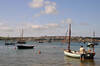
The sandy beach at rock stretches towards Brea Hill and at low tide it joins with Daymer Bay to form a huge expanse of sand. The area around the slipways is used to launch and retrieve boats (by 4 x 4 vehicles pulling trailers when the tide is out).
Since 2015, a large strip of the dunes near Brea Hill has been washed away by the sea resulting in sandy cliff edges that are prone to collapse. The coast path has been moved away from the edge. The sand from the demolished dunes has extended the spit from Rock beach further into the channel which has whittled away some of St George's Cove on the opposite side and is starting to push the channel into the edge of the Doom Bar at Harbour Cove.
- Tide times
- Beach info
- Map
- Dogs: allowed all year
Circular walks visiting Rock beach
-
6.7 miles/10.9 km - Easy
Rock to St Minver

Rock to St Minver
6.7 miles/10.9 km - Easy
A circular walk from Rock along the sand dunes to St Enodoc church, once buried in the sand, and across fields to the mediaeval church of St Minver, returning via 3 pubs and the brewery where "Doom Bar" was first produced.
-
5.8 miles/9.4 km - Easy-moderate
Rock to Polzeath

Rock to Polzeath
5.8 miles/9.4 km - Easy-moderate
A circular walk across the dunes and headland between Rock and Polzeath, returning via St Enodoc Church, where Sir John Betjeman is buried.
-
6.4 miles/10.3 km - Easy-moderate
Daymer Bay to Padstow

Daymer Bay to Padstow
6.4 miles/10.3 km - Easy-moderate
A figure-of-8 walk from Daymer Bay thorough the dunes to Rock, passing the once-buried St Enodoc church, before crossing on the ferry to Padstow, and returning along three miles of sandy beaches.


Download the iWalk Cornwall app and use the QR scanner within the app to find out more about any of the walks above.
There are also walks further down the Camel Estuary around Polzeath and on the other side around Padstow.