Evening walks in Cornwall

Enjoy the walks by being guided by the app
The following walks are the ones more likely to be suitable for an evening walk. They are all under 4 miles so can be done in around a couple of hours (depending on your walking speed). Check the sunset time before setting off. The time from sunset to twilight is about 35 mins in April and August, rising to about 45 mins in mid-June.
-
1.8 miles/2.9 km - Easy
The Camelford Way
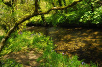
The Camelford Way
1.8 miles/2.9 km - Easy
A short and easy circular walk from Camelford along the wildflower-rich meadows of the River Camel to the clapper bridge at Fenteroon, returning through the fields with views over the Camel Valley.
-
2.7 miles/4.3 km - Easy
Hayle and The Towans
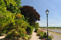
Hayle and The Towans
2.7 miles/4.3 km - Easy
A circular walk on the Towans at Hayle, where Cornwall's beam engines were cast using sand from a prehistoric lagoon when West Penwith was an island.
-
3.4 miles/5.5 km - Easy
Botallack Head and Levant Mine
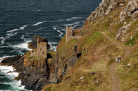
Botallack Head and Levant Mine
3.4 miles/5.5 km - Easy
A circular walk around Cornwall's most iconic mining remains, used for the filming of the BBC's Poldark series
-
3.5 miles/5.6 km - Easy
Bude to Northcott Mouth
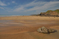
Bude to Northcott Mouth
3.5 miles/5.6 km - Easy
A circular walk past the historic Sea Pool to Crooklets beach and along Maer cliff to the beach at Northcott Mouth, where the shipwreck of the SS Belem is exposed at low tide.
-
3.7 miles/6 km - Easy
Polzeath to St Enodoc Church
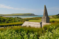
Polzeath to St Enodoc Church
3.7 miles/6 km - Easy
A circular walk along the coast from Polzeath past a number of small coves to the vast sandy beach at Daymer Bay, returning through the dunes past St Enodoc Church which was once so deeply buried in the sand that entrance for services was through the roof.
-
3.9 miles/6.3 km - Easy
Bude Canal and Coast
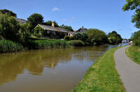
Bude Canal and Coast
3.9 miles/6.3 km - Easy
A figure-of-8 walk at Bude where the demand for lime-rich sand could not even be met by a reported 4000 horses a day, and so a 35-mile canal was built to transport it to the Tamar Valley.
-
2.2 miles/3.6 km - Easy-moderate
West Pentire and Polly Joke
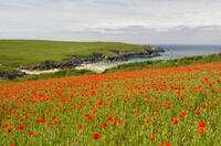
West Pentire and Polly Joke
2.2 miles/3.6 km - Easy-moderate
A circular walk through the poppy fields of West Pentire to Polly Joke beach, returning over the headland to the pub that was a cowshed until the mid-20th Century.
-
2.4 miles/3.8 km - Easy-moderate
Gwithian and Upton Towans
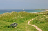
Gwithian and Upton Towans
2.4 miles/3.8 km - Easy-moderate
A circular walk around the nature reserve in the sand dunes that was once the National Explosives Works where girls manufactured dynamite from nitroglycerine.
-
2.4 miles/3.9 km - Easy-moderate
Tintagel, Church and Castle
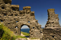
Tintagel, Church and Castle
2.4 miles/3.9 km - Easy-moderate
A short circular walk exploring some of the historic sites in Tintagel including King Arthur's Castle and Merlin's Cave, the Old Post Office, and the ancient parish church on the cliffs.
-
3 miles/4.9 km - Easy-moderate
Baker's Pit and Rogers' Tower
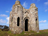
Baker's Pit and Rogers' Tower
3 miles/4.9 km - Easy-moderate
A circular walk from the Bakers Pit nature reserve to an Iron Age hillfort where the remains of prehistoric roundhouses were seen as a convenient source of stone for a folly built in the era when the Poldark novels are set.
-
3.0 miles/4.9 km - Easy-moderate
St Agnes Beacon and Wheal Coates
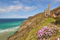
St Agnes Beacon and Wheal Coates
3.0 miles/4.9 km - Easy-moderate
A circular walk between St Agnes Head and the engine houses of Wheal Coates via St Agnes Beacon, with spectacular panoramic views
-
3.1 miles/5 km - Easy-moderate
Padstow to Harbour Cove
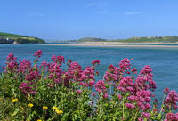
Padstow to Harbour Cove
3.1 miles/5 km - Easy-moderate
A circular walk through Padstow's mediaeval network of streets to the church, the Elizabethan Manor at Prideaux Place and Tregirls Farm, with panoramic views of the estuary, returning along a mile of sandy beaches.
-
3.4 miles/5.4 km - Easy-moderate
Wheal Maid and Poldice Valley
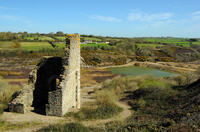
Wheal Maid and Poldice Valley
3.4 miles/5.4 km - Easy-moderate
A circular walk in the area described in Victorian times as the richest square mile anywhere on Earth
-
3.6 miles/5.8 km - Easy-moderate
St Newlyn East and Lappa Valley
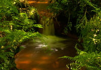
St Newlyn East and Lappa Valley
3.6 miles/5.8 km - Easy-moderate
A circular walk from St Newlyn East through the woods of the Lappa Valley where the Steam Railway now encompasses what was one of the most famous mines in Cornwall during Victorian times and the riverbeds are still stained red.
-
3.8 miles/6.1 km - Easy-moderate
St Clement and Malpas
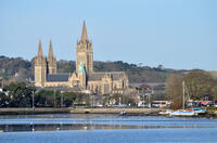
St Clement and Malpas
3.8 miles/6.1 km - Easy-moderate
A circular walk at the confluence of the Truro and Tresillian rivers, once defended by Moresk castle and later where timber for the mines was unloaded and floated as rafts into Truro
-
3.9 miles/6.3 km - Easy-moderate
Land's End
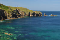
Land's End
3.9 miles/6.3 km - Easy-moderate
A circular walk on the rugged cliffs at the most westerly point of the British mainland with spectacular views and spectacular wildflowers.
-
2.8 miles/4.5 km - Moderate
Two Coombes of Lansallos

Two Coombes of Lansallos
2.8 miles/4.5 km - Moderate
A circular walk from Lansallos to the coves of Lantivet Bay where farmers collected seaweed and sand to improve the soil and smugglers landed French brandy.
-
2.9 miles/4.7 km - Moderate
Polperro harbour and headlands
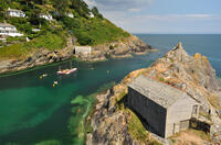
Polperro harbour and headlands
2.9 miles/4.7 km - Moderate
A figure-of-eight walk around the fishing village and headlands surrounding Polperro, passing the net loft perched above the harbour, the Victorian sea pool, the site of the mediaeval chapel and the harbourmaster's route to the lighthouse.
-
2.9 miles/4.7 km - Moderate
Port Quin to Lundy Bay
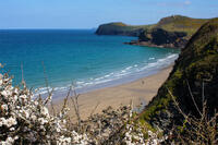
Port Quin to Lundy Bay
2.9 miles/4.7 km - Moderate
A circular walk from the fishing village of Port Quin to the golden sandy beaches of Epphaven Cove and Lundy Bay with spectacular coastal scenery, via the cliff-edge folly on Doyden Point built as a gambling den.
-
3.3 miles/5.3 km - Moderate
Boscastle Headlands
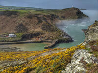
Boscastle Headlands
3.3 miles/5.3 km - Moderate
A circular walk from Boscastle to Pentargon waterfall and Willapark coastguard lookout with magnificent views of the village and harbour from the headlands where, according to legend, the village women once gathered dressed in red to fool a French ship into fleeing from British army redcoats.
-
3.5 miles/5.6 km - Moderate
Padstow town and obelisk
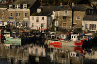
Padstow town and obelisk
3.5 miles/5.6 km - Moderate
A short circular walk from Padstow harbour to the viewpoints at the War Memorial and Victorian obelisk, the Elizabethan Manor at Prideaux Place, and including some pretty backstreets that lie off the main tourist routes.
-
3.5 miles/5.7 km - Moderate
West Pentire to Crantock Beach
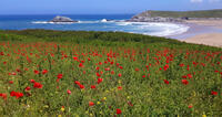
West Pentire to Crantock Beach
3.5 miles/5.7 km - Moderate
A circular walk on the northernmost end of one of Cornwall's largest areas of sand dunes that stretch from Crantock to Perranporth, under which one mediaeval chapel was found and another is said to still be lost.
-
3.6 miles/5.8 km - Moderate
Gribbin Head
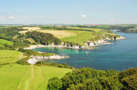
Gribbin Head
3.6 miles/5.8 km - Moderate
A circular walk on the headland near Fowey where Daphne du Maurier lived and formed the basis for scenes in her books.
-
3.8 miles/6.8 km - Moderate
Minions and the Cheesewring

Minions and the Cheesewring
3.8 miles/6.8 km - Moderate
A circular walk around the iconic landmarks at Minions, including The Hurlers stone circles, The Cheesewring and the engine houses of the South Phoenix Mine.
-
3.9 miles/5.8 km - Moderate
Newlyn to Mousehole
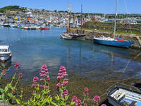
Newlyn to Mousehole
3.9 miles/5.8 km - Moderate
A circular walk at the heart of Cornwall's fishing industry to the village where Stargazy Pie was invented and a candle-lit parade is held each year to celebrate the catch of Tom Bawcock.
-
2.2 miles/3.5 km - Moderate-strenuous
Trebarwith Strand to Backways Cove
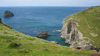
Trebarwith Strand to Backways Cove
2.2 miles/3.5 km - Moderate-strenuous
A short circular walk from the long, sandy beach of Trebarwith Strand to the rugged rocky cove at Backways in which sea foam tornadoes form in windy weather, and returning over the massive headland of Dennis Point with panoramic views of Port Isaac Bay.
-
3.3 miles/5.3 km - Moderate-strenuous
Port Isaac
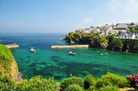
Port Isaac
3.3 miles/5.3 km - Moderate-strenuous
A short circular walk in Doc Martin Country including the pretty fishing village of Port Isaac and the historic beach of Port Gaverne with birds-eye views over the harbour.
Download the iWalk Cornwall app and use the QR scanner within the app to find out more about any of the walks above.


