
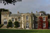
Walks in Cornwall in Rosamunde Pilcher filming locations
Enjoy the walks by being guided by the app


The following walks are in areas that were used for filming TV programmes made from the Rosamunde Pilcher novels.
-
1.9 miles/3 km - Easy
Park Head and Pentire Steps

Park Head and Pentire Steps
1.9 miles/3 km - Easy
A circular walk on Park Head, used as one of the filming locations in the Poldark BBC TV series and with spectacular views over Bedruthan Steps and the Trescore Islands.
-
4.4 miles/7.1 km - Easy
Truro and the old Newham railway

Truro and the old Newham railway
4.4 miles/7.1 km - Easy
A circular walk at Truro along the river, trackbed of the Newham railway and through the historic city centre.
-
2.4 miles/3.8 km - Easy-moderate
Gwithian and Upton Towans

Gwithian and Upton Towans
2.4 miles/3.8 km - Easy-moderate
A circular walk around the nature reserve in the sand dunes that was once the National Explosives Works where girls manufactured dynamite from nitroglycerine.
-
2.5 miles/4 km - Easy-moderate
Bodmin town and beacon

Bodmin town and beacon
2.5 miles/4 km - Easy-moderate
A circular walk to the Beacon Local Nature Reserve, Jail and through Bodmin's historic centre.
-
2.5 miles/4 km - Easy-moderate
Stepper Point and the Doom Bar

Stepper Point and the Doom Bar
2.5 miles/4 km - Easy-moderate
A circular walk overlooking the infamous Doom Bar - from which the internationally popular beer is named - on which hundreds of vessels were wrecked when attempting to navigate into Padstow harbour and many still lie beneath the sands
-
3.0 miles/4.9 km - Easy-moderate
St Agnes Beacon and Wheal Coates

St Agnes Beacon and Wheal Coates
3.0 miles/4.9 km - Easy-moderate
A circular walk between St Agnes Head and the engine houses of Wheal Coates via St Agnes Beacon, with spectacular panoramic views
-
3.1 miles/5 km - Easy-moderate
Padstow to Harbour Cove

Padstow to Harbour Cove
3.1 miles/5 km - Easy-moderate
A circular walk through Padstow's mediaeval network of streets to the church, the Elizabethan Manor at Prideaux Place and Tregirls Farm, with panoramic views of the estuary, returning along a mile of sandy beaches.
-
3.2 miles/5.1 km - Easy-moderate
Lanhydrock Gardens

Lanhydrock Gardens
3.2 miles/5.1 km - Easy-moderate
A fairly short and easy circular walk through Lanhydrock gardens with plenty of picnic spots along the River Fowey that you can combine with a visit to the house.
-
3.7 miles/5.9 km - Easy-moderate
Lerryn River and Tivoli lost gardens

Lerryn River and Tivoli lost gardens
3.7 miles/5.9 km - Easy-moderate
A woodland and riverside walk at Lerryn - thought to be the inspiration for the book The Wind In The Willows - and the lost pleasure gardens of Tivoli Park
-
3.7 miles/5.9 km - Easy-moderate
St Mabyn to Pencarrow House

St Mabyn to Pencarrow House
3.7 miles/5.9 km - Easy-moderate
A fairly easy circular walk from St Mabyn past the church and through rolling countryside to Pencarrow House and its magnificent gardens.
-
3.9 miles/6.3 km - Easy-moderate
Land's End

Land's End
3.9 miles/6.3 km - Easy-moderate
A circular walk on the rugged cliffs at the most westerly point of the British mainland with spectacular views and spectacular wildflowers.
-
3.9 miles/6.3 km - Easy-moderate
Penzance to Newlyn

Penzance to Newlyn
3.9 miles/6.3 km - Easy-moderate
A circular walk at Mount's Bay from the largest port town in the bay to the harbour of Cornwall's largest fishing fleet.
-
4 miles/6.4 km - Easy-moderate
Watergate Bay to Newquay (via bus)

Watergate Bay to Newquay (via bus)
4 miles/6.4 km - Easy-moderate
A one-way coastal walk, made circular via an initial bus journey, from Watergate Bay along the coast path to Newquay, passing the sea caves at Whipsiderry beach, the Iron Age hillfort on Trevelgue head and the beaches of Porth, Lusty Glaze and Tolcarne.
-
4.9 miles/7.9 km - Easy-moderate
Marazion to Perranuthnoe

Marazion to Perranuthnoe
4.9 miles/7.9 km - Easy-moderate
A mostly circular walk to Perranuthnoe beach from one of Britain's most ancient towns - Marazion - burnt down twice by the French and once more in a Cornish rebellion
-
5.4 miles/8.7 km - Easy-moderate
Falmouth and Pendennis Point

Falmouth and Pendennis Point
5.4 miles/8.7 km - Easy-moderate
A circular walk around the thriving town of Falmouth, which didn't exist until Elizabethan times when Sir Walter Raleigh suggested that the largest natural harbour in Europe would be a good place to build a port town.
-
6.2 miles/10 km - Easy-moderate
Widemouth to Bude

Widemouth to Bude
6.2 miles/10 km - Easy-moderate
A circular walk from Widemouth Bay along the Coast Path though the Phillips Point nature reserve to The Storm Tower at Compass Point and then along the Bude Canal to Whalesborough, returning across the fields to Widemouth.
-
6.4 miles/10.3 km - Easy-moderate
Daymer Bay to Padstow

Daymer Bay to Padstow
6.4 miles/10.3 km - Easy-moderate
A figure-of-8 walk from Daymer Bay through the dunes to Rock, passing the once-buried St Enodoc church, before crossing on the ferry to Padstow, and returning along three miles of sandy beaches.
-
2.9 miles/4.7 km - Moderate
Polperro harbour and headlands

Polperro harbour and headlands
2.9 miles/4.7 km - Moderate
A figure-of-eight walk around the fishing village and headlands surrounding Polperro, passing the net loft perched above the harbour, the Victorian sea pool, the site of the mediaeval chapel and the harbourmaster's route to the lighthouse.
-
3 miles/4.9 km - Moderate
Porthcurno to Penberth Cove

Porthcurno to Penberth Cove
3 miles/4.9 km - Moderate
A circular walk with spectacular coastal scenery from Porthcurno to Penberth Cove, passing the famous wobbling boulder of Logan Rock and returning via the escape route from the wartime tunnels which housed one of the world's largest telegraph stations.
-
3.1 miles/5 km - Moderate
Porthgwarra to Minack

Porthgwarra to Minack
3.1 miles/5 km - Moderate
A circular walk to the Minack Theatre, via St Levan's church, St Leven's Holy Well and Porthchapel beach, from Porthgwarra where the beach is accessed via a rock tunnel created by local miners.
-
3.3 miles/5.3 km - Moderate
Readymoney Cove to Polridmouth

Readymoney Cove to Polridmouth
3.3 miles/5.3 km - Moderate
A circular walk in du Maurier country from Readymoney Cove - where she lived in the 1940s - to Polridmouth, where the shipwreck inspired her book Rebecca.
-
3.4 miles/5.4 km - Moderate
Mevagissey to Portmellon

Mevagissey to Portmellon
3.4 miles/5.4 km - Moderate
A circular walk from the busy fishing port of Mevagissey into the Portmellon Valley and through the West Bodrugan Woods nature reserve to the beachside village of Portmellon where boats have been built for hundreds of years, and still are.
-
3.5 miles/5.6 km - Moderate
Padstow town and obelisk

Padstow town and obelisk
3.5 miles/5.6 km - Moderate
A short circular walk from Padstow harbour to the viewpoints at the War Memorial and Victorian obelisk, the Elizabethan Manor at Prideaux Place, and including some pretty backstreets that lie off the main tourist routes.
-
4.0 miles/6.5 km - Moderate
Pendeen to Portheras Cove

Pendeen to Portheras Cove
4.0 miles/6.5 km - Moderate
A circular walk from Pendeen via the Geevor and Levant mines to the lighthouse at Pendeen Watch, returning via the white, sandy beach at Portheras Cove.
-
4.3 miles/7 km - Moderate
Lelant to St Ives

Lelant to St Ives
4.3 miles/7 km - Moderate
A one-way walk to St Ives along the beaches from Lelant including the vast expanse of Porthkidney Sands, Carbis Bay and Porthminster Beach using the train or bus to make the route almost circular.
-
4.3 miles/7 km - Moderate
St Ives

St Ives
4.3 miles/7 km - Moderate
A circular walk at St Ives along the granite coastline and white sandy beaches which have inspired so many artists, through some of the most famous parts of the town including the harbour, The Island and The Tate, and via the church and holy well of the Celtic girl Ia who, according to legend, was the first to settle here.
-
4.5 miles/7.3 km - Moderate
Bedruthan Steps

Bedruthan Steps
4.5 miles/7.3 km - Moderate
A circular walk with spectacular views of the rock stacks at Bedruthan Steps, about which the myth of a giant's stepping stones was concocted for the amusement of Victorian tourists flocking to Padstow and Newquay on the new railway.
-
4.5 miles/7.2 km - Moderate
Mullion three coves

Mullion three coves
4.5 miles/7.2 km - Moderate
A walk to the Victorian harbour of Mullion Cove via two sandy coves either side of where Marconi made history by achieving what was thought impossible by many of the scientific community at the time - the transmission of a radio signal all the way across the Atlantic.
-
4.7 miles/7.6 km - Moderate
Fowey to Polridmouth

Fowey to Polridmouth
4.7 miles/7.6 km - Moderate
A figure-of-eight walk from Readymoney Cove past the Tudor fort and along the coast where Daphne du Maurier lived to Polridmouth, where the shipwreck inspired the end of her book Rebecca, and then along the mediaeval streets of Fowey.
-
4.8 miles/7.7 km - Moderate
Lelant Saltings to Carbis Bay

Lelant Saltings to Carbis Bay
4.8 miles/7.7 km - Moderate
A circular walk from Lelant following St Michael's Way along the vast stretch of beach from Porthkidney Sands to Carbis Bay, with views over St Ives Bay on the return route.
-
5.0 miles/8.1 km - Moderate
Hell's Mouth to Godrevy

Hell's Mouth to Godrevy
5.0 miles/8.1 km - Moderate
A circular walk following the coast from Hell's Mouth past Godrevy lighthouse to the sandy beaches of St Ives Bay, returning via a pilgrimage route along the Red River Valley.
-
5.1 miles/8.2 km - Moderate
Lerryn to St Winnow

Lerryn to St Winnow
5.1 miles/8.2 km - Moderate
A circular walk to the creekside church of St Winnow along the River Fowey and Lerryn where hoards of Roman coins have been found on the river banks, and overlooked by the manor house that is thought may have been the inspiration for Toad Hall in The Wind in the Willows.
-
5.5 miles/8.9 km - Moderate
Gunwalloe Coves

Gunwalloe Coves
5.5 miles/8.9 km - Moderate
A circular walk from the Loe Bar to Dollar Cove passing the wrecks of treasure ships whose cargo still washes ashore, returning via the Halzephron Inn which still has a trapdoor leading to an underground network of tunnels used by smugglers.
-
5.6 miles/9.0 km - Moderate
Rame Head and Cawsand

Rame Head and Cawsand
5.6 miles/9.0 km - Moderate
A circular walk around Rame Head - the southeastern corner of Cornwall - past the mediaeval chapel and the remains of a huge gun battery, now a nature reserve, on Penlee Point to Cawsand which was once the smuggling capital of Cornwall.
-
5.7 miles/9.1 km - Moderate
Mount Edgcumbe to Kingsand

Mount Edgcumbe to Kingsand
5.7 miles/9.1 km - Moderate
A circular walk though the Mount Edgcumbe Country Park to Kingsand with views over Plymouth Sound including Drake's Island where Drake set sail to circumnavigate the globe, and the breakwater which Napoleon described as an engineering masterpiece as he left England on his prison ship.
-
5.8 miles/9.3 km - Moderate
Newquay

Newquay
5.8 miles/9.3 km - Moderate
A circular walk around the UK's surf capital which was transformed from a tiny fishing village with a few thatched cottages when, in order to export ore from the harbour, a horse-drawn tramway was built across Cornwall which later became part of the Great Western Railway.
-
6 miles/9.7 km - Moderate
Sennen Cove, Land's End and Nanjizal

Sennen Cove, Land's End and Nanjizal
6 miles/9.7 km - Moderate
A circular walk from the white sandy beach at Sennen Cove along the towering granite cliffs via Land's End to the song of the sea cave at Nanjizal. The best way to see Land's End.
-
6.2 miles/10 km - Moderate
Bedruthan Steps to Porthcothan

Bedruthan Steps to Porthcothan
6.2 miles/10 km - Moderate
A circular walk featuring some of the most spectacular scenery of the North Cornish coast including the rock stacks of Bedruthan Steps, the azure lagoon of the Trescore Islands and the sheltered golden sandy beach at Porthcothan.
-
6.2 miles/10 km - Moderate
Chapel Porth to Trevaunance Cove

Chapel Porth to Trevaunance Cove
6.2 miles/10 km - Moderate
A circular walk along the coast between the golden sandy beaches of Chapel Porth and Trevaunance Cove at St Agnes via the iconic engine houses of Wheal Coates, perched above the breakers.
-
6.8 miles/11 km - Moderate
St Ives to Carn Naun

St Ives to Carn Naun
6.8 miles/11 km - Moderate
A circular walk from St Ives on the ancient churchway towards Zennor and returning along the rugged coast to Porthmeor, where a Victorian cargo ship and the St Ives lifeboat were both wrecked and the ship's boilers are still visible at low tide.
-
7.4 miles/12.1 km - Moderate
Trevone to Padstow

Trevone to Padstow
7.4 miles/12.1 km - Moderate
A circular walk to Padstow from Trevone beach, which tracks the route taken by sailing ships along the rugged Atlantic coast to the daymark at Stepper Point, past the infamous Doom Bar and the sandbanks of Hawker's, Harbour and St George's coves before finally reaching safe harbour in Padstow.
-
7.6 miles/12.3 km - Moderate
Poldhu Cove to Cury

Poldhu Cove to Cury
7.6 miles/12.3 km - Moderate
A circular walk via some of the mediaeval farmsteads on the west of The Lizard to the ancient churchyard of Cury from the coves of Mullion and Gunwalloe where the wrecks of treasure ships still lie.
-
8 miles/13 km - Moderate
Port Isaac to St Kew

Port Isaac to St Kew
8 miles/13 km - Moderate
A circular walk in the valleys of the streams of Port Gaverne and Port Isaac then on to St Kew.
-
2.5 miles/3.9 km - Moderate-strenuous
Talland Bay to Polperro

Talland Bay to Polperro
2.5 miles/3.9 km - Moderate-strenuous
A circular walk between Talland Bay and Polperro along an area of coastline so famous for smuggling that there is even a museum on the subject.
-
3.3 miles/5.3 km - Moderate-strenuous
Port Isaac

Port Isaac
3.3 miles/5.3 km - Moderate-strenuous
A short circular walk in Doc Martin Country including the pretty fishing village of Port Isaac and the historic beach of Port Gaverne with birds-eye views over the harbour.
-
3.8 miles/6.1 km - Moderate-strenuous
Caerhays Castle to Hemmick Beach

Caerhays Castle to Hemmick Beach
3.8 miles/6.1 km - Moderate-strenuous
A circular walk around Veryan Bay between two sandy beaches from Caerhays Castle where the gardens contain nationally-important collections from the expeditions of Victorian plant hunters
-
3.8 miles/6.1 km - Moderate-strenuous
Hall Walk from Fowey to Polruan

Hall Walk from Fowey to Polruan
3.8 miles/6.1 km - Moderate-strenuous
A circular version of the famous Hall Walk from Bodinnick to Polruan, recorded as a walk with "sweete senting flowers" in Tudor times and during the Civil War where a gun shot aimed at Charles I is said to have instead killed a fisherman who stood on the same spot moments later.
-
5.1 miles/8.2 km - Moderate-strenuous
Lamorna and St Loy

Lamorna and St Loy
5.1 miles/8.2 km - Moderate-strenuous
A circular walk visiting prehistoric stone circles, crosses and tombs and along the granite cliffs from Lamorna Cove to the sea-polished boulders of St Loy's Cove where sailors of a sinking vessel were able to climb to safety onto a large ship which had been wrecked there seven months before.
-
5.4 miles/8.7 km - Moderate-strenuous
Porthcurno, Porthgwarra and Gwennap Head

Porthcurno, Porthgwarra and Gwennap Head
5.4 miles/8.7 km - Moderate-strenuous
A circular walk from Porthcurno, passing the Minack Theatre, St Leven's Holy Well, Porthchapel and Porthgwarra beaches, to Gwennap Head where the English Channel meets the Atlantic and the Runnelstone Reef has claimed so many ships that divers are unsure where the wreckage is from.
-
5.4 miles/8.6 km - Moderate-strenuous
Zennor to The Carracks

Zennor to The Carracks
5.4 miles/8.6 km - Moderate-strenuous
A circular walk towards St Ives from Zennor following the Coast Path past the haunts of the legendary mermaid of Zennor to the islets of The Carracks, frequented by seals, and returning on the Coffin Path, along which villagers made their final journey to Zennor church.
-
6.8 miles/11.0 km - Moderate-strenuous
Porthcothan, Bedruthan Steps and Watergate Bay (via bus)
Porthcothan, Bedruthan Steps and Watergate Bay (via bus)
6.8 miles/11.0 km - Moderate-strenuous
A (bus-assisted) one-way walk along the coast with spectacular wildflowers and one of Cornwall's most photographed views over the volcanic rock stacks of Bedruthan Steps, which Victorians liked to think of as a giant's stepping stones.
-
6.8 miles/10.9 km - Moderate-strenuous
Porthleven to Rinsey Head

Porthleven to Rinsey Head
6.8 miles/10.9 km - Moderate-strenuous
A circular walk from Porthleven to the cliff-edge engine houses of Rinsey Head and Trewavas where the under-sea mine, set out with tables and food for the annual Tribute dinner, is said to have been breached by the sea just minutes before all the miners were due underground.
-
6.8 miles/10.9 km - Moderate-strenuous
Talland Bay to Looe

Talland Bay to Looe
6.8 miles/10.9 km - Moderate-strenuous
A circular walk along the coast from Talland Bay to Looe, passing the pilgrimage site of Looe Island which Jesus was said to have visited as a child, and returning via the ancient Giant's Hedge in Kilminorth Wood and Talland's mediaeval church.
-
7.6 miles/12.3 km - Moderate-strenuous
Mevagissey to Charlestown (via bus)

Mevagissey to Charlestown (via bus)
7.6 miles/12.3 km - Moderate-strenuous
A one-way coastal walk, made circular via an initial bus journey, from the fishing port of Mevagissey to Charlestown - one of the best-preserved Georgian ports in the world and an engineering masterpiece which included a seven-mile-long leat.
-
7.7 miles/12.4 km - Moderate-strenuous
Zennor to St Ives (via bus)

Zennor to St Ives (via bus)
7.7 miles/12.4 km - Moderate-strenuous
A fairly demanding but rewarding one-way coastal walk, made circular via an initial bus journey, along the rugged coast between St Ives and Zennor, passing Seal Island which may have given rise to the legend of the mermaid of Zennor and - thanks to some imaginative naming - ice cream (Moomaid of Zennor). The walk is in the optimal direction to remove time pressure and for panoramic views across St Ives bay.
-
12.1 miles/19.4 km - Moderate-strenuous
St Ives to Zennor

St Ives to Zennor
12.1 miles/19.4 km - Moderate-strenuous
A fairly long and demanding but rewarding circular walk along the coffin path and rugged coast between St Ives and Zennor. The walk is organised so that the coastal section is in the optimal direction for panoramic views across St Ives bay.


Download the iWalk Cornwall app and use the QR scanner within the app to find out more about any of the walks above.
