
Walks in Cornwall on the Mining Trails
Enjoy the walks by being guided by the app


These are routes that include parts of the Mining Trails (formerly Mineral Tramways) network of trails in the area between Portreath and Devoran. Also see the Mining Heritage walks for a broader list and the Clay Trails for walks on the trails in the St Austell China Clay area.
-
6 miles/9.6 km - Easy
Twelveheads and Chacewater

Twelveheads and Chacewater
6 miles/9.6 km - Easy
A circular walk in the Copper Kingdom of the Old World where the majority of world's copper came from during the 18th and 19th Centuries
-
3.4 miles/5.4 km - Easy-moderate
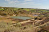
Wheal Maid and Poldice Valley

Wheal Maid and Poldice Valley
3.4 miles/5.4 km - Easy-moderate
A circular walk in the area described in Victorian times as the richest square mile anywhere on Earth
-
4.3 miles/7 km - Easy-moderate
Tehidy Woods to Deadman's Cove

Tehidy Woods to Deadman's Cove
4.3 miles/7 km - Easy-moderate
A circular walk through the wildlife reserve and bluebell woodland of Tehidy Country Park to Deadman's Cove and the North Cliffs, where many sailing ships were wrecked before the Godrevy Lighthouse was built.
-
6.2 miles/10 km - Easy-moderate
Gwennap Pit and Carn Marth

Gwennap Pit and Carn Marth
6.2 miles/10 km - Easy-moderate
A circular walk through an area steeped in mining history, with panoramic views from Carn Marth and the almost legendary Gwennap Pit which became so famous that even the neighbouring mine was renamed to Cathedral
-
5.9 miles/9.5 km - Moderate
Carn Brea and the Great Flat Lode

Carn Brea and the Great Flat Lode
5.9 miles/9.5 km - Moderate
A circular walk along the Great Flat Lode, where the Basset family made their fortune from the rich mineral reserves, to Carn Brea where they built a hunting lodge balanced on a tor in the style of a castle.
-
5.2 miles/8.4 km - Moderate-strenuous
Portreath and Tehidy Woods

Portreath and Tehidy Woods
5.2 miles/8.4 km - Moderate-strenuous
A circular walk along the rugged North Cliffs hiding smuggler's coves such as Ralph's Cupboard, to the sandy beach and historic mining port of Portreath, returning via the bluebell woodland of Illogan and Tehidy Country Park.
-
7.3 miles/11.7 km - Strenuous
Portreath to Wheal Tye

Portreath to Wheal Tye
7.3 miles/11.7 km - Strenuous
A circular walk along the rugged coast from Portreath towards Porthtowan passing small coves and remnants of the clifftop mines beside the old RAF base, and returning via the horse-drawn tramway that brought fortune to Portreath harbour, where its "lighthouse" and "monkey house" remain from the shipping activity.


Download the iWalk Cornwall app and use the QR scanner within the app to find out more about any of the walks above.
