Walks in Pentire Point To Widemouth AONB
Enjoy the walks by being guided by the app
-
2.2 miles/3.5 km - Easy-moderate
Lesnewth Church to Hallwell Woods
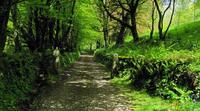
Lesnewth Church to Hallwell Woods
2.2 miles/3.5 km - Easy-moderate
A short circular walk in the tributary valleys of the River Valency through bluebell woodland beside a stream, and across meadows rich in wildflowers to the ancient Celtic churchyard of Lesnewth.
-
2.4 miles/3.9 km - Easy-moderate
Tintagel, Church and Castle
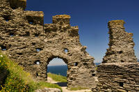
Tintagel, Church and Castle
2.4 miles/3.9 km - Easy-moderate
A short circular walk exploring some of the historic sites in Tintagel including King Arthur's Castle and Merlin's Cave, the Old Post Office, and the ancient parish church on the cliffs.
-
3 miles/4.8 km - Easy-moderate
Tintagel Church to Trebarwith Strand
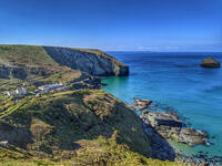
Tintagel Church to Trebarwith Strand
3 miles/4.8 km - Easy-moderate
A circular walk on quarrymens' trails along the cliffs of Tintagel past the Thunderhole blowhole to the long, sandy beach at Trebarwith Strand from Tintagel's mediaeval clifftop church with relics including the font that once stood in Tintagel Castle's chapel.
-
2.6 miles/4.2 km - Moderate
Boscastle to Minster Church
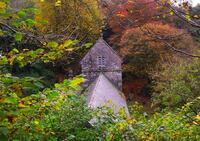
Boscastle to Minster Church
2.6 miles/4.2 km - Moderate
A short circular walk from Boscastle through bluebell woodland alongside the River Valency to the ancient Celtic churchyard and sacred spring at Minster, returning along the River Jordan, beside which Bottreaux Castle was once situated, and Boscastle's Old Road.
-
2.7 miles/4.4 km - Moderate
Tintagel to Bossiney
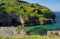
Tintagel to Bossiney
2.7 miles/4.4 km - Moderate
A circular walk via through Tintagel to Tintagel Castle and along the coastline via the headlands of Barras Nose and Willapark to the sandy beach at Bossiney Haven from Tintagel Haven where Merlin's Cave is uncovered at low tide.
-
2.7 miles/4.3 km - Moderate
Trebarwith Valley
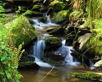
Trebarwith Valley
2.7 miles/4.3 km - Moderate
A fairly short circular walk exploring Trebarwith Valley, a designated Area of Outstanding Natural Beauty in North Cornwall. The walk includes bluebell woodland, panoramic views from both sides of the valley and the Trebarwith Nature Reserve.
-
2.9 miles/4.7 km - Moderate
Port Quin to Lundy Bay
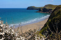
Port Quin to Lundy Bay
2.9 miles/4.7 km - Moderate
A circular walk from the fishing village of Port Quin to the golden sandy beaches of Epphaven Cove and Lundy Bay with spectacular coastal scenery, via the cliff-edge folly on Doyden Point built as a gambling den.
-
3 miles/4.8 km - Moderate
Millook to Trebarfoote
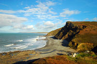
Millook to Trebarfoote
3 miles/4.8 km - Moderate
A circular walk through Woodland Trust reserves of the ancient Millook woods, meadows to the former smuggling den and 1920s wild party venue of Trebarfoote, and along the coast from Cancleave Strand to Millook Haven where colliding continents have melted and folded the rocks like toffee.
-
3.3 miles/5.3 km - Moderate
Boscastle Headlands
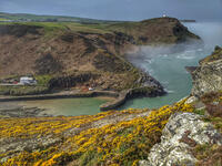
Boscastle Headlands
3.3 miles/5.3 km - Moderate
A circular walk from Boscastle to Pentargon waterfall and Willapark coastguard lookout with magnificent views of the village and harbour from the headlands where, according to legend, the village women once gathered dressed in red to fool a French ship into fleeing from British army redcoats.
-
3.8 miles/6.1 km - Moderate
St Endellion to Port Isaac
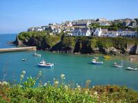
St Endellion to Port Isaac
3.8 miles/6.1 km - Moderate
A figure-of-8 walk from St Endellion to Port Isaac, via the estate of the ancient family of Roscarrock, who survived torture on the rack during Tudor times for being Catholic sympathisers, returning to the parish church, dedicated to the daughter of a Celtic king, on the ancient route which itself influenced the fervent adoption of Methodism in Port Isaac.
-
3.8 miles/6.1 km - Moderate
Tintagel to Rocky Valley
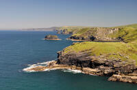
Tintagel to Rocky Valley
3.8 miles/6.1 km - Moderate
A circular walk via King Arthur's Great Halls and the Old Post Office and along the coastline from Tintagel Castle past towering headlands and island bird colonies to the golden, sandy cove at Bossiney Haven, returning via the labyrinthine carvings and ruins of mills in the woods of Rocky Valley.
-
3.9 miles/6.2 km - Moderate
Bossiney, St Nectan's Glen and Rocky Valley
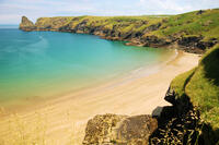
Bossiney, St Nectan's Glen and Rocky Valley
3.9 miles/6.2 km - Moderate
A short circular walk through the woods of St Nectan's Glen and canyons of Rocky Valley, past the ruined mills and labyrinthine carvings, and along the coast to the golden sandy cove at Bossiney Haven.
-
4.1 miles/6.5km - Moderate
Trewarmett to Trebarwith Strand
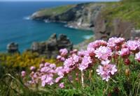
Trewarmett to Trebarwith Strand
4.1 miles/6.5km - Moderate
A circular walk down Trebarwith Valley to Trebarwith Strand then along the cliffs above the beach, with magnificent views of the bay between Dennis Point and Penhallic Point and the pinnacles of the coastal slate quarries now colonised by birds and wildflowers.
-
4.2 miles/6.7 km - Moderate
The Rumps to Polzeath around Pentire Point
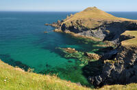
The Rumps to Polzeath around Pentire Point
4.2 miles/6.7 km - Moderate
A circular walk across the Iron Age hillfort on the twin headlands of The Rumps and around Pentire Point, with panoramic views of the Camel Estuary and the offshore islands, to the sandy beach at Polzeath.
-
4.8 miles/7.7 km - Moderate
St Nectan's Glen and Trevillett Valley
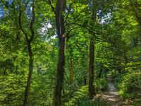
St Nectan's Glen and Trevillett Valley
4.8 miles/7.7 km - Moderate
A circular walk from Bossiney through broadleaf woodland to the spectacular waterfall at St Nectan's Glen, returning through a wildlife area created from the old slate tips of Trevillett Quarry.
-
5 miles/8 km - Moderate
Lesnewth to Tresparrett in the Valency Valley
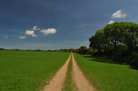
Lesnewth to Tresparrett in the Valency Valley
5 miles/8 km - Moderate
A circular walk in the upper reaches of the River Valency above Boscastle, where author Thomas Hardy lived and met the love of his life, starting from the ancient Celtic church of Lesnewth to St Juliot church which Hardy restored.
-
5 miles/8 km - Moderate
Trebarwith Strand to Tintagel Castle
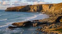
Trebarwith Strand to Tintagel Castle
5 miles/8 km - Moderate
A walk on the tracks trodden by the donkeys laden with slate from the coastal quarries of Trebarwith to Tintagel Haven where the slate was loaded onto ships and Tintagel Castle's island, inhabited during the mediaeval period, the Celtic times of King Arthur, and before this by the Romans.
-
5.5 miles/8.7 km - Moderate
Boscastle to Tintagel (via bus)
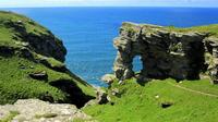
Boscastle to Tintagel (via bus)
5.5 miles/8.7 km - Moderate
A one-way coastal walk, made circular via an initial bus journey, along the dramatic coastline of islands and arches from Boscastle to Tintagel, rated as one of the top five walks in Cornwall.
-
5.9 miles/9.5 km - Moderate
Trewarmett to Tregardock
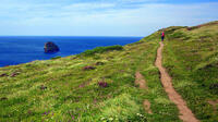
Trewarmett to Tregardock
5.9 miles/9.5 km - Moderate
A circular walk to the remote sandy beach at Tregardock, returning along the coast path with panoramic views of Port Isaac Bay, through the wildflowers of Treligga Downs and via Backways Cove.
-
6.2 miles/10 km - Moderate
Boscastle to Rocky Valley
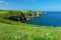
Boscastle to Rocky Valley
6.2 miles/10 km - Moderate
A circular walk from Boscastle along the dramatic coastline of islands and arches towards Tintagel, following the cascading river up Rocky Valley past the ruined mills and labyrinthine carvings and returning via the mediaeval churches of Trethevy, Trevalga and Forrabury.
-
2.2 miles/3.5 km - Moderate-strenuous
Trebarwith Strand to Backways Cove
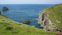
Trebarwith Strand to Backways Cove
2.2 miles/3.5 km - Moderate-strenuous
A short circular walk from the long, sandy beach of Trebarwith Strand to the rugged rocky cove at Backways in which sea foam tornadoes form in windy weather, and returning over the massive headland of Dennis Point with panoramic views of Port Isaac Bay.
-
2.9 miles/4.6 km - Moderate-strenuous
Crackington Haven to St Gennys Church
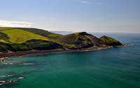
Crackington Haven to St Gennys Church
2.9 miles/4.6 km - Moderate-strenuous
A circular walk from the surf beach at Crackington Haven to the mediaeval church at St Gennys via the imposing Penkenna Point, where there are spectacular views of the bay and the secluded landing points used by some of North Cornwall's most notorious smugglers and wreckers.
-
3.3 miles/5.3 km - Moderate-strenuous
Port Isaac
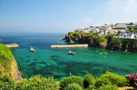
Port Isaac
3.3 miles/5.3 km - Moderate-strenuous
A short circular walk in Doc Martin Country including the pretty fishing village of Port Isaac and the historic beach of Port Gaverne with birds-eye views over the harbour.
-
4 miles/6.4 km - Moderate-strenuous
Trebarwith Valley to Backways Cove
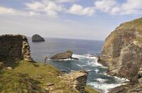
Trebarwith Valley to Backways Cove
4 miles/6.4 km - Moderate-strenuous
A circular walk in Trebarwith Valley to beaches and the coastal slate quarries of Backways Cove and Trebarwith Strand, and Dennis Point, overlooking the bay and point opposite where the ships moored to be loaded with roofing slates which were also brought down the valley on a road covered with beach sand to stop the horses being flattened by runaway carts.
-
4.3 miles/6.9 km - Moderate-strenuous
Crackington Haven to The Strangles
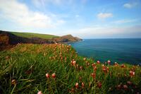
Crackington Haven to The Strangles
4.3 miles/6.9 km - Moderate-strenuous
A circular walk from Crackington Haven, with panoramic views of the Shipwreck Coast, to the long, sandy Strangles beach, returning through bluebell woodland along the Ludon river valley.
-
4.8 miles/7.7 km - Moderate-strenuous
Millook Haven to Dizzard
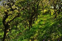
Millook Haven to Dizzard
4.8 miles/7.7 km - Moderate-strenuous
A circular walk through the Millook woodland reserves to the ancient gnarled oak forest of The Dizzard, returning along the coast with panoramic views to Hartland Point, to the chevron-folded cliffs and honeycomb reefs of Millook Haven.
-
4.8 miles/7.7 km - Moderate-strenuous
Port Quin to Port Isaac
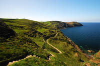
Port Quin to Port Isaac
4.8 miles/7.7 km - Moderate-strenuous
A circular walk along the rollercoaster path from Port Quin, descending into Port Isaac, with spectacular views of the harbour, via the old houses of Roscarrock Hill including Doc Martin's, one with roof timbers tied on by an anchor chain, and the Sunday School with a bell from a shipwreck.
-
4.9 miles/7.8 km - Moderate-strenuous
The Strangles to Buckator
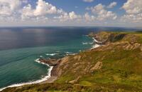
The Strangles to Buckator
4.9 miles/7.8 km - Moderate-strenuous
A circular walk along the volcanic coastline north of Boscastle, including Cornwall's highest cliff and The Strangles beach with its spectacular arch known as the Northern Door.
-
5.4 miles/8.7 km - Moderate-strenuous
Boscastle to Buckator
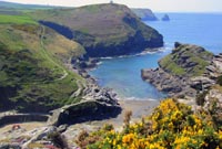
Boscastle to Buckator
5.4 miles/8.7 km - Moderate-strenuous
A circular walk along the coastline from Boscastle via the Pentargon waterfall and the rugged cliffs at Buckator, returning along the Valency valley.
-
6 miles/9.7 km - Moderate-strenuous
Port Gaverne to Barretts Zawn
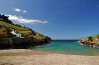
Port Gaverne to Barretts Zawn
6 miles/9.7 km - Moderate-strenuous
A circular walk from Port Gaverne around Port Isaac Bay to Barretts Zawn, where a tunnel leads to the beach, through which donkeys used to haul slate.
-
9.9 miles/15.9 km - Moderate-strenuous
Port Isaac to Polzeath (via bus)
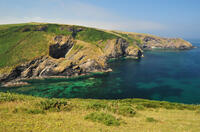
Port Isaac to Polzeath (via bus)
9.9 miles/15.9 km - Moderate-strenuous
A one-way coastal walk, made circular via an initial bus journey, from Port Isaac to Polzeath along the Rollercoaster Path to Port Quin, the golden beaches of Lundy Bay via the Iron Age hillfort on the twin headland of The Rumps.
-
4 miles/6.4 km - Strenuous
Tregardock to Dannonchapel
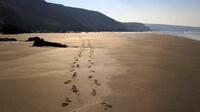
Tregardock to Dannonchapel
4 miles/6.4 km - Strenuous
A circular walk from Tregardock, passing the long, remote sandy beach, to the ruins of the mediaeval manor of Dannonchapel, and includes one of the steepest and most spectacular sections of the North Cornish Coast path with vibrant wildflowers in spring and summer.
-
4.5 miles/7.3 km - Strenuous
St Gennys Church to Dizzard
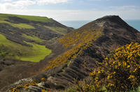
St Gennys Church to Dizzard
4.5 miles/7.3 km - Strenuous
A circular walk at St Gennys from the mediaeval church, via the smuggling routes though bluebell woods along the stream and an Iron Age clifftop fort crumbling into the sea, to some of North Cornwall's most remote coastline.
-
4.7 miles/7.6 km - Strenuous
Barrett's Zawn and Dannonchapel
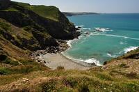
Barrett's Zawn and Dannonchapel
4.7 miles/7.6 km - Strenuous
A circular walk including some of the more remote parts of the coast path around Port Isaac Bay, passing the Donkey Hole at Barrett's Zawn and returning through the abandoned hamlet of Dannonchapel.
-
6.4 miles/10.3 km - Strenuous
Crackington Haven to Widemouth (via bus)
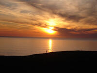
Crackington Haven to Widemouth (via bus)
6.4 miles/10.3 km - Strenuous
A one-way coastal walk, made circular via an initial bus journey, along the Shipwreck Coast from Crackington Haven to Widemouth Bay passing the bluebell woodland of ancient twisted oaks at The Dizzard, chevron folded rocks and honeycomb reefs of Millook Haven and fossil beds of Wanson Mouth.
-
7 miles/11.2 km - Strenuous
Crackington Haven to Boscastle (via bus)
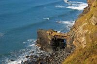
Crackington Haven to Boscastle (via bus)
7 miles/11.2 km - Strenuous
A one-way coastal walk, made circular via an initial bus journey, along the Shipwreck Coast from Crackington Haven to Boscastle passing the highest cliff in Cornwall and the long, sandy beach at The Strangles.
-
9.7 miles/15.6 km - Strenuous
Port Isaac to Tintagel
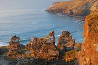
Port Isaac to Tintagel
9.7 miles/15.6 km - Strenuous
A one-way walk from Port Isaac to Tintagel along towering cliffs, past the long, sandy beaches of Tregardock and Trebarwith, the slate pinnacles of the coastal quarries and via the mediaeval cliff-top church to the castle of Arthurian legend.
Download the iWalk Cornwall app and use the QR scanner within the app to find out more about any of the walks above.


