Walks in Cornwall
Enjoy the walks by being guided by the app
-
1.8 miles/2.9 km - Easy
The Camelford Way
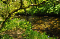
The Camelford Way
1.8 miles/2.9 km - Easy
A short and easy circular walk from Camelford along the wildflower-rich meadows of the River Camel to the clapper bridge at Fenteroon, returning through the fields with views over the Camel Valley.
-
6.7 miles/10.9 km - Easy
Rock to St Minver
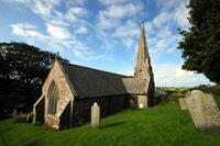
Rock to St Minver
6.7 miles/10.9 km - Easy
A circular walk from Rock along the sand dunes to St Enodoc church, once buried in the sand, and across fields to the mediaeval church of St Minver, returning via 3 pubs and the brewery where "Doom Bar" was first produced.
-
3.2 miles/5.1 km - Easy-moderate
Lanhydrock Gardens
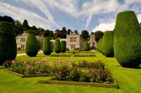
Lanhydrock Gardens
3.2 miles/5.1 km - Easy-moderate
A fairly short and easy circular walk through Lanhydrock gardens with plenty of picnic spots along the River Fowey that you can combine with a visit to the house.
-
3.2 miles/5.1 km - Easy-moderate
Poundstock to Penfound
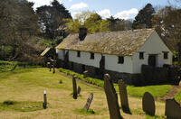
Poundstock to Penfound
3.2 miles/5.1 km - Easy-moderate
A circular walk along country lanes, tracks and through fields to Penfound Manor - thought to be the oldest continually-inhabited ancestral home in England - from Poundstock church and gildhouse - the only surviving mediaeval church house of its kind in Cornwall.
-
3.8 miles/6.1 km - Easy-moderate
Lanhydrock to Respryn
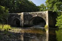
Lanhydrock to Respryn
3.8 miles/6.1 km - Easy-moderate
A circular walk through the mature broadleaf woodland in the less well-known areas of the Lanhydrock estate, through bluebell woods and along the River Fowey, past the mediaeval bridge at Respryn, built after numerous prayers for safe passage in the ford-side chapel, had not resulted in the desired outcome.
-
3.7 miles/5.9 km - Easy-moderate
St Mabyn to Pencarrow House
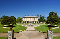
St Mabyn to Pencarrow House
3.7 miles/5.9 km - Easy-moderate
A fairly easy circular walk from St Mabyn past the church and through rolling countryside to Pencarrow House and its magnificent gardens.
-
4.2 miles/6.8 km - Easy-moderate
Davidstow and Inny Vale
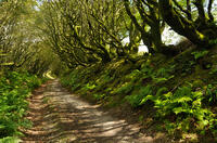
Davidstow and Inny Vale
4.2 miles/6.8 km - Easy-moderate
A circular walk in the Inny Vale on the northern edge of Bodmin Moor through the WW2 airbase on Davidstow Moor, the tunnel of trees to Treworra and past the source of the River Inny to the church and holy well of St David.
-
5.3 miles/8.5 km - Easy-moderate
Lanhydrock to Restormel
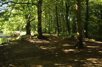
Lanhydrock to Restormel
5.3 miles/8.5 km - Easy-moderate
A circular walk from the mediaeval bridge at Respryn along the River Fowey through the bluebell woodland of the Lanhydrock Estate to the circular Norman castle at Restormel which had a pressurised piped water system 700 years ahead of its time.
-
5.8 miles/9.4 km - Easy-moderate
Rock to Polzeath
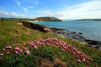
Rock to Polzeath
5.8 miles/9.4 km - Easy-moderate
A circular walk across the dunes and headland between Rock and Polzeath, returning via St Enodoc Church, where Sir John Betjeman is buried.
-
6.2 miles/10 km - Easy-moderate
Widemouth to Bude
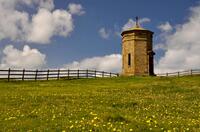
Widemouth to Bude
6.2 miles/10 km - Easy-moderate
A circular walk from Widemouth Bay along the Coast Path though the Phillips Point nature reserve to The Storm Tower at Compass Point and then along the Bude Canal to Whalesborough, returning across the fields to Widemouth.
-
6.8 miles/10.9 km - Easy-moderate
Seven Bays (via bus)
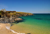
Seven Bays (via bus)
6.8 miles/10.9 km - Easy-moderate
A one-way coastal walk, made circular via an initial bus journey, along the Seven Bays coast and around Trevose Head past the lighthouse.
-
6.8 miles/10.9 km - Easy-moderate
Wadebridge to Polbrock
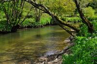
Wadebridge to Polbrock
6.8 miles/10.9 km - Easy-moderate
A circular walk from Wadebridge through the Treraven nature reserve, bluebell woodland at Hustyn Mill and meadows along the River Camel to Polbrock, returning along the Camel Trail.
-
3.1 miles/5.0 km - Moderate
St Breward to Lank
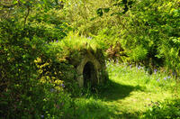
St Breward to Lank
3.1 miles/5.0 km - Moderate
A short circular walk from St Breward through ancient bluebell woods along the valley of the River Camel to the holy well, ending at the mediaeval church and inn.
-
3.8 miles/6.1 km - Moderate
Tintagel to Rocky Valley
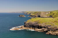
Tintagel to Rocky Valley
3.8 miles/6.1 km - Moderate
A circular walk via King Arthur's Great Halls and the Old Post Office and along the coastline from Tintagel Castle past towering headlands and island bird colonies to the golden, sandy cove at Bossiney Haven, returning via the labyrinthine carvings and ruins of mills in the woods of Rocky Valley.
-
5 miles/8 km - Moderate
Lesnewth to Tresparrett in the Valency Valley
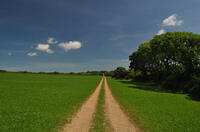
Lesnewth to Tresparrett in the Valency Valley
5 miles/8 km - Moderate
A circular walk in the upper reaches of the River Valency above Boscastle, where author Thomas Hardy lived and met the love of his life, starting from the ancient Celtic church of Lesnewth to St Juliot church which Hardy restored.
-
5.2 miles/8.4 km - Moderate
Poley's Bridge to Blisland
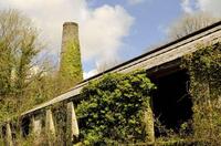
Poley's Bridge to Blisland
5.2 miles/8.4 km - Moderate
A circular walk from Poley's Bridge along the Camel Trail past the old china clay driers to Wenfordbridge and crossing the De Lank valley and Pendrift Downs to Blisland, returning along the Camel valley.
-
5.3 miles/8.6 km - Moderate
Little Petherick Creek and the Camel Trail
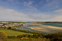
Little Petherick Creek and the Camel Trail
5.3 miles/8.6 km - Moderate
A circular walk via the Victorian obelisk overlooking Padstow, the creek-side church at Little Petherick and the tidal enclosure of Sea Mills, returning via the Camel Trail bridge which carried the railway that brought the first Victorian tourists to Padstow and Cornish fish to London.
-
5.6 miles/9.0 km - Moderate
Rame Head and Cawsand
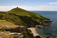
Rame Head and Cawsand
5.6 miles/9.0 km - Moderate
A circular walk around Rame Head - the southeastern corner of Cornwall - past the mediaeval chapel and the remains of a huge gun battery, now a nature reserve, on Penlee Point to Cawsand which was once the smuggling capital of Cornwall.
-
5.6 miles/9.0 km - Moderate
St Clether to the Rising Sun
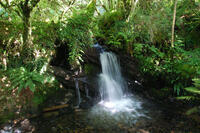
St Clether to the Rising Sun
5.6 miles/9.0 km - Moderate
A figure-of-8 walk from St Clether past the ancient chapel and holy well, with views over the Inny Valley, to the Rising Sun pub near Altarnun, serving beer made from the moorland springwater by a local micro-brewery.
-
5.7 miles/9.2 km - Moderate
Hellandbridge to St Mabyn
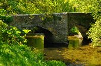
Hellandbridge to St Mabyn
5.7 miles/9.2 km - Moderate
A circular walk from Helland's mediaeval bridge through bluebell woodland and the fields overlooked by the Iron Age rounds at Pencarrow to the Norman church at St Mabyn, dedicated to the daughter of a Celtic King, and returning via the stump of the Neolithic Long Stone which stood for millennia until it was broken up for gateposts in 1850.
-
6.1 miles/9.9 km - Moderate
Dunmere, Penhargard and Bodmin Jail
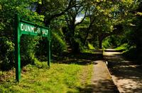
Dunmere, Penhargard and Bodmin Jail
6.1 miles/9.9 km - Moderate
A circular walk along the River Camel from Dunmere through bluebell woods and fields to Penhargard, and along an ancient route lined with wildflowers to Bodmin's historic jail.
-
6.4 miles/10.3 km - Moderate
St Breward to Advent
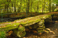
St Breward to Advent
6.4 miles/10.3 km - Moderate
A circular walk from St Breward past the granite pillars of Devil's Jump to the 8ft Celtic cross and ancient churchyard of Advent at the foot of the moors, returning via the remains of the mediaeval village of Carwether to the Inn used by 11th century monks to build the highest church in Cornwall.
-
3.7 miles/5.9 km - Moderate-strenuous
North Hill to Hawks Tor
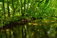
North Hill to Hawks Tor
3.7 miles/5.9 km - Moderate-strenuous
A circular walk along prehistoric trade routes in the Lynher valley from the village of North Hill where the granite was quarried to build Westminster Bridge.
-
4.3 miles/6.9 km - Moderate-strenuous
Blisland and Pendrift Downs
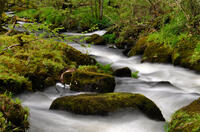
Blisland and Pendrift Downs
4.3 miles/6.9 km - Moderate-strenuous
A circular walk from Blisland through the De Lank granite quarry, used for many famous buildings including the Royal Opera House, between the moss-covered boulders and trees of the De Lank river valley and across the Pendrift Downs, passing Jubilee Rock - a huge granite boulder, decorated with carvings.
-
6.4 miles/10.3 km - Moderate-strenuous
Cubert to St Piran's Round
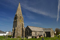
Cubert to St Piran's Round
6.4 miles/10.3 km - Moderate-strenuous
A circular walk from Cubert's Celtic churchyard through the cowslip meadows of the Penhale Sands nature reserve and on paths lined with wildflowers along the river valley to reach St Piran's Round - the remains of the mediaeval amphitheatre.
-
3.6 miles/5.8 km - Strenuous
Poundstock to Millook
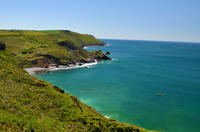
Poundstock to Millook
3.6 miles/5.8 km - Strenuous
A circular walk from Poundstock through bluebell woods along the river to the pretty pebbles and chevron-folded cliffs of Millook Haven and along the coast path with panoramic views from Bridwill Point.
-
4 miles/6.4 km - Strenuous
Tregardock to Dannonchapel
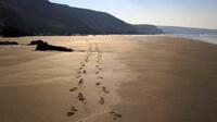
Tregardock to Dannonchapel
4 miles/6.4 km - Strenuous
A circular walk from Tregardock, passing the long, remote sandy beach, to the ruins of the mediaeval manor of Dannonchapel, and includes one of the steepest and most spectacular sections of the North Cornish Coast path with vibrant wildflowers in spring and summer.
-
4.7 miles/7.6 km - Strenuous
Barrett's Zawn and Dannonchapel
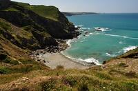
Barrett's Zawn and Dannonchapel
4.7 miles/7.6 km - Strenuous
A circular walk including some of the more remote parts of the coast path around Port Isaac Bay, passing the Donkey Hole at Barrett's Zawn and returning through the abandoned hamlet of Dannonchapel.
Download the iWalk Cornwall app and use the QR scanner within the app to find out more about any of the walks above.


