
Circular walks around Portscatho
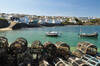
Enjoy the walks by being guided by the app


-
3.3 miles/5.4 km - Easy-moderate
Towan Beach to Place House

Towan Beach to Place House
3.3 miles/5.4 km - Easy-moderate
A walk on contrasting coastlines, from the rugged Roseland coast to the sheltered creeks of the Percuil River opposite St Mawes.
-
3.4 miles/5.4 km - Easy-moderate
St Anthony Head (short version)

St Anthony Head (short version)
3.4 miles/5.4 km - Easy-moderate
A walk on the Roseland coast and then into the Fal estuary to St Anthony Church via the fort St Anthony Head and the golden sandy beaches of Molunan.
-
4 miles/6.4 km - Easy-moderate
Towan Beach to Portscatho

Towan Beach to Portscatho
4 miles/6.4 km - Easy-moderate
A circular walk on the Roseland coast where, during the Napoleonic Wars, smugglers would row out to the middle of The Channel in pilot gigs to trade with the enemy.
-
4.4 miles/7 km - Easy-moderate
Portscatho to Pendower Beach

Portscatho to Pendower Beach
4.4 miles/7 km - Easy-moderate
A circular walk along two miles of beaches around Gerrans Bay which were once used by Portscatho smugglers to land contraband and strewn with the wreckage of sailing ships that overshot Falmouth Harbour and ran aground on The Whelps reef.
-
5.9 miles/9.5 km - Easy-moderate
St Anthony Head

St Anthony Head
5.9 miles/9.5 km - Easy-moderate
A walk along the Roseland coast and creeks opposite St Mawes, passing the preserved fort and Fraggle Rock lighthouse on St Anthony Head and the golden sandy beaches of Molunan.
-
5.3 miles/8.5 km - Moderate
Pendower Beach to Veryan

Pendower Beach to Veryan
5.3 miles/8.5 km - Moderate
A circular walk from Pendower Beach to Veryan via Nare Head where, in Victorian times, an unhappily married fisherman lived alone in a cliff-edge cottage, lowering his boat on a rope over the cliff and returning once a week to Veryan to bring his wife fish.


Download the iWalk Cornwall app and use the QR scanner within the app to find out more about any of the walks above.
