



Walks in Cornwall starting from a NT car park
Enjoy the walks by being guided by the app





-
1.9 miles/3 km - Easy
Park Head and Pentire Steps
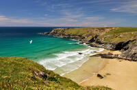
Park Head and Pentire Steps
1.9 miles/3 km - Easy
A circular walk on Park Head, used as one of the filming locations in the Poldark BBC TV series and with spectacular views over Bedruthan Steps and the Trescore Islands.
-
2 miles/3.2 km - Easy
Trevose Head (short version)
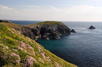
Trevose Head (short version)
2 miles/3.2 km - Easy
A circular walk around the rugged coastline of Trevose Head via the iconic lighthouse and golden sandy beach at Mother Ivey's Bay, with spectacular wildflowers in spring and summer and thundering waves in winter that sometimes expose the shipwreck at Booby's Bay.
-
3.4 miles/5.5 km - Easy
Botallack Head and Levant Mine
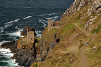
Botallack Head and Levant Mine
3.4 miles/5.5 km - Easy
A circular walk around Cornwall's most iconic mining remains, used for the filming of the BBC's Poldark series
-
2.3 miles/3.7 km - Easy-moderate
Crantock
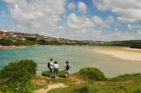
Crantock
2.3 miles/3.7 km - Easy-moderate
A circular walk along the Gannel Estuary from Crantock Beach to Penpol Creek, returning though the village of Crantock.
-
3.0 miles/4.9 km - Easy-moderate
St Agnes Beacon and Wheal Coates
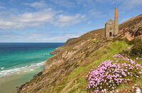
St Agnes Beacon and Wheal Coates
3.0 miles/4.9 km - Easy-moderate
A circular walk between St Agnes Head and the engine houses of Wheal Coates via St Agnes Beacon, with spectacular panoramic views
-
3.2 miles/5.1 km - Easy-moderate
Lanhydrock Gardens
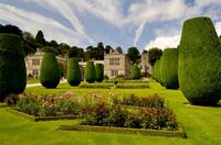
Lanhydrock Gardens
3.2 miles/5.1 km - Easy-moderate
A fairly short and easy circular walk through Lanhydrock gardens with plenty of picnic spots along the River Fowey that you can combine with a visit to the house.
-
3.3 miles/5.4 km - Easy-moderate
Towan Beach to Place House
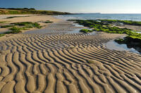
Towan Beach to Place House
3.3 miles/5.4 km - Easy-moderate
A walk on contrasting coastlines, from the rugged Roseland coast to the sheltered creeks of the Percuil River opposite St Mawes.
-
3.4 miles/5.4 km - Easy-moderate
St Anthony Head (short version)
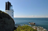
St Anthony Head (short version)
3.4 miles/5.4 km - Easy-moderate
A walk on the Roseland coast and then into the Fal estuary to St Anthony Church via the fort St Anthony Head and the golden sandy beaches of Molunan.
-
3.8 miles/6.1 km - Easy-moderate
Lanhydrock to Respryn
Lanhydrock to Respryn
3.8 miles/6.1 km - Easy-moderate
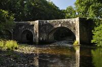
A circular walk through the mature broadleaf woodland in the less well-known areas of the Lanhydrock estate, through bluebell woods and along the River Fowey, past the mediaeval bridge at Respryn, built after numerous prayers for safe passage in the ford-side chapel, had not resulted in the desired outcome.
-
3.9 miles/6.2 km - Easy-moderate
Holywell to Polly Joke
Holywell to Polly Joke
3.9 miles/6.2 km - Easy-moderate
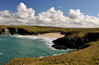
A circular walk from Holywell Bay on the dunes and Kelsey Head to the sandy beach of Polly Joke.
-
4 miles/6.4 km - Easy-moderate
Towan Beach to Portscatho
Towan Beach to Portscatho
4 miles/6.4 km - Easy-moderate
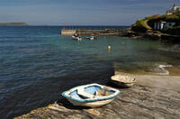
A circular walk on the Roseland coast where, during the Napoleonic Wars, smugglers would row out to the middle of The Channel in pilot gigs to trade with the enemy.
-
4.5 miles/7.2 km - Easy-moderate
Crantock and The Gannel
Crantock and The Gannel
4.5 miles/7.2 km - Easy-moderate
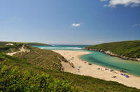
A circular walk along the River Gannel from Crantock, originally settled by Celtic monks whose chapel is thought may be buried beneath the dunes.
-
4.7 miles/7.6 km - Easy-moderate
Trelissick
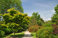
Trelissick
4.7 miles/7.6 km - Easy-moderate
A figure-of-8 walk along the creeks of the River Fal through the 300 acre estate surrounding Trelissick House.
-
4.9 miles/7.9 km - Easy-moderate
Holywell to Crantock
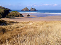
Holywell to Crantock
4.9 miles/7.9 km - Easy-moderate
A circular walk from Holywell Bay past the (currently entombed) sacred spring and along the coast to the sandy beaches of Porth Joke and Crantock, returning via the dunes of the Cubert Common nature conservation area.
-
5.3 miles/8.5 km - Easy-moderate
Lanhydrock to Restormel
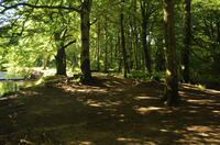
Lanhydrock to Restormel
5.3 miles/8.5 km - Easy-moderate
A circular walk from the mediaeval bridge at Respryn along the River Fowey through the bluebell woodland of the Lanhydrock Estate to the circular Norman castle at Restormel which had a pressurised piped water system 700 years ahead of its time.
-
5.9 miles/9.5 km - Easy-moderate
St Anthony Head
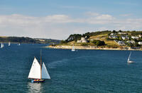
St Anthony Head
5.9 miles/9.5 km - Easy-moderate
A walk along the Roseland coast and creeks opposite St Mawes, passing the preserved fort and Fraggle Rock lighthouse on St Anthony Head and the golden sandy beaches of Molunan.
-
2.5 miles/4 km - Moderate
Danescombe Valley
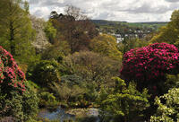
Danescombe Valley
2.5 miles/4 km - Moderate
A circular walk from Cotehele Quay into the broadleaf woodland of the Danescombe Valley where bluebells and orchids flower in spring and fungi erupt through the carpet of autumn leaves.
-
2.4 miles/3.9 km - Moderate
Palace Cove and Lansallos
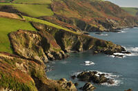
Palace Cove and Lansallos
2.4 miles/3.9 km - Moderate
A circular walk to the small coves of Lantivet Bay used in Victorian times for pilchard fishing, collecting seaweed as fertiliser and smuggling barrels of French brandy.
-
2.8 miles/4.5 km - Moderate
Two Coombes of Lansallos
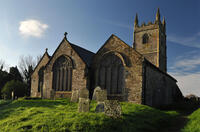
Two Coombes of Lansallos
2.8 miles/4.5 km - Moderate
A circular walk from Lansallos to the coves of Lantivet Bay where farmers collected seaweed and sand to improve the soil and smugglers landed French brandy.
-
2.9 miles/4.7 km - Moderate
Port Quin to Lundy Bay
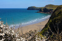
Port Quin to Lundy Bay
2.9 miles/4.7 km - Moderate
A circular walk from the fishing village of Port Quin to the golden sandy beaches of Epphaven Cove and Lundy Bay with spectacular coastal scenery, via the cliff-edge folly on Doyden Point built as a gambling den.
-
3.9 miles/6.2 km - Moderate
Cotehele to Metherell
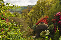
Cotehele to Metherell
3.9 miles/6.2 km - Moderate
A circular walk via the quays, woods, engine house and mills of the Cotehele Estate where by Georgian times the house had become a tourist attraction because it was so antiquated, and has changed little since.
-
4.2 miles/6.7 km - Moderate
The Rumps to Polzeath around Pentire Point
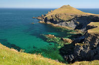
The Rumps to Polzeath around Pentire Point
4.2 miles/6.7 km - Moderate
A circular walk across the Iron Age hillfort on the twin headlands of The Rumps and around Pentire Point, with panoramic views of the Camel Estuary and the offshore islands, to the sandy beach at Polzeath.
-
4.5 miles/7.3 km - Moderate
Bedruthan Steps
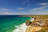
Bedruthan Steps
4.5 miles/7.3 km - Moderate
A circular walk with spectacular views of the rock stacks at Bedruthan Steps, about which the myth of a giant's stepping stones was concocted for the amusement of Victorian tourists flocking to Padstow and Newquay on the new railway.
-
4.5 miles/7.3 km - Moderate
Sandymouth to Coombe Valley
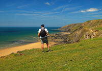
Sandymouth to Coombe Valley
4.5 miles/7.3 km - Moderate
A circular walk from Sandymouth beach, via the Landmark Trust's historic buildings of Coombe and a derelict mill which is one of the largest bat colonies in England, to the remains of the once great manor of Stowe Barton, the interior furnishings of which can be seen in Prideaux Place at Padstow.
-
4.8 miles/7.8 km - Moderate
Godolphin to Tregonning
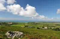
Godolphin to Tregonning
4.8 miles/7.8 km - Moderate
A circular walk from the mansion with possibly the oldest formal gardens in the country to two hills that altered the course of history, creating the wealthiest estate in Cornwall and giving rise to the Cornish China Clay industry.
-
5 miles/8 km - Moderate
Lantivet Bay and Lansallos
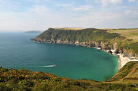
Lantivet Bay and Lansallos
5 miles/8 km - Moderate
A circular walk above the white sand crescent of Lantic Bay and the small coves of Lantivet Bay where a battle was once fought between smugglers and Customs men, and following an ancient cart track along the stream through the woods to the mediaeval church of Lansallos.
-
5.1 miles/8.2 km - Moderate
Predannack to Kynance Cove
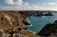
Predannack to Kynance Cove
5.1 miles/8.2 km - Moderate
A circular walk through the Lizard National Nature Reserve from Predannack to Kynance Cove along the rugged Serpentine cliffs where the "great silver ship" was wrecked in 1616 and more than 700 Spanish silver coins have so far been found.
-
5.3 miles/8.5 km - Moderate
Pendower Beach to Veryan
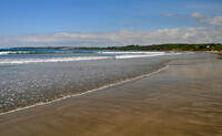
Pendower Beach to Veryan
5.3 miles/8.5 km - Moderate
A circular walk from Pendower Beach to Veryan via Nare Head where, in Victorian times, an unhappily married fisherman lived alone in a cliff-edge cottage, lowering his boat on a rope over the cliff and returning once a week to Veryan to bring his wife fish.
-
5.4 miles/8.6 km - Moderate
Cape Cornwall to Levant
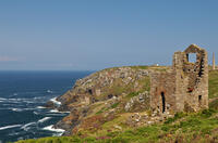
Cape Cornwall to Levant
5.4 miles/8.6 km - Moderate
A circular walk from England's only Cape, via the engine houses of Kenidjack Valley and perched on rock ledges at Botallack Head, to Levant Mine which had over 60 miles of tunnels beneath the Atlantic and now has a working restored beam engine.
-
5.5 miles/8.9 km - Moderate
Gunwalloe Coves
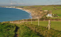
Gunwalloe Coves
5.5 miles/8.9 km - Moderate
A circular walk from the Loe Bar to Dollar Cove passing the wrecks of treasure ships whose cargo still washes ashore, returning via the Halzephron Inn which still has a trapdoor leading to an underground network of tunnels used by smugglers.
-
5.9 miles/9.5 km - Moderate
Cotehele to Calstock
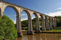
Cotehele to Calstock
5.9 miles/9.5 km - Moderate
A circular walk through the gardens of Cotehele to Calstock where Cornwall's largest Roman fort once stood, the Vikings allied with the Cornish to fight off the Saxons, and more recently railway wagons were lifted over 100ft by steam power from the quay to the top of the viaduct.
-
6.2 miles/10 km - Moderate
Bedruthan Steps to Porthcothan
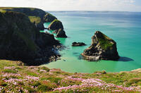
Bedruthan Steps to Porthcothan
6.2 miles/10 km - Moderate
A circular walk featuring some of the most spectacular scenery of the North Cornish coast including the rock stacks of Bedruthan Steps, the azure lagoon of the Trescore Islands and the sheltered golden sandy beach at Porthcothan.
-
6.2 miles/10 km - Moderate
Chapel Porth to Trevaunance Cove
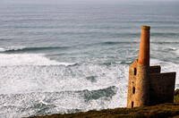
Chapel Porth to Trevaunance Cove
6.2 miles/10 km - Moderate
A circular walk along the coast between the golden sandy beaches of Chapel Porth and Trevaunance Cove at St Agnes via the iconic engine houses of Wheal Coates, perched above the breakers.
-
6.3 miles/10.1 km - Moderate
Helford Passage
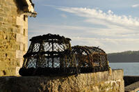
Helford Passage
6.3 miles/10.1 km - Moderate
A circular walk on the Helford River, where the mild climate and south-facing slopes allow subtropical plants collected by Victorian expeditions to flourish in the gardens of Glendurgan and Trebah.
-
7.4 miles/11.9 km - Moderate
Holywell to St Piran's Oratory
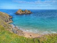
Holywell to St Piran's Oratory
7.4 miles/11.9 km - Moderate
A circular walk from Holywell Bay along the rugged coastline to Perran Beach and across the dunes to the mediaeval relics of St Piran's Oratory, Church and Cross, returning via the Penhale Sands nature reserve which is carpeted in cowslips during spring.
-
4.8 miles/7.7 km - Moderate-strenuous
Port Quin to Port Isaac
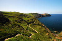
Port Quin to Port Isaac
4.8 miles/7.7 km - Moderate-strenuous
A circular walk along the rollercoaster path from Port Quin, descending into Port Isaac, with spectacular views of the harbour, via the old houses of Roscarrock Hill including Doc Martin's, one with roof timbers tied on by an anchor chain, and the Sunday School with a bell from a shipwreck.
-
5.2 miles/8.3 km - Moderate-strenuous
Nare Head to Portloe
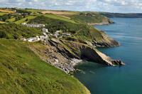
Nare Head to Portloe
5.2 miles/8.3 km - Moderate-strenuous
A circular walk around Nare Head, past the restored Cold War nuclear bunker, to the pretty fishing village of Portloe, with views along the length of The Roseland coast and over The Whelps reef - a graveyard for sailing ships that misjudged the entrance to Falmouth.
-
5.4 miles/8.6 km - Moderate-strenuous
Duckpool to Woodford
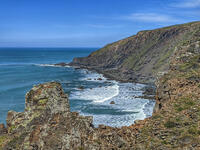
Duckpool to Woodford
5.4 miles/8.6 km - Moderate-strenuous
A circular walk in Morwenstow parish along towering cliffs and through broadleaf woods where a hamlet has been preserved in a joint project between the Landmark Trust and National Trust


Download the iWalk Cornwall app and use the QR scanner within the app to find out more about any of the walks above.