Circular walks in Cornwall with blackberries
Enjoy the walks by being guided by the app
-
2 miles/3.2 km - Easy
Trevose Head (short version)
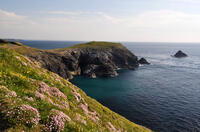
Trevose Head (short version)
2 miles/3.2 km - Easy
A circular walk around the rugged coastline of Trevose Head via the iconic lighthouse and golden sandy beach at Mother Ivey's Bay, with spectacular wildflowers in spring and summer and thundering waves in winter that sometimes expose the shipwreck at Booby's Bay.
-
2.2 miles/3.6 km - Easy-moderate
West Pentire and Polly Joke
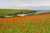
West Pentire and Polly Joke
2.2 miles/3.6 km - Easy-moderate
A circular walk through the poppy fields of West Pentire to Polly Joke beach, returning over the headland to the pub that was a cowshed until the mid-20th Century.
-
2.7 miles/4.4 km - Easy-moderate
Blisland to Lavethan Wood
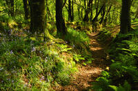
Blisland to Lavethan Wood
2.7 miles/4.4 km - Easy-moderate
A short circular walk from the village of Blisland through the churchyard, two stretches of the Woodland Trust reserve of Lavethan Wood and land which was once the estates of Lavethan and Barlandew manors.
-
3.2 miles/5.1 km - Easy-moderate
Lanhydrock Gardens

Lanhydrock Gardens
3.2 miles/5.1 km - Easy-moderate
A fairly short and easy circular walk through Lanhydrock gardens with plenty of picnic spots along the River Fowey that you can combine with a visit to the house.
-
3.3 miles/5.2 km - Easy-moderate
St Keverne to Porthallow
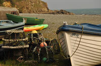
St Keverne to Porthallow
3.3 miles/5.2 km - Easy-moderate
A circular walk through woods and meadows to Porthoustock and Porthallow from St Keverne, settled in the Dark Ages by Celtic monks trading with Brittany
-
3.3 miles/5.4 km - Easy-moderate
Towan Beach to Place House
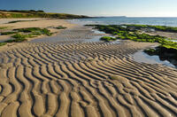
Towan Beach to Place House
3.3 miles/5.4 km - Easy-moderate
A walk on contrasting coastlines, from the rugged Roseland coast to the sheltered creeks of the Percuil River opposite St Mawes.
-
3.4 miles/5.5 km - Easy-moderate
Jacobstow to Poulza
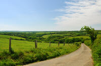
Jacobstow to Poulza
3.4 miles/5.5 km - Easy-moderate
A circular countryside walk around the Saxon area of Jacobstow near Bude where an ancient mediaeval altar was removed from the church during the 16th Century and used as a footbridge over a stream, then used as a churchyard seat in Victorian times, and finally returned to the church in the 1970s.
-
3.4 miles/5.4 km - Easy-moderate
St Anthony Head (short version)
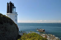
St Anthony Head (short version)
3.4 miles/5.4 km - Easy-moderate
A walk on the Roseland coast and then into the Fal estuary to St Anthony Church via the fort St Anthony Head and the golden sandy beaches of Molunan.
-
3.7 miles/6 km - Easy-moderate
St Just-in-Roseland to Messack Point
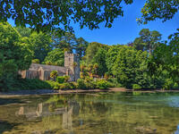
St Just-in-Roseland to Messack Point
3.7 miles/6 km - Easy-moderate
A circular walk on the Roseland along both sides of St Just creek to Messack Point, where there are spectacular views over one of the largest natural harbours in the world.
-
4.1 miles/6.6 km - Easy-moderate
Degibna and Carminowe Valley
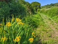
Degibna and Carminowe Valley
4.1 miles/6.6 km - Easy-moderate
A circular walk in the wooded valleys beside the Loe Pool with panoramic views over the lake
-
4.3 miles/7 km - Easy-moderate
Tehidy Woods to Deadman's Cove
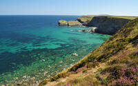
Tehidy Woods to Deadman's Cove
4.3 miles/7 km - Easy-moderate
A circular walk through the wildlife reserve and bluebell woodland of Tehidy Country Park to Deadman's Cove and the North Cliffs, where many sailing ships were wrecked before the Godrevy Lighthouse was built.
-
4.7 miles/7.6 km - Easy-moderate
Deadman's Cove to Red River Valley
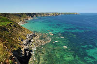
Deadman's Cove to Red River Valley
4.7 miles/7.6 km - Easy-moderate
A circular walk along a coast of shipwrecks and smugglers from Deadman's Cove to Hell's Mouth, past the collapse of the North Cliffs that went viral on YouTube, and returning through the nature reserve along the Red River Valley.
-
5 miles/8.1 km - Easy-moderate
Camelford to Watergate
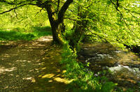
Camelford to Watergate
5 miles/8.1 km - Easy-moderate
A circular walk from Camelford through bluebell woods along the Camel valley to the Celtic churchyard of Advent and the Neolithic remains on the edge of Bodmin Moor.
-
5.1 miles/8.2 km - Easy-moderate
Polyphant
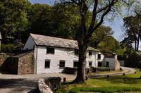
Polyphant
5.1 miles/8.2 km - Easy-moderate
A circular countryside walk to the mills in the Inny Valley from Polyphant, Cornish for "toad pool", to Gimblett's Mill where the bridge was rebuilt after a wall of water swept down the valley in 1847 destroying nearly everything in its path.
-
5.8 miles/9.4 km - Easy-moderate
Rock to Polzeath
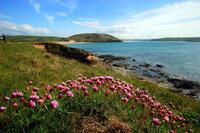
Rock to Polzeath
5.8 miles/9.4 km - Easy-moderate
A circular walk across the dunes and headland between Rock and Polzeath, returning via St Enodoc Church, where Sir John Betjeman is buried.
-
5.9 miles/9.5 km - Easy-moderate
St Anthony Head
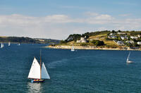
St Anthony Head
5.9 miles/9.5 km - Easy-moderate
A walk along the Roseland coast and creeks opposite St Mawes, passing the preserved fort and Fraggle Rock lighthouse on St Anthony Head and the golden sandy beaches of Molunan.
-
6 miles/9.7 km - Easy-moderate
Three Saints Way
Three Saints Way
6 miles/9.7 km - Easy-moderate
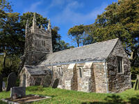
A circular walk around the tributary valleys of the River Ottery and Kensey between three of Cornwall's least-well-known mediaeval churches
-
6.1 miles/9.7 km - Easy-moderate
Trevose Head
Trevose Head
6.1 miles/9.7 km - Easy-moderate
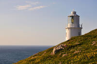
A circular walk around the rugged coastline of Trevose Head via the iconic lighthouse and golden sandy bays of Constantine, Booby's, Mother Ivey's and Harlyn, with spectacular wildflowers in spring and summer.
-
2.6 miles/4.2 km - Moderate
Boscastle to Minster Church
Boscastle to Minster Church
2.6 miles/4.2 km - Moderate
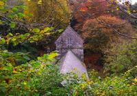
A short circular walk from Boscastle through bluebell woodland alongside the River Valency to the ancient Celtic churchyard and sacred spring at Minster, returning along the River Jordan, beside which Bottreaux Castle was once situated, and Boscastle's Old Road.
-
2.7 miles/4.3 km - Moderate
Trebarwith Valley
Trebarwith Valley
2.7 miles/4.3 km - Moderate
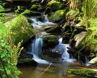
A fairly short circular walk exploring Trebarwith Valley, a designated Area of Outstanding Natural Beauty in North Cornwall. The walk includes bluebell woodland, panoramic views from both sides of the valley and the Trebarwith Nature Reserve.
-
3 miles/4.8 km - Moderate
Cremyll to Maker Church
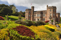
Cremyll to Maker Church
3 miles/4.8 km - Moderate
A circular walk on a peninsula protruding into the Hamoaze estuary and where the land was dotted with gun batteries, defending against a potential invasion from Napoleon.
-
3.5 miles/5.7 km - Moderate
West Pentire to Crantock Beach
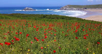
West Pentire to Crantock Beach
3.5 miles/5.7 km - Moderate
A circular walk on the northernmost end of one of Cornwall's largest areas of sand dunes that stretch from Crantock to Perranporth, under which one mediaeval chapel was found and another is said to still be lost.
-
3.6 miles/5.8 km - Moderate
Delabole

Delabole
3.6 miles/5.8 km - Moderate
A circular walk around Delabole past the slate quarry, along back lanes and tracks, and through fields and bluebell woods.
-
3.8 miles/6.1 km - Moderate
Helford and Frenchman's Creek
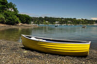
Helford and Frenchman's Creek
3.8 miles/6.1 km - Moderate
A circular walk through the wooded valleys of the Helford River including the most famous - Frenchman's Creek - which is still as pristine as when it inspired Daphne du Maurier's novel
-
4.2 miles/6.7 km - Moderate
The Rumps to Polzeath around Pentire Point
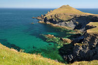
The Rumps to Polzeath around Pentire Point
4.2 miles/6.7 km - Moderate
A circular walk across the Iron Age hillfort on the twin headlands of The Rumps and around Pentire Point, with panoramic views of the Camel Estuary and the offshore islands, to the sandy beach at Polzeath.
-
4.2 miles/6.8 km - Moderate
St Ives to Carbis Bay
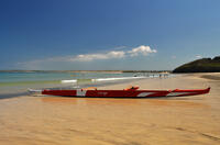
St Ives to Carbis Bay
4.2 miles/6.8 km - Moderate
A circular walk from St Ives through the Steeple Woods nature reserve to the monument overlooking St Ives Bay where the eccentric quinquennial ceremony of John Knill has been performed for over 200 years, returning along the coast via the white sandy beaches of Carbis Bay and Porthminster.
-
5 miles/8 km - Moderate
Lesnewth to Tresparrett in the Valency Valley
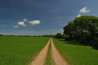
Lesnewth to Tresparrett in the Valency Valley
5 miles/8 km - Moderate
A circular walk in the upper reaches of the River Valency above Boscastle, where author Thomas Hardy lived and met the love of his life, starting from the ancient Celtic church of Lesnewth to St Juliot church which Hardy restored.
-
5.1 miles/8.2 km - Moderate
Predannack to Kynance Cove
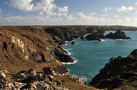
Predannack to Kynance Cove
5.1 miles/8.2 km - Moderate
A circular walk through the Lizard National Nature Reserve from Predannack to Kynance Cove along the rugged Serpentine cliffs where the "great silver ship" was wrecked in 1616 and more than 700 Spanish silver coins have so far been found.
-
5.2 miles/8.4 km - Moderate
Poley's Bridge to Blisland
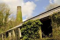
Poley's Bridge to Blisland
5.2 miles/8.4 km - Moderate
A circular walk from Poley's Bridge along the Camel Trail past the old china clay driers to Wenfordbridge and crossing the De Lank valley and Pendrift Downs to Blisland, returning along the Camel valley.
-
5.3 miles/8.6 km - Moderate
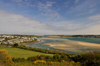
Little Petherick Creek and the Camel Trail
Little Petherick Creek and the Camel Trail
5.3 miles/8.6 km - Moderate
A circular walk via the Victorian obelisk overlooking Padstow, the creek-side church at Little Petherick and the tidal enclosure of Sea Mills, returning via the Camel Trail bridge which carried the railway that brought the first Victorian tourists to Padstow and Cornish fish to London.
-
5.6 miles/9 km - Moderate
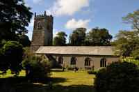
Delabole to Lanteglos
Delabole to Lanteglos
5.6 miles/9 km - Moderate
A circular walk through bluebell woodland, fields and along back lanes from Delabole to Camelford's parish church at Lanteglos, returning via the Iron Age forts of Castle Goff and Delinuth Camp.
-
5.6 miles/9.0 km - Moderate
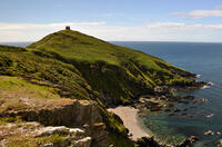
Rame Head and Cawsand
Rame Head and Cawsand
5.6 miles/9.0 km - Moderate
A circular walk around Rame Head - the southeastern corner of Cornwall - past the mediaeval chapel and the remains of a huge gun battery, now a nature reserve, on Penlee Point to Cawsand which was once the smuggling capital of Cornwall.
-
5.7 miles/9.2 km - Moderate
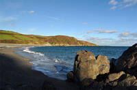
Coverack to St Keverne
Coverack to St Keverne
5.7 miles/9.2 km - Moderate
A circular walk from Coverack to St Keverne, past the treacherous Manacles reef, known as the grave of a thousand ships, where at least a hundred wrecks have been recorded and over a thousand people have drowned.
-
5.9 miles/9.5 km - Moderate
Carn Brea and the Great Flat Lode
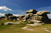
Carn Brea and the Great Flat Lode
5.9 miles/9.5 km - Moderate
A circular walk along the Great Flat Lode, where the Basset family made their fortune from the rich mineral reserves, to Carn Brea where they built a hunting lodge balanced on a tor in the style of a castle.
-
6.1 miles/9.8 km - Moderate
St Just-in-Roseland to St Mawes
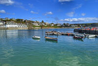
St Just-in-Roseland to St Mawes
6.1 miles/9.8 km - Moderate
A circular walk on the Roseland peninsula to St Mawes from the subtropical gardens of St Just church, along Carrick Roads where Europe's only fishery entirely under sail catch oysters using the traditional methods that have sustained their stocks.
-
6.2 miles/10 km - Moderate
Mullion to Predannack
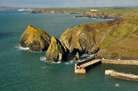
Mullion to Predannack
6.2 miles/10 km - Moderate
A circular walk passing the sandy beach at Polurrian Cove, the storm-beaten Victorian harbour at Mullion Cove, and along the cliffs of the National Nature Reserve overlooking Mullion Island, with vibrant wildflowers in spring and summer.
-
6.4 miles/10.3 km - Moderate
St Breward to Advent
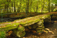
St Breward to Advent
6.4 miles/10.3 km - Moderate
A circular walk from St Breward past the granite pillars of Devil's Jump to the 8ft Celtic cross and ancient churchyard of Advent at the foot of the moors, returning via the remains of the mediaeval village of Carwether to the Inn used by 11th century monks to build the highest church in Cornwall.
-
4 miles/6.4 km - Moderate-strenuous
Trebarwith Valley to Backways Cove
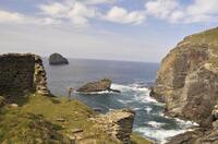
Trebarwith Valley to Backways Cove
4 miles/6.4 km - Moderate-strenuous
A circular walk in Trebarwith Valley to beaches and the coastal slate quarries of Backways Cove and Trebarwith Strand, and Dennis Point, overlooking the bay and point opposite where the ships moored to be loaded with roofing slates which were also brought down the valley on a road covered with beach sand to stop the horses being flattened by runaway carts.
-
5.1 miles/8.2 km - Moderate-strenuous
St Neot Two Valleys
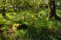
St Neot Two Valleys
5.1 miles/8.2 km - Moderate-strenuous
A circular walk from St Neot though the valley of the River Loveny, past a prehistoric settlement, through bluebell woodland and along the River Fowey, and returning via the church, famous for its mediaeval stained-glass.
-
6.7 miles/10.8 km - Moderate-strenuous
Portwrinkle to Downderry
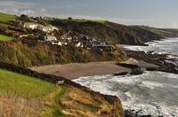
Portwrinkle to Downderry
6.7 miles/10.8 km - Moderate-strenuous
A circular walk around Whitsand Bay to Downderry from Portwrinkle, where the ghost of Silas Finn is said to haunt the cliffs.
-
4 miles/6.4 km - Strenuous
Tregardock to Dannonchapel
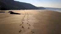
Tregardock to Dannonchapel
4 miles/6.4 km - Strenuous
A circular walk from Tregardock, passing the long, remote sandy beach, to the ruins of the mediaeval manor of Dannonchapel, and includes one of the steepest and most spectacular sections of the North Cornish Coast path with vibrant wildflowers in spring and summer.
-
4.4 miles/7 km - Strenuous
Morwenstow to Marsland
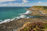
Morwenstow to Marsland
4.4 miles/7 km - Strenuous
A circular walk from Vicarage Cliff along the coast path to Marsland Mouth at the Devon border, returning through fields to Morwenstow rectory, church and the Rectory Tearooms - the last stand of the Cornish cream tea before the Devon border.
Download the iWalk Cornwall app and use the QR scanner within the app to find out more about any of the walks above.


