
Walks in Cornwall
Enjoy the walks by being guided by the app


-
1.8 miles/2.9 km - Easy
The Camelford Way

The Camelford Way
1.8 miles/2.9 km - Easy
A short and easy circular walk from Camelford along the wildflower-rich meadows of the River Camel to the clapper bridge at Fenteroon, returning through the fields with views over the Camel Valley.
-
1.9 miles/3 km - Easy
Park Head and Pentire Steps

Park Head and Pentire Steps
1.9 miles/3 km - Easy
A circular walk on Park Head, used as one of the filming locations in the Poldark BBC TV series and with spectacular views over Bedruthan Steps and the Trescore Islands.
-
2 miles/3.2 km - Easy
Trevose Head (short version)

Trevose Head (short version)
2 miles/3.2 km - Easy
A circular walk around the rugged coastline of Trevose Head via the iconic lighthouse and golden sandy beach at Mother Ivey's Bay, with spectacular wildflowers in spring and summer and thundering waves in winter that sometimes expose the shipwreck at Booby's Bay.
-
2.2 miles/3.6 km - Easy
Eden Project

Eden Project
2.2 miles/3.6 km - Easy
A walk though a granite landscape mined first for tin, then china clay and now for geothermal power to generate electricity and heat the space-age greenhouses of the Eden Project.
-
2.5 miles/4 km - Easy
Botallack Head

Botallack Head
2.5 miles/4 km - Easy
A circular walk around Cornwall's most iconic mining remains, used for the filming of the BBC's Poldark series
-
2.7 miles/4.3 km - Easy
Hayle and The Towans

Hayle and The Towans
2.7 miles/4.3 km - Easy
A circular walk on the Towans at Hayle, where Cornwall's beam engines were cast using sand from a prehistoric lagoon when West Penwith was an island.
-
2.9 miles/4.7 km - Easy
Helston

Helston
2.9 miles/4.7 km - Easy
A circular walk at Helston along the wooded valley of the River Cober and through the town via the church.
-
3.2 miles/5.2 km - Easy
King's Wood and Pentewan Valley

King's Wood and Pentewan Valley
3.2 miles/5.2 km - Easy
A circular walk through the King's Wood Woodland Trust reserve to the lost port of Pentewan, along the trackbed of the horse-drawn tramway that once carried china clay to the busy port and via the system of reservoirs and sluices that were used to flush sand out of the harbour.
-
3.5 miles/5.6 km - Easy
Bude to Northcott Mouth

Bude to Northcott Mouth
3.5 miles/5.6 km - Easy
A circular walk past the Sea Pool to Crooklets beach and along Maer cliff to the beach at Northcott Mouth, where the shipwreck of the SS Belem is exposed at low tide.
-
3.5 miles/5.6 km - Easy
Par and Tywardreath

Par and Tywardreath
3.5 miles/5.6 km - Easy
A circular walk at Tywardreath where a mediaeval Priory was based and Par where much of the route was once a tidal creek and a wetland nature reserve has been created on some of the reclaimed land.
-
3.7 miles/6 km - Easy
Polzeath to St Enodoc Church

Polzeath to St Enodoc Church
3.7 miles/6 km - Easy
A circular walk along the coast from Polzeath past a number of small coves to the vast sandy beach at Daymer Bay, returning through the dunes past St Enodoc Church which was once so deeply buried in the sand that entrance for services was through the roof.
-
3.9 miles/6.3 km - Easy
Bude Canal and Coast

Bude Canal and Coast
3.9 miles/6.3 km - Easy
A figure-of-8 walk at Bude where the demand for lime-rich sand could not even be met by 4000 horses a day and so a 35-mile canal was built to transport it to the Tamar Valley.
-
4.2 miles/6.8 km - Easy
Constantine to Scott's Quay

Constantine to Scott's Quay
4.2 miles/6.8 km - Easy
A circular walk at Constantine through woods and to the creek on the Helford river where a bustling quarrying and mining industry operated in Victorian times but have now been reclaimed by nature.
-
4.3 miles/6.9 km - Easy
Mawgan Porth to St Mawgan

Mawgan Porth to St Mawgan
4.3 miles/6.9 km - Easy
A mostly circular walk from Mawgan Porth along the Vale of Lanherne, following the river Menalhyl to St Mawgan and returning past the 800-year-old cloistered Convent where the sanctuary light has been burning for hundreds of years.
-
4.4 miles/7.1 km - Easy
Truro and the old Newham railway

Truro and the old Newham railway
4.4 miles/7.1 km - Easy
A circular walk at Truro along the river, trackbed of the Newham railway and through the historic city centre.
-
5.3 miles/8.5 km - Easy
Dunmere to Grogley Halt

Dunmere to Grogley Halt
5.3 miles/8.5 km - Easy
A circular walk along the Camel valley from Dunmere Halt to Grogley Halt on the Camel Trail, passing the Camel Valley vineyard and the Boscarne platform where the Bodmin-Wenford steam trains depart.
-
6 miles/9.7 km - Easy
Marazion to Penzance
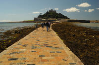
Marazion to Penzance
6 miles/9.7 km - Easy
A circular walk around Mount's Bay where the remains of the prehistoric forest that surrounded St Michael's Mount can still occasionally be seen on very low tides after storms
-
6 miles/9.6 km - Easy
Twelveheads and Chacewater

Twelveheads and Chacewater
6 miles/9.6 km - Easy
A circular walk in the Copper Kingdom of the Old World where the majority of world's copper came from during the 18th and 19th Centuries
-
6.7 miles/10.9 km - Easy
Rock to St Minver

Rock to St Minver
6.7 miles/10.9 km - Easy
A circular walk from Rock along the sand dunes to St Enodoc church, once buried in the sand, and across fields to the mediaeval church of St Minver, returning via 3 pubs and the brewery where "Doom Bar" was first produced.
-
2.2 miles/3.5 km - Easy-moderate
Lesnewth Church to Hallwell Woods

Lesnewth Church to Hallwell Woods
2.2 miles/3.5 km - Easy-moderate
A short circular walk in the tributary valleys of the River Valency through bluebell woodland beside a stream, and across meadows rich in wildflowers to the ancient Celtic churchyard of Lesnewth.
-
2.2 miles/3.6 km - Easy-moderate
West Pentire and Polly Joke

West Pentire and Polly Joke
2.2 miles/3.6 km - Easy-moderate
A circular walk through the poppy fields of West Pentire to Polly Joke beach, returning over the headland to the pub that was a cowshed until the mid-20th Century.
-
2.3 miles/3.7 km - Easy-moderate
Crantock

Crantock
2.3 miles/3.7 km - Easy-moderate
A circular walk along the Gannel Estuary from Crantock Beach to Penpol Creek, returning though the village of Crantock.
-
2.4 miles/3.8 km - Easy-moderate
Gwithian and Upton Towans

Gwithian and Upton Towans
2.4 miles/3.8 km - Easy-moderate
A circular walk around the nature reserve in the sand dunes that was once the National Explosives Works where girls manufactured dynamite from nitroglycerine.
-
2.4 miles/3.9 km - Easy-moderate
St Tudy to Wetherham

St Tudy to Wetherham
2.4 miles/3.9 km - Easy-moderate
A circular countryside walk from the 15th century church at St Tudy through the grounds of the 18th century Manor of Wetherham, returning to the church alehouse where ale brewed by the church was sold to raise funds, and later became the village lock-up known as The Clink.
-
2.4 miles/3.9 km - Easy-moderate
Tintagel, Church and Castle

Tintagel, Church and Castle
2.4 miles/3.9 km - Easy-moderate
A short circular walk exploring some of the historic sites in Tintagel including King Arthur's Castle and Merlin's Cave, the Old Post Office, and the ancient parish church on the cliffs.
-
2.5 miles/4 km - Easy-moderate
Bodmin town and beacon

Bodmin town and beacon
2.5 miles/4 km - Easy-moderate
A circular walk to the Beacon Local Nature Reserve, Jail and through Bodmin's historic centre.
-
2.5 miles/4 km - Easy-moderate
Stepper Point and the Doom Bar

Stepper Point and the Doom Bar
2.5 miles/4 km - Easy-moderate
A circular walk overlooking the infamous Doom Bar - from which the internationally popular beer is named - on which hundreds of vessels were wrecked when attempting to navigate into Padstow harbour and many still lie beneath the sands
-
2.6 miles/4.2 km - Easy-moderate
Warbstow Cross and Bury

Warbstow Cross and Bury
2.6 miles/4.2 km - Easy-moderate
A fairly short and easy circular walk around Warbstow, crossing ramparts of the massive Iron Age hillfort, through fields and along country lanes lined with wildflowers, returning via the mediaeval church which is dedicated to the daughter of a Saxon King who was tutored by the Celtic Saint Morwenna.
-
2.7 miles/4.4 km - Easy-moderate
Blisland to Lavethan Wood

Blisland to Lavethan Wood
2.7 miles/4.4 km - Easy-moderate
A short circular walk from the village of Blisland through the churchyard, two stretches of the Woodland Trust reserve of Lavethan Wood and land which was once the estates of Lavethan and Barlandew manors.
-
2.7 miles/4.4 km - Easy-moderate
Gwennap Pit to Carn Marth (short version)

Gwennap Pit to Carn Marth (short version)
2.7 miles/4.4 km - Easy-moderate
A circular walk at Carn Marth with panoramic views right across mid-Cornwall to Falmouth and the Roseland, the Cornish Alps and Bodmin Moor, and St Agnes and Trevose Head
-
3 miles/4.8 km - Easy-moderate
Looe woodland, river and coast

Looe woodland, river and coast
3 miles/4.8 km - Easy-moderate
A walk following the West Looe river from woods to its confluence and then to meet the Atlantic beside one of Cornwall's mediaeval ports.
-
3 miles/4.9 km - Easy-moderate
Baker's Pit and Rogers' Tower

Baker's Pit and Rogers' Tower
3 miles/4.9 km - Easy-moderate
A circular walk from the Bakers Pit nature reserve to an Iron Age hillfort where the remains of prehistoric roundhouses were seen as a convenient source of stone for a folly built in the era when the Poldark novels are set.
-
3.0 miles/4.9 km - Easy-moderate
St Agnes Beacon and Wheal Coates

St Agnes Beacon and Wheal Coates
3.0 miles/4.9 km - Easy-moderate
A circular walk between St Agnes Head and the engine houses of Wheal Coates via St Agnes Beacon, with spectacular panoramic views
-
3 miles/4.8 km - Easy-moderate
Tintagel Church to Trebarwith Strand

Tintagel Church to Trebarwith Strand
3 miles/4.8 km - Easy-moderate
A circular walk on quarrymens' trails along the cliffs of Tintagel past the Thunderhole blowhole to the long, sandy beach at Trebarwith Strand from Tintagel's mediaeval clifftop church with relics including the font that once stood in Tintagel Castle's chapel.
-
3.1 miles/5 km - Easy-moderate
Padstow to Harbour Cove

Padstow to Harbour Cove
3.1 miles/5 km - Easy-moderate
A circular walk through Padstow's mediaeval network of streets to the church, the Elizabethan Manor at Prideaux Place and Tregirls Farm, with panoramic views of the estuary, returning along a mile of sandy beaches.
-
3.2 miles/5.1 km - Easy-moderate
Lanhydrock Gardens

Lanhydrock Gardens
3.2 miles/5.1 km - Easy-moderate
A fairly short and easy circular walk through Lanhydrock gardens with plenty of picnic spots along the River Fowey that you can combine with a visit to the house.
-
3.2 miles/5.1 km - Easy-moderate
Poundstock to Penfound

Poundstock to Penfound
3.2 miles/5.1 km - Easy-moderate
A circular walk along country lanes, tracks and through fields to Penfound Manor - thought to be the oldest continually-inhabited ancestral home in England - from Poundstock church and gildhouse - the only surviving mediaeval church house of its kind in Cornwall.
-
3.3 miles/5.3 km - Easy-moderate
Penrose to the Loe Bar

Penrose to the Loe Bar
3.3 miles/5.3 km - Easy-moderate
A circular walk alongside the Loe Pool to the Loe Bar and back via the farm on the hill spur, which in Cornish gave the name to the Penrose Estate.
-
3.3 miles/5.2 km - Easy-moderate
St Keverne to Porthallow

St Keverne to Porthallow
3.3 miles/5.2 km - Easy-moderate
A circular walk through woods and meadows to Porthoustock and Porthallow from St Keverne, settled in the Dark Ages by Celtic monks trading with Brittany
-
3.3 miles/5.4 km - Easy-moderate
Towan Beach to Place House

Towan Beach to Place House
3.3 miles/5.4 km - Easy-moderate
A walk on contrasting coastlines, from the rugged Roseland coast to the sheltered creeks of the Percuil River opposite St Mawes.
-
3.4 miles/5.5 km - Easy-moderate
Jacobstow to Poulza

Jacobstow to Poulza
3.4 miles/5.5 km - Easy-moderate
A circular countryside walk around the Saxon area of Jacobstow near Bude where an ancient mediaeval altar was removed from the church during the 16th Century and used as a footbridge over a stream, then used as a churchyard seat in Victorian times, and finally returned to the church in the 1970s.
-
3.4 miles/5.5 km - Easy-moderate
Luxulyan Valley circular

Luxulyan Valley circular
3.4 miles/5.5 km - Easy-moderate
A circular walk following the leats and horse-drawn tramways through the World Heritage site of the Luxulyan Valley to the massive viaduct which carried the tramways towards Newquay and water to winch the trams up the valley with a huge waterwheel, recommended in guidebooks as early as the 1920s "as one of the most glorious walks in all Cornwall".
-
3.4 miles/5.4 km - Easy-moderate
St Anthony Head (short version)

St Anthony Head (short version)
3.4 miles/5.4 km - Easy-moderate
A walk on the Roseland coast and then into the Fal estuary to St Anthony Church via the fort St Anthony Head and the golden sandy beaches of Molunan.
-
3.4 miles/5.4 km - Easy-moderate
Wheal Maid and Poldice Valley

Wheal Maid and Poldice Valley
3.4 miles/5.4 km - Easy-moderate
A circular walk in the area described in Victorian times as the richest square mile anywhere on Earth
-
3.5 miles/5.6 km - Easy-moderate
Mawnan
Mawnan
3.5 miles/5.6 km - Easy-moderate
A circular walk through three of the wooded valleys to the sheltered coves at the mouth of the Helford River
-
3.6 miles/5.8 km - Easy-moderate
Lost Church and Perranporth dunes

Lost Church and Perranporth dunes
3.6 miles/5.8 km - Easy-moderate
A circular walk on the highest dune system in Britain to the chapel dating from Celtic times which was lost in the dunes for nearly 1000 years.
-
3.6 miles/5.8 km - Easy-moderate
St Newlyn East and Lappa Valley

St Newlyn East and Lappa Valley
3.6 miles/5.8 km - Easy-moderate
A circular walk from St Newlyn East through the woods of the Lappa Valley where the Steam Railway now encompasses what was one of the most famous mines in Cornwall during Victorian times and the riverbeds are still stained red.
-
3.7 miles/6.0 km - Easy-moderate
Calstock

Calstock
3.7 miles/6.0 km - Easy-moderate
A walk at Calstock where a Victorian mineral railway from Kelly Bray once ran down to the quayside and the viaduct was built in the 1900s to connect this to Plymouth, creating today's Tamar Valley Line.
-
3.7 miles/5.9 km - Easy-moderate
Lerryn River and Tivoli lost gardens

Lerryn River and Tivoli lost gardens
3.7 miles/5.9 km - Easy-moderate
A woodland and riverside walk at Lerryn - thought to be the inspiration for the book The Wind In The Willows - and the lost pleasure gardens of Tivoli Park
-
3.7 miles/5.9 km - Easy-moderate
Newmills to Tregadillett

Newmills to Tregadillett
3.7 miles/5.9 km - Easy-moderate
A circular walk in the Kensey valley from the end of the steam railway at Newmills, through the bluebell woods at Trebursye, to the Eliot Arms in Tregadillett and returning to Newmills via the remains of a prehistoric fort, to catch the steam train back to Launceston.
-
3.7 miles/5.9 km - Easy-moderate
Restormel Castle and Lostwithiel

Restormel Castle and Lostwithiel
3.7 miles/5.9 km - Easy-moderate
A circular walk to the mediaeval capital of Cornwall from one of its most striking Norman castles along the valley where Victoria and Albert tried their hand at mining and members of the Royal family still sometimes visit.
-
3.7 miles/6 km - Easy-moderate
St Just-in-Roseland to Messack Point

St Just-in-Roseland to Messack Point
3.7 miles/6 km - Easy-moderate
A circular walk on the Roseland along both sides of St Just creek to Messack Point, where there are spectacular views over one of the largest natural harbours in the world.
-
3.8 miles/6.1 km - Easy-moderate
Lanhydrock to Respryn

Lanhydrock to Respryn
3.8 miles/6.1 km - Easy-moderate
A circular walk through the mature broadleaf woodland in the less well-known areas of the Lanhydrock estate, through bluebell woods and along the River Fowey, past the mediaeval bridge at Respryn, built after numerous prayers for safe passage in the ford-side chapel, had not resulted in the desired outcome.
-
3.8 miles/6.1 km - Easy-moderate
Roche and the rock

Roche and the rock
3.8 miles/6.1 km - Easy-moderate
A circular walk at Roche where the spectacular remains of a mediaeval chapel are built into the towering rock outcrop and the villagers have defended public access to it with dynamite
-
3.8 miles/6.1 km - Easy-moderate
St Clement and Malpas

St Clement and Malpas
3.8 miles/6.1 km - Easy-moderate
A circular walk at the confluence of the Truro and Tresillian rivers, once defended by Moresk castle and later where timber for the mines was unloaded and floated as rafts into Truro
-
3.8 miles/6.1 km - Easy-moderate
St Issey to Sea Mills

St Issey to Sea Mills
3.8 miles/6.1 km - Easy-moderate
A circular walk from St Issey along the river valley, the Saint's Way to the creek-side church at Little Petherick, and along the creek to the tidal enclosure of Sea Mills, returning via two old inns.
-
3.7 miles/5.9 km - Easy-moderate
St Mabyn to Pencarrow House

St Mabyn to Pencarrow House
3.7 miles/5.9 km - Easy-moderate
A fairly easy circular walk from St Mabyn past the church and through rolling countryside to Pencarrow House and its magnificent gardens.
-
3.9 miles/6.2 km - Easy-moderate
Crowan to Clowance Estate

Crowan to Clowance Estate
3.9 miles/6.2 km - Easy-moderate
A circular walk in the parish of Crowan from the church to the Clowance Estate - the mansion of the St Aubyn Baronets until the fifth Baronet failed to produce a legitimate heir due to his 15 children all being born to women not married to him.
-
3.9 miles/6.2 km - Easy-moderate
Holywell to Polly Joke

Holywell to Polly Joke
3.9 miles/6.2 km - Easy-moderate
A circular walk from Holywell Bay on the dunes and Kelsey Head to the sandy beach of Polly Joke.
-
3.9 miles/6.3 km - Easy-moderate
Land's End

Land's End
3.9 miles/6.3 km - Easy-moderate
A circular walk on the rugged cliffs at the most westerly point of the British mainland with spectacular views and spectacular wildflowers.
-
3.9 miles/6.3 km - Easy-moderate
Penzance to Newlyn

Penzance to Newlyn
3.9 miles/6.3 km - Easy-moderate
A circular walk at Mount's Bay from the largest port town in the bay to the harbour of Cornwall's largest fishing fleet.
-
3.9 miles/6.2 km - Easy-moderate
Stannon Moor prehistoric relics

Stannon Moor prehistoric relics
3.9 miles/6.2 km - Easy-moderate
A circular walk around Stannon Moor near St Breward with panoramic views of Bodmin Moor, passing stone circles, burial chambers and other prehistoric monuments to a massive granite boulder balanced on Louden Hill which gently rocks if you sit on it.
-
4 miles/6.5 km - Easy-moderate
Mylor and Restronguet Creeks

Mylor and Restronguet Creeks
4 miles/6.5 km - Easy-moderate
A circular walk along the Mylor and Restronguet creeks via the Pandora Inn, said to be once owned and renamed by the captain of HMS Pandora sent to capture mutineers from The Bounty, and where a passing-boat was kept to connect the post road between Falmouth and Truro, summoned by a bell on the other side of the creek.
-
4 miles/6.4 km - Easy-moderate
Watergate Bay to Newquay (via bus)

Watergate Bay to Newquay (via bus)
4 miles/6.4 km - Easy-moderate
A one-way coastal walk, made circular via an initial bus journey, from Watergate Bay along the coast path to Newquay, passing the sea caves at Whipsiderry beach, the Iron Age hillfort on Trevelgue head and the beaches of Porth, Lusty Glaze and Tolcarne.
-
4.1 miles/6.6 km - Easy-moderate
Degibna and Carminowe Valley

Degibna and Carminowe Valley
4.1 miles/6.6 km - Easy-moderate
A circular walk in the wooded valleys beside the Loe Pool with panoramic views over the lake
-
4.1 miles/6.5 km - Easy-moderate
Mylor to Flushing

Mylor to Flushing
4.1 miles/6.5 km - Easy-moderate
A circular walk from Mylor Harbour along the creeks of Carrick Roads to Flushing which was named after a town in Holland when Dutch engineers built the quays, and where ships' captains would keep a watchful eye over Falmouth Harbour from their tall houses.
-
4.1 miles/6.6 km - Easy-moderate
North Petherwin to Winsdon

North Petherwin to Winsdon
4.1 miles/6.6 km - Easy-moderate
A circular walk from North Petherwin in the river valleys of the Bolsbridge Water.
-
4.2 miles/6.8 km - Easy-moderate
Davidstow and Inny Vale

Davidstow and Inny Vale
4.2 miles/6.8 km - Easy-moderate
A circular walk in the Inny Vale on the northern edge of Bodmin Moor through the WW2 airbase on Davidstow Moor, the tunnel of trees to Treworra and past the source of the River Inny to the church and holy well of St David.
-
4.3 miles/7 km - Easy-moderate
Tehidy Woods to Deadman's Cove

Tehidy Woods to Deadman's Cove
4.3 miles/7 km - Easy-moderate
A circular walk through the wildlife reserve and bluebell woodland of Tehidy Country Park to Deadman's Cove and the North Cliffs, where many sailing ships were wrecked before the Godrevy Lighthouse was built.
-
4.4 miles/7 km - Easy-moderate
Giant's Quoit and Pendarves Wood

Giant's Quoit and Pendarves Wood
4.4 miles/7 km - Easy-moderate
A walk from a tiny village designed by Victorians, through ancient woodland that was once part of the Pendarves Estate to the prehistoric tomb that, despite two collapses over the centuries, is once again standing.
-
4.4 miles/7 km - Easy-moderate
Portscatho to Pendower Beach

Portscatho to Pendower Beach
4.4 miles/7 km - Easy-moderate
A circular walk along two miles of beaches around Gerrans Bay which were once used by Portscatho smugglers to land contraband and strewn with the wreckage of sailing ships that overshot Falmouth Harbour and ran aground on The Whelps reef.
-
4.5 miles/7.2 km - Easy-moderate
Cardinham Woods and Lady Vale
Cardinham Woods and Lady Vale
4.5 miles/7.2 km - Easy-moderate
A circular walk in the wooded valley surrounding Cardinham Water where the mediaeval chapel of St Mary de Valle once stood but now only the Lady Vale mediaeval bridge remains.
-
4.5 miles/7.2 km - Easy-moderate
Crantock and The Gannel

Crantock and The Gannel
4.5 miles/7.2 km - Easy-moderate
A circular walk along the River Gannel from Crantock, originally settled by Celtic monks whose chapel is thought may be buried beneath the dunes.
-
4.5 miles/7.2 km - Easy-moderate
Kennack Sands to Cadgwith

Kennack Sands to Cadgwith
4.5 miles/7.2 km - Easy-moderate
A circular walk from Kennack Sands to Cadgwith Cove via the Poltesco valley where during Victorian times waterwheels and steam engines powered an industry producing large decorative pieces of serpentine but has now been recolonised by nature
-
4.7 miles/7.6 km - Easy-moderate
Deadman's Cove to Red River Valley

Deadman's Cove to Red River Valley
4.7 miles/7.6 km - Easy-moderate
A circular walk along a coast of shipwrecks and smugglers from Deadman's Cove to Hell's Mouth, past the collapse of the North Cliffs that went viral on YouTube, and returning through the nature reserve along the Red River Valley.
-
4.7 miles/7.5 km - Easy-moderate
St Teath

St Teath
4.7 miles/7.5 km - Easy-moderate
A circular walk in the countryside around St Teath where the North Cornwall Railway once ran to the bustling quarry at Delabole which provided employment for the thriving Victorian village.
-
4.7 miles/7.6 km - Easy-moderate
Trelissick

Trelissick
4.7 miles/7.6 km - Easy-moderate
A figure-of-8 walk along the creeks of the River Fal through the 300 acre estate surrounding Trelissick House.
-
4.8 miles/7.7 km - Easy-moderate
Saltash and the Lynher Valley

Saltash and the Lynher Valley
4.8 miles/7.7 km - Easy-moderate
A circular walk in the ferry town that was the main riverside settlement in mediaeval times when Plymouth was moorland, and where a handful of Elizabethan buildings still remain from the period when Francis Drake built a property empire from his circumnavigation of the globe.
-
4.9 miles/7.9 km - Easy-moderate
Constantine Bay to Porthcothan

Constantine Bay to Porthcothan
4.9 miles/7.9 km - Easy-moderate
A circular walk between Constantine Bay to Porthcothan via nature's swimming pool at Treyarnon beach and a spectacular series of islands, headlands and tiny coves named after wine and pepper smuggled there, and the rock where a customs officer was left by smugglers to drown.
-
4.9 miles/7.9 km - Easy-moderate
Holywell to Crantock

Holywell to Crantock
4.9 miles/7.9 km - Easy-moderate
A circular walk from Holywell Bay past the remarkable sacred spring and along the coast to the sandy beaches of Porth Joke and Crantock, returning via the dunes of the Cubert Common nature conservation area.
-
4.9 miles/7.9 km - Easy-moderate
Marazion to Perranuthnoe

Marazion to Perranuthnoe
4.9 miles/7.9 km - Easy-moderate
A mostly circular walk to Perranuthnoe beach from one of Britain's most ancient towns - Marazion - burnt down twice by the French and once more in a Cornish rebellion
-
5 miles/8.1 km - Easy-moderate
Camelford to Watergate

Camelford to Watergate
5 miles/8.1 km - Easy-moderate
A circular walk from Camelford through bluebell woods along the Camel valley to the Celtic churchyard of Advent and the Neolithic remains on the edge of Bodmin Moor.
-
5 miles/8 km - Easy-moderate
Minions and Caradon Hill

Minions and Caradon Hill
5 miles/8 km - Easy-moderate
A walk through the remains of the UK's most productive copper mines which employed thousands of people in Victorian times, including brakemen who each scooted an individual loaded ore wagon down to Liskeard on the railway that forms much of the walk route.
-
5 miles/8 km - Easy-moderate
St Austell, Clay Trails and Menacuddle Well

St Austell, Clay Trails and Menacuddle Well
5 miles/8 km - Easy-moderate
A circular walk in china clay country, including a trail laid on the trackbed of a mineral railway from St Austell to the Cornish Alps and one of Cornwall's most picturesque holy wells.
-
5.1 miles/8.3 km - Easy-moderate
Deerpark to Herodsfoot

Deerpark to Herodsfoot
5.1 miles/8.3 km - Easy-moderate
A woodland walk in what's likely to have been a mediaeval deer park to the site of Cornwall's second-largest gunpowder manufacturing operation, which despite exploding several times was sufficiently successful to give rise to a nearby sister site known as Trago Mills.
-
5.1 miles/8.2 km - Easy-moderate
Helford to Dennis Head

Helford to Dennis Head
5.1 miles/8.2 km - Easy-moderate
A circular walk around the creeks of the Helford River and the small villages settled by Celtic monks from Brittany.
-
about 5.1 miles/8.3 km - Easy-moderate
Helston and Cober Valley

Helston and Cober Valley
about 5.1 miles/8.3 km - Easy-moderate
A circular walk from Helston along the Cober Valley to the granite quarries at Coverack Bridges, where the viaduct of the Helston Railway can still be seen spanning the valley.
-
5.1 miles/8.2 km - Easy-moderate
Polyphant

Polyphant
5.1 miles/8.2 km - Easy-moderate
A circular countryside walk to the mills in the Inny Valley from Polyphant, Cornish for "toad pool", to Gimblett's Mill where the bridge was rebuilt after a wall of water swept down the valley in 1847 destroying nearly everything in its path.
-
5.1 miles/8.2 km - Easy-moderate
St Breward to King Arthur's Hall

St Breward to King Arthur's Hall
5.1 miles/8.2 km - Easy-moderate
A circular walk from St Breward across the Treswallock Downs to the curious prehistoric structure of King Arthur's Hall and ending at the mediaeval Old Inn.
-
5.2 miles/8.3 km - Easy-moderate
Tregantle to Crafthole
Tregantle to Crafthole
5.2 miles/8.3 km - Easy-moderate
A circular walk in tributary valleys of the St Germans River and past the Victorian coastal defences overlooking Whitsand Bay, where one of the forts is still in use today.
-
5.2 miles/8.4 km - Easy-moderate
Wadebridge to St Breock

Wadebridge to St Breock
5.2 miles/8.4 km - Easy-moderate
A circular walk from Wadebridge on the Camel Trail alongside the Amble Marshes nature reserve then across meadows and wooded creeks to the mediaeval church of St Breock, returning via the woods of the Polmorla valley.
-
5.3 miles/8.5 km - Easy-moderate
Lanhydrock to Restormel

Lanhydrock to Restormel
5.3 miles/8.5 km - Easy-moderate
A circular walk from the mediaeval bridge at Respryn along the River Fowey through the bluebell woodland of the Lanhydrock Estate to the circular Norman castle at Restormel which had a pressurised piped water system 700 years ahead of its time.
-
5.4 miles/8.7 km - Easy-moderate
Falmouth and Pendennis Point

Falmouth and Pendennis Point
5.4 miles/8.7 km - Easy-moderate
A circular walk around the thriving town of Falmouth, which didn't exist until Elizabethan times when Sir Walter Raleigh suggested that the largest natural harbour in Europe would be a good place to build a port town.
-
5.5 miles/8.8 km - Easy-moderate
Altarnun and West Moor

Altarnun and West Moor
5.5 miles/8.8 km - Easy-moderate
A walk from Altarnun across the downs and out onto the open moor where the relics of mediaeval tin workings and prehistoric roundhouses can still be seen
-
5.8 miles/9.3 km - Easy-moderate
Castle-an-dinas and Menalhyl valley

Castle-an-dinas and Menalhyl valley
5.8 miles/9.3 km - Easy-moderate
A mostly circular walk from the Castle-an-dinas Iron Age hillfort with 360 degree views across Cornwall, then into the valley to the River Menalhyl, followed by wooded paths lined with primroses, bluebells and wild garlic, and lanes with vibrant wildflowers.
-
5.8 miles/9.4 km - Easy-moderate
Rock to Polzeath

Rock to Polzeath
5.8 miles/9.4 km - Easy-moderate
A circular walk across the dunes and headland between Rock and Polzeath, returning via St Enodoc Church, where Sir John Betjeman is buried.
-
5.8 miles/9.4 km - Easy-moderate
Rosemullion Head

Rosemullion Head
5.8 miles/9.4 km - Easy-moderate
A circular walk passing the National Trust's Glendurgan gardens and the equally spectacular submarine gardens of Rosemullion Head where fish dart amongst the brightly-coloured blooms.
-
5.8 miles/9.3 km - Easy-moderate
St Stephen and Tregargus Valley

St Stephen and Tregargus Valley
5.8 miles/9.3 km - Easy-moderate
A circular walk from St Stephen along a tributary valley of the River Fal to the hamlet of Coombe via some of Cornwall's best preserved remains of the Victorian and early 20th Century China Stone industry
-
5.9 miles/9.5 km - Easy-moderate
St Anthony Head

St Anthony Head
5.9 miles/9.5 km - Easy-moderate
A walk along the Roseland coast and creeks opposite St Mawes, passing the preserved fort and Fraggle Rock lighthouse on St Anthony Head and the golden sandy beaches of Molunan.
-
6 miles/9.6 km - Easy-moderate
Penrose and Porthleven

Penrose and Porthleven
6 miles/9.6 km - Easy-moderate
A circular walk through the woodland alongside the Loe to the most southerly port on the British mainland, famous for its huge storm waves.
-
6 miles/9.7 km - Easy-moderate
Praa Sands to Prussia Cove

Praa Sands to Prussia Cove
6 miles/9.7 km - Easy-moderate
A circular walk on Cornwall's Channel coast where horses carried ore, Victorian fishermen built huts and smugglers sailed to France, but before all this Neolithic people settled and worked flints carried down the English Channel from chalk areas during the Ice Age
-
6 miles/9.6 km - Easy-moderate
Stithians to Kennall Vale

Stithians to Kennall Vale
6 miles/9.6 km - Easy-moderate
A circular walk in the valley of the River Kennall, where during Victorian times the cascading river was used to power gunpowder mills, five of which exploded in a chain reaction so violent that the roof of one was found a mile away.
-
6 miles/9.7 km - Easy-moderate
Three Saints Way

Three Saints Way
6 miles/9.7 km - Easy-moderate
A circular walk around the tributary valleys of the River Ottery and Kensey between three of Cornwall's least-well-known mediaeval churches
-
6.1 miles/9.7 km - Easy-moderate
Egloshayle to Dinham Bridge

Egloshayle to Dinham Bridge
6.1 miles/9.7 km - Easy-moderate
A circular walk in the Allen Valley from Egloshayle though the broadleaf woodland alongside the River Allen past the mills of Hingham and Lemail, returning via the Celtic Three Holed Cross and the remains of Castle Killibury which from mediaeval Welsh texts is thought might be one of King Arthur's several castles.
-
6.1 miles/9.8 km - Easy-moderate
Feock to Devoran

Feock to Devoran
6.1 miles/9.8 km - Easy-moderate
A circular walk to the Victorian-engineered town of Devoran which was once the largest mining port in Cornwall, and along Restronguet Creek on the route of the railway that lead from the ore bins and smelting houses to the mines of Redruth
-
6.1 miles/9.8 km - Easy-moderate
Golitha Falls and Siblyback Lake

Golitha Falls and Siblyback Lake
6.1 miles/9.8 km - Easy-moderate
A circular walk through the Golitha Falls National Nature Reserve along ancient rights of way to pass around Siblyback Lake, where the remains of a mediaeval field system rise from the water when reservoir levels fall.
-
6.1 miles/9.7 km - Easy-moderate
Trevose Head

Trevose Head
6.1 miles/9.7 km - Easy-moderate
A circular walk around the rugged coastline of Trevose Head via the iconic lighthouse and golden sandy bays of Constantine, Booby's, Mother Ivey's and Harlyn, with spectacular wildflowers in spring and summer.
-
6.2 miles/10 km - Easy-moderate
Gwennap Pit and Carn Marth

Gwennap Pit and Carn Marth
6.2 miles/10 km - Easy-moderate
A circular walk through an area steeped in mining history, with panoramic views from Carn Marth and the almost legendary Gwennap Pit which became so famous that even the neighbouring mine was renamed to Cathedral
-
6.2 miles/10 km - Easy-moderate
The Loe

The Loe
6.2 miles/10 km - Easy-moderate
A circular walk around the Loe Pool, the largest natural freshwater lake in Cornwall, and along the Loe Bar, one of Cornwall's most treacherous beaches on which 100 of those onboard the HMS Anson drowned metres from the shore, motivating the invention of the rocket lifesaving apparatus that saved thousands of lives.
-
6.2 miles/10 km - Easy-moderate
Widemouth to Bude

Widemouth to Bude
6.2 miles/10 km - Easy-moderate
A circular walk from Widemouth Bay along the Coast Path though the Phillips Point nature reserve to The Storm Tower at Compass Point and then along the Bude Canal to Whalesborough, returning across the fields to Widemouth.
-
6.4 miles/10.3 km - Easy-moderate
Daymer Bay to Padstow

Daymer Bay to Padstow
6.4 miles/10.3 km - Easy-moderate
A figure-of-8 walk from Daymer Bay through the dunes to Rock, passing the once-buried St Enodoc church, before crossing on the ferry to Padstow, and returning along three miles of sandy beaches.
-
6.4 miles/10.2 km - Easy-moderate
Truro to Roseworthy

Truro to Roseworthy
6.4 miles/10.2 km - Easy-moderate
A circular walk in the Kenwyn valley following the Kenwyn upriver from Truro's Victoria Gardens where the elaborate Victorian system of weir gates, a hydraulic ram and leats both maintained the fish pond in the gardens and provided drinking water for horses in the city centre.
-
6.5 miles/10.5 km - Easy-moderate
Budock Water and the Lakes

Budock Water and the Lakes
6.5 miles/10.5 km - Easy-moderate
A walk from what was once the parish church for Falmouth to the lakes in a river valley which the Celtic people described as secluded and where Argal Mill lies somewhere beneath the water in a Cornish version of Atlantis.
-
6.6 miles/10.7 km - Easy-moderate
St Mawgan to St Columb Major

St Mawgan to St Columb Major
6.6 miles/10.7 km - Easy-moderate
A circular walk along the Vale of Lanherne to the mediaeval market town of St Columb Major, where Cornish Hurling is still played, through the broadleaf woodland of the Carnanton Estate along the River Menalhyl, returning to the riverside pub, church and convent at St Mawgan.
-
6.7 miles/10.8 km - Easy-moderate
Penryn Creeks and Enys

Penryn Creeks and Enys
6.7 miles/10.8 km - Easy-moderate
A circular walk along the creeks of Carrick Roads and through the woodland of the Enys Estate, famous for its bluebells in spring
-
6.8 miles/10.9 km - Easy-moderate
Seven Bays (via bus)

Seven Bays (via bus)
6.8 miles/10.9 km - Easy-moderate
A one-way coastal walk, made circular via an initial bus journey, along the Seven Bays coast and around Trevose Head past the lighthouse.
-
6.8 miles/10.9 km - Easy-moderate
Wadebridge to Polbrock

Wadebridge to Polbrock
6.8 miles/10.9 km - Easy-moderate
A circular walk from Wadebridge through the Treraven nature reserve, bluebell woodland at Hustyn Mill and meadows along the River Camel to Polbrock, returning along the Camel Trail.
-
7.3 miles/11.7 km - Easy-moderate
Golitha Falls to Trethevy Quoit

Golitha Falls to Trethevy Quoit
7.3 miles/11.7 km - Easy-moderate
A circular walk through the Golitha Falls National Nature Reserve, to King Doniert's Stone - a memorial to the last King of Cornwall, and the prehistoric tomb of Trethevy Quoit, returning via St Cleer where the holy well is reputed to cure madness.
-
2.5 miles/4 km - Moderate
Danescombe Valley

Danescombe Valley
2.5 miles/4 km - Moderate
A circular walk from Cotehele Quay into the broadleaf woodland of the Danescombe Valley where bluebells and orchids flower in spring and fungi erupt through the carpet of autumn leaves.
-
2.4 miles/3.9 km - Moderate
Palace Cove and Lansallos

Palace Cove and Lansallos
2.4 miles/3.9 km - Moderate
A circular walk to the small coves of Lantivet Bay used in Victorian times for pilchard fishing, collecting seaweed as fertiliser and smuggling barrels of French brandy.
-
2.6 miles/4.2 km - Moderate
Boscastle to Minster Church

Boscastle to Minster Church
2.6 miles/4.2 km - Moderate
A short circular walk from Boscastle through bluebell woodland alongside the River Valency to the ancient Celtic churchyard and sacred spring at Minster, returning along the River Jordan, beside which Bottreaux Castle was once situated, and Boscastle's Old Road.
-
2.7 miles/4.4 km - Moderate
Tintagel to Bossiney

Tintagel to Bossiney
2.7 miles/4.4 km - Moderate
A circular walk via through Tintagel to Tintagel Castle and along the coastline via the headlands of Barras Nose and Willapark to the sandy beach at Bossiney Haven from Tintagel Haven where Merlin's Cave is uncovered at low tide.
-
2.7 miles/4.3 km - Moderate
Trebarwith Valley

Trebarwith Valley
2.7 miles/4.3 km - Moderate
A fairly short circular walk exploring Trebarwith Valley, a designated Area of Outstanding Natural Beauty in North Cornwall. The walk includes bluebell woodland, panoramic views from both sides of the valley and the Trebarwith Nature Reserve.
-
2.8 miles/4.5 km - Moderate
Two Coombes of Lansallos

Two Coombes of Lansallos
2.8 miles/4.5 km - Moderate
A circular walk from Lansallos to the coves of Lantivet Bay where farmers collected seaweed and sand to improve the soil and smugglers landed French brandy.
-
2.9 miles/4.7 km - Moderate
Charlestown to Porthpean

Charlestown to Porthpean
2.9 miles/4.7 km - Moderate
A circular walk between the sheltered cove at Porthpean and the historic port of Charlestown, originally built to export copper, then China Clay, and now used for filming by Hollywood and Poldark.
-
2.9 miles/4.7 km - Moderate
Polperro harbour and headlands

Polperro harbour and headlands
2.9 miles/4.7 km - Moderate
A figure-of-eight walk around the fishing village and headlands surrounding Polperro, passing the net loft perched above the harbour, the Victorian sea pool, the site of the mediaeval chapel and the harbourmaster's route to the lighthouse.
-
2.9 miles/4.7 km - Moderate
Port Quin to Lundy Bay

Port Quin to Lundy Bay
2.9 miles/4.7 km - Moderate
A circular walk from the fishing village of Port Quin to the golden sandy beaches of Epphaven Cove and Lundy Bay with spectacular coastal scenery, via the cliff-edge folly on Doyden Point built as a gambling den.
-
2.9 miles/4.7 km - Moderate
Week St Mary to Penhallam

Week St Mary to Penhallam
2.9 miles/4.7 km - Moderate
A circular walk from the Saxon village of Week St Mary through Ashbury woods, beneath the Iron Age fort, to the remains of the mediaeval manor of Penhallam which was only rediscovered in the 1960s, returning via the church, repaired after the pinnacle above the door was severed by lightning and crashed through the roof.
-
3 miles/4.8 km - Moderate
Cremyll to Maker Church

Cremyll to Maker Church
3 miles/4.8 km - Moderate
A circular walk on a peninsula protruding into the Hamoaze estuary and where the land was dotted with gun batteries, defending against a potential invasion from Napoleon.
-
3 miles/4.8 km - Moderate
Millook to Trebarfoote

Millook to Trebarfoote
3 miles/4.8 km - Moderate
A circular walk through Woodland Trust reserves of the ancient Millook woods, meadows to the former smuggling den and 1920s wild party venue of Trebarfoote, and along the coast from Cancleave Strand to Millook Haven where colliding continents have melted and folded the rocks like toffee.
-
3 miles/4.9 km - Moderate
Par Beach to Polkerris
Par Beach to Polkerris
3 miles/4.9 km - Moderate
A circular walk on the coast path and Saint's Way from Par to the fishing hamlet of Polkerris where the pub has retreated into the Lifeboat station after being washed away by a storm in Victorian times, and Napoleonic cannons were built into the harbour wall as mooring posts.
-
3 miles/4.9 km - Moderate
Porthcurno to Penberth Cove

Porthcurno to Penberth Cove
3 miles/4.9 km - Moderate
A circular walk with spectacular coastal scenery from Porthcurno to Penberth Cove, passing the famous wobbling boulder of Logan Rock and returning via the escape route from the wartime tunnels which housed one of the world's largest telegraph stations.
-
3.1 miles/4.9 km - Moderate
Kilminorth Woods and the Giant's Hedge

Kilminorth Woods and the Giant's Hedge
3.1 miles/4.9 km - Moderate
A woodland walk alongside the West Looe River where the Giant's Hedge once divided kingdoms of the Dark Ages, centuries before the ancient trees that now tower above it were even seedlings.
-
3.1 miles/5 km - Moderate
Porthgwarra to Minack

Porthgwarra to Minack
3.1 miles/5 km - Moderate
A circular walk to the Minack Theatre, via St Levan's church, St Leven's Holy Well and Porthchapel beach, from Porthgwarra where the beach is accessed via a rock tunnel created by local miners.
-
3.1 miles/4.9 km - Moderate
Trevaunance Cove and Blue Hills mine

Trevaunance Cove and Blue Hills mine
3.1 miles/4.9 km - Moderate
A circular walk along the stream of Trevellas Coombe where tin ore is still worked using traditional water power, past Stippy Stappy - the row of sea captain's cottages, and down the valley to the sandy beach of Trevaunance Cove with the remains of Victorian harbour which was demolished by Atlantic storms.
-
3.1 miles/5.0 km - Moderate
St Breward to Lank

St Breward to Lank
3.1 miles/5.0 km - Moderate
A short circular walk from St Breward through ancient bluebell woods along the valley of the River Camel to the holy well, ending at the mediaeval church and inn.
-
3.2 miles/5.2 km - Moderate
Helman Tor and Red Moor

Helman Tor and Red Moor
3.2 miles/5.2 km - Moderate
A circular walk to the neolithic enclosure on the summit of Helman Tor and through the woodland of Cornwall's largest nature reserve.
-
3.2 miles/5.1 km - Moderate
Lizard to Kynance Cove (shorter version)

Lizard to Kynance Cove (shorter version)
3.2 miles/5.1 km - Moderate
A circular walk from Lizard village to Kynance Cove with spectacular views, wildflowers including Cornwall's county flower and wildlife including the Cornish Chough.
-
3.3 miles/5.3 km - Moderate
Boscastle Headlands

Boscastle Headlands
3.3 miles/5.3 km - Moderate
A circular walk from Boscastle to Pentargon waterfall and Willapark coastguard lookout with magnificent views of the village and harbour from the headlands where the village women once gathered dressed in red to fool a French ship into fleeing from British army redcoats.
-
3.3 miles/5.3 km - Moderate
Readymoney Cove to Polridmouth

Readymoney Cove to Polridmouth
3.3 miles/5.3 km - Moderate
A circular walk in du Maurier country from Readymoney Cove - where she lived in the 1940s - to Polridmouth, where the shipwreck inspired her book Rebecca.
-
3.4 miles/5.4 km - Moderate
Mevagissey to Portmellon

Mevagissey to Portmellon
3.4 miles/5.4 km - Moderate
A circular walk from the busy fishing port of Mevagissey into the Portmellon Valley and through the West Bodrugan Woods nature reserve to the beachside village of Portmellon where boats have been built for hundreds of years, and still are.
-
3.5 miles/5.6 km - Moderate
Padstow town

Padstow town
3.5 miles/5.6 km - Moderate
A short circular walk from Padstow harbour to the viewpoints at the War Memorial and Victorian obelisk, the Elizabethan Manor at Prideaux Place, and including some pretty backstreets that lie off the main tourist routes.
-
3.5 miles/5.7 km - Moderate
West Pentire to Crantock Beach

West Pentire to Crantock Beach
3.5 miles/5.7 km - Moderate
A circular walk on the northernmost end of one of Cornwall's largest areas of sand dunes that stretch from Crantock to Perranporth, under which one mediaeval chapel was found and another is said to still be lost.
-
3.6 miles/5.8 km - Moderate
Delabole

Delabole
3.6 miles/5.8 km - Moderate
A circular walk around Delabole past the slate quarry, along back lanes and tracks, and through fields and bluebell woods.
-
3.6 miles/5.8 km - Moderate
Gribbin Head

Gribbin Head
3.6 miles/5.8 km - Moderate
A circular walk on the headland near Fowey where Daphne du Maurier lived and formed the basis for scenes in her books.
-
3.6 miles/5.7 km - Moderate
Withiel and Tremore Valley

Withiel and Tremore Valley
3.6 miles/5.7 km - Moderate
A circular walk in the Ruthern and Tremore river valleys following the Saint's Way to Withiel where the award-winning cheese Cornish Yarg was first made from a recipe in a dusty book found in the attic, that is thought to date back to the 13th Century.
-
3.6 miles/5.8 km - Moderate
Portwrinkle to Sheviock

Portwrinkle to Sheviock
3.6 miles/5.8 km - Moderate
A circular walk from the beach and tiny harbour of Portwrinkle to the small village of Sheviock, thought to be Cornish for "abounding in strawberries", with a church abounding in mediaeval tombs.
-
3.7 miles/5.9 km - Moderate
Sancreed to Carn Euny

Sancreed to Carn Euny
3.7 miles/5.9 km - Moderate
A countryside walk to the Celtic church and Holy Well at Sancreed and the Iron Age village of Carn Euny where a well-preserved underground chamber known as a fogou has puzzled archaelogists for centuries
-
3.7 miles/6 km - Moderate
St Just to Cape Cornwall

St Just to Cape Cornwall
3.7 miles/6 km - Moderate
A circular walk from St Just to the rugged coast of England's only Cape topped by a monument fashioned from a mine chimney, passing mediaeval and prehistoric remains.
-
3.8 miles/6.1 km - Moderate
Helford and Frenchman's Creek

Helford and Frenchman's Creek
3.8 miles/6.1 km - Moderate
A circular walk through the wooded valleys of the Helford River including the most famous - Frenchman's Creek - which is still as pristine as when it inspired Daphne du Maurier's novel
-
3.8 miles/6.1 km - Moderate
Church Cove and Lizard Point

Church Cove and Lizard Point
3.8 miles/6.1 km - Moderate
A circular walk on The Lizard to the most southerly point from Church Cove, where the Lizard lifeboat is now launched to the old lifeboat station at Polpeor Cove.
-
3.8 miles/6.8 km - Moderate
Minions and the Cheesewring

Minions and the Cheesewring
3.8 miles/6.8 km - Moderate
A circular walk around the iconic landmarks at Minions, including The Hurlers stone circles, The Cheesewring and the engine houses of the South Phoenix Mine.
-
3.8 miles/6.1 km - Moderate
Porth Nanven to Nanquidno

Porth Nanven to Nanquidno
3.8 miles/6.1 km - Moderate
A circular walk from the Cot Valley past the beaches of Nanquidno and Porth Nanven where granite boulders polished over millions of years by prehistoric oceans and then buried by the soil are being exposed once again by the sea.
-
3.8 miles/6.1 km - Moderate
St Endellion to Port Isaac

St Endellion to Port Isaac
3.8 miles/6.1 km - Moderate
A figure-of-8 walk from St Endellion to Port Isaac, via the estate of the ancient family of Roscarrock, who survived torture on the rack during Tudor times for being Catholic sympathisers, returning to the parish church, dedicated to the daughter of a Celtic king, on the ancient route which itself influenced the fervent adoption of Methodism in Port Isaac.
-
3.8 miles/6.1 km - Moderate
Tintagel to Rocky Valley

Tintagel to Rocky Valley
3.8 miles/6.1 km - Moderate
A circular walk via King Arthur's Great Halls and the Old Post Office and along the coastline from Tintagel Castle past towering headlands and island bird colonies to the golden, sandy cove at Bossiney Haven, returning via the labyrinthine carvings and ruins of mills in the woods of Rocky Valley.
-
3.9 miles/6.2 km - Moderate
Bossiney, St Nectan's Glen and Rocky Valley

Bossiney, St Nectan's Glen and Rocky Valley
3.9 miles/6.2 km - Moderate
A short circular walk through the woods of St Nectan's Glen and canyons of Rocky Valley, past the ruined mills and labyrinthine carvings, and along the coast to the golden sandy cove at Bossiney Haven.
-
3.9 miles/6.2 km - Moderate
Cotehele to Metherell

Cotehele to Metherell
3.9 miles/6.2 km - Moderate
A circular walk via the quays, woods, engine house and mills of the Cotehele Estate where by Georgian times the house had become a tourist attraction because it was so antiquated, and has changed little since.
-
3.9 miles/5.8 km - Moderate
Newlyn to Mousehole

Newlyn to Mousehole
3.9 miles/5.8 km - Moderate
A circular walk at the heart of Cornwall's fishing industry to the village where Stargazy Pie was invented and a candle-lit parade is held each year to celebrate the catch of Tom Bawcock.
-
3.9 miles/6.3 km - Moderate
Perranuthnoe to Prussia Cove
")
Perranuthnoe to Prussia Cove
3.9 miles/6.3 km - Moderate
A circular walk along Mount's Bay from the large sandy beach at Perranuthnoe to the smugglers' coves at Prussia Cove, returning across the fields with views over St Michael's Mount.
-
4 miles/6.5 km - Moderate
Bowithick to Buttern Hill

Bowithick to Buttern Hill
4 miles/6.5 km - Moderate
A circular walk over the northern tip of Bodmin Moor to the prehistoric burial chamber at the top of Buttern Hill and source of the River Fowey, returning via farm tracks and country lanes to the tributary streams of the River Inny.
-
4.0 miles/6.5 km - Moderate
Pendeen to Portheras Cove

Pendeen to Portheras Cove
4.0 miles/6.5 km - Moderate
A circular walk from Pendeen via the Geevor and Levant mines to the lighthouse at Pendeen Watch, returning via the white, sandy beach at Portheras Cove.
-
4 miles/6.4 km - Moderate
Towan Beach to Portscatho

Towan Beach to Portscatho
4 miles/6.4 km - Moderate
A circular walk on the Roseland coast where, during the Napoleonic Wars, smugglers would row out to the middle of The Channel in pilot gigs to trade with the enemy.
-
4.1 miles/6.5 km - Moderate
Cadgwith Cove to Church Cove

Cadgwith Cove to Church Cove
4.1 miles/6.5 km - Moderate
A circular walk on the serpentine coast of The Lizard from Cadgwith Cove to Church Cove, returning via two ancient churches and the holy well of St Ruan.
-
4.1 miles/6.5km - Moderate
Trewarmett to Trebarwith Strand

Trewarmett to Trebarwith Strand
4.1 miles/6.5km - Moderate
A circular walk down Trebarwith Valley to Trebarwith Strand then along the cliffs above the beach, with magnificent views of the bay between Dennis Point and Penhallic Point and the pinnacles of the coastal slate quarries now colonised by birds and wildflowers.
-
4.2 miles/6.7 km - Moderate
Coombe and Old Kea

Coombe and Old Kea
4.2 miles/6.7 km - Moderate
A circular walk on the creeks of the Fal river network settled by Celtic monks where the ruin of a huge mediaeval church still towers above the trees
-
4.2 miles/6.7 km - Moderate
The Rumps to Polzeath around Pentire Point

The Rumps to Polzeath around Pentire Point
4.2 miles/6.7 km - Moderate
A circular walk across the Iron Age hillfort on the twin headlands of The Rumps and around Pentire Point, with panoramic views of the Camel Estuary and the offshore islands, to the sandy beach at Polzeath.
-
4.2 miles/6.8 km - Moderate
St Dominic to Cotehele Bridge

St Dominic to Cotehele Bridge
4.2 miles/6.8 km - Moderate
A figure-of-eight walk from St Dominic along the wooded valley to the quays of Bohetherick and Cotehele, where limestone and coal were continuously fed into kilns to produce lime for the market gardens in the Tamar Valley.
-
4.2 miles/6.8 km - Moderate
St Ives to Carbis Bay

St Ives to Carbis Bay
4.2 miles/6.8 km - Moderate
A circular walk from St Ives through the Steeple Woods nature reserve to the monument overlooking St Ives Bay where the eccentric quinquennial ceremony of John Knill has been performed for over 200 years, returning along the coast via the white sandy beaches of Carbis Bay and Porthminster.
-
4.2 miles/6.7 km - Moderate
Werrington to Bridgetown

Werrington to Bridgetown
4.2 miles/6.7 km - Moderate
A circular walk through two tributary valleys of the River Tamar in a parish that was borrowed by Devon for 800 years, passing the remains of the wharf at the furthest reaches of the Bude Canal.
-
4.3 miles/7 km - Moderate
Lelant to St Ives

Lelant to St Ives
4.3 miles/7 km - Moderate
A one-way walk to St Ives along the beaches from Lelant including the vast expanse of Porthkidney Sands, Carbis Bay and Porthminster Beach using the train or bus to make the route almost circular.
-
4.3 miles/7 km - Moderate
St Ives

St Ives
4.3 miles/7 km - Moderate
A circular walk at St Ives along the granite coastline and white sandy beaches which have inspired so many artists, through some of the most famous parts of the town including the harbour, The Island and The Tate, and via the church and holy well of the Celtic girl Ia who, according to legend, was the first to settle here.
-
4.3 miles/6.9 km - Moderate
Treslea Downs and Warleggan

Treslea Downs and Warleggan
4.3 miles/6.9 km - Moderate
A circular walk at one of Cornwall's more remote and eccentric hamlets, displaying a "twinned with Narnia" sign and with a church where the vicar surrounded his rectory with barbed wire and preached to an empty church containing name cards of his parishioners
-
4.4 miles/7 km - Moderate
Kennack Sands to Lankidden Cove

Kennack Sands to Lankidden Cove
4.4 miles/7 km - Moderate
A circular walk on The Lizard from Kennack Sands where some of the oldest prehistoric finds have been made in Cornwall, including an entire lost Stone Age village which was uncovered by a gorse fire in the 1960s.
-
4.4 miles/7.1 km - Moderate
The Lizard and Kynance Cove

The Lizard and Kynance Cove
4.4 miles/7.1 km - Moderate
A circular walk along the Victorian Excursion route from Lizard village to the most southerly point and along the coast path to Kynance Cove with spectacular views, wildflowers, and wildlife including the Cornish Chough.
-
4.4 miles/7.1 km - Moderate
Porthallow to Gillan

Porthallow to Gillan
4.4 miles/7.1 km - Moderate
A circular walk up Gillan Creek from Porthallow via Nare Point where, during World War II, an elaborate decoy for Falmouth Harbour was created by Ealing Film Studios with fake railways, houses and explosive special effects.
-
4.4 miles/7 km - Moderate
Praa Sands to Trewavas Mine

Praa Sands to Trewavas Mine
4.4 miles/7 km - Moderate
A circular walk from Praa sands across Rinsey Head to the engine house of the ironically-named Wheal Prosper, and Trewavas mine where an engine house now forms part of the path
-
4.4 miles/7.1 km - Moderate
Sandymouth to Coombe Valley

Sandymouth to Coombe Valley
4.4 miles/7.1 km - Moderate
A circular walk from Sandymouth beach, via the Landmark Trust's historic buildings of Coombe and a derelict mill which is one of the largest bat colonies in England, to the remains of the once great manor of Stowe Barton, the interior furnishings of which can be seen in Prideaux Place at Padstow.
-
4.5 miles/7.3 km - Moderate
Bedruthan Steps

Bedruthan Steps
4.5 miles/7.3 km - Moderate
A circular walk with spectacular views of the rock stacks at Bedruthan Steps, about which the myth of a giant's stepping stones was concocted for the amusement of Victorian tourists flocking to Padstow and Newquay on the new railway.
-
4.5 miles/7.2 km - Moderate
Mullion three coves

Mullion three coves
4.5 miles/7.2 km - Moderate
A walk to the Victorian harbour of Mullion Cove via two sandy coves either side of where Marconi made history by achieving what was thought impossible by many of the scientific community at the time - the transmission of a radio signal all the way across the Atlantic.
-
4.5 miles/7.2 km - Moderate
Porth Reservoir and Colan church

Porth Reservoir and Colan church
4.5 miles/7.2 km - Moderate
A circular walk through the wildlife reserve around the reservoir lake, past crumbling ruins of Fir Hill Manor and via farmland, a mill and wooded vales that were also once part of the great estate.
-
4.7 miles/7.6 km - Moderate
Cardinham and Bury Castle

Cardinham and Bury Castle
4.7 miles/7.6 km - Moderate
A circular walk in the tributary valleys of Cardinham Water to the remains of the Bury Castle hill fort where the ramparts are still over 14ft high even after more than 2000 years.
-
4.7 miles/7.6 km - Moderate
Fowey to Polridmouth

Fowey to Polridmouth
4.7 miles/7.6 km - Moderate
A figure-of-eight walk from Readymoney Cove past the Tudor fort and along the coast where Daphne du Maurier lived to Polridmouth, where the shipwreck inspired the end of her book Rebecca, and then along the mediaeval streets of Fowey.
-
4.7 miles/7.5 km - Moderate
Perranporth to St Agnes (via bus)

Perranporth to St Agnes (via bus)
4.7 miles/7.5 km - Moderate
A one-way coastal walk, made circular via an initial bus journey, along the ore-bearing cliffs between Perranporth and St Agnes passing the remains of Nobel's dynamite works, Britain's best preserved spitfire base and the Blue Hills of Trevellas Coombe where tin is still processed on a small scale using traditional methods.
-
4.7 miles/7.5 km - Moderate
Porthtowan to Chapel Porth

Porthtowan to Chapel Porth
4.7 miles/7.5 km - Moderate
A circular walk from Porthtowan, along the coast, valleys and woodland, passing engine houses and other relics of Cornish copper mining.
-
4.8 miles/7.7 km - Moderate
St Nectan's Glen and Trevillett Valley

St Nectan's Glen and Trevillett Valley
4.8 miles/7.7 km - Moderate
A circular walk from Bossiney through broadleaf woodland to the spectacular waterfall at St Nectan's Glen, returning through a wildlife area created from the old slate tips of Trevillett Quarry.
-
4.8 miles/7.8 km - Moderate
Godolphin to Tregonning

Godolphin to Tregonning
4.8 miles/7.8 km - Moderate
A circular walk from the mansion with possibly the oldest formal gardens in the country to two hills that altered the course of history, creating the wealthiest estate in Cornwall and giving rise to the Cornish China Clay industry.
-
4.8 miles/7.7 km - Moderate
Grampound to Trenowth

Grampound to Trenowth
4.8 miles/7.7 km - Moderate
A circular walk in the Fal valley from Grampound which began as river port in Roman times which evolved into the gateway into West Cornwall in mediaeval times and went on to become the centre of Cornwall's tanning industry.
-
4.8 miles/7.7 km - Moderate
Lelant Saltings to Carbis Bay

Lelant Saltings to Carbis Bay
4.8 miles/7.7 km - Moderate
A circular walk from Lelant following St Michael's Way along the vast stretch of beach from Porthkidney Sands to Carbis Bay, with views over St Ives Bay on the return route.
-
4.8 miles/7.8 km - Moderate
Luxulyan Valley to Prideaux

Luxulyan Valley to Prideaux
4.8 miles/7.8 km - Moderate
A circular walk through the World Heritage site of the Luxulyan Valley and surrounding countryside, over the massive viaduct supporting a horse-drawn tram route to Newquay and along the leat that fed Charlestown Harbour.
-
4.9 miles/7.9 km - Moderate
Gorran Haven to Dodman Point

Gorran Haven to Dodman Point
4.9 miles/7.9 km - Moderate
A circular walk in the bays of Mevagissey and Veryan from the fishing village of Gorran Haven to the remote, sandy Hemmick Beach via The Deadman's Point of old nautical maps, still marked with a huge cross to warn sailors of the perilous lee shores, and Vault Beach where the wreckage washed ashore.
-
4.9 miles/7.8 km - Moderate
Ladock Woods and Holy Well

Ladock Woods and Holy Well
4.9 miles/7.8 km - Moderate
A circular walk from the woodland of The Duchy to the Holy Well of St Ladock in the river valley where in 1802 a gold nugget was found that contained enough gold to make an elegant necklace which is now in Truro museum.
-
5 miles/8 km - Moderate
Caradon Hill to Trethevy Quoit

Caradon Hill to Trethevy Quoit
5 miles/8 km - Moderate
A circular walk in the valley of the River Seaton to the Neolithic tomb from the copper mines of Caradon Hill where the brittle ore could not be usefully crushed by machine so teenage girls were used instead to break the ore with hammers.
-
5.0 miles/8.1 km - Moderate
Hell's Mouth to Godrevy

Hell's Mouth to Godrevy
5.0 miles/8.1 km - Moderate
A circular walk following the coast from Hell's Mouth past Godrevy lighthouse to the sandy beaches of St Ives Bay, returning via a pilgrimage route along the Red River Valley.
-
5 miles/8 km - Moderate
Lantivet Bay and Lansallos

Lantivet Bay and Lansallos
5 miles/8 km - Moderate
A circular walk above the white sand crescent of Lantic Bay and the small coves of Lantivet Bay where a battle was once fought between smugglers and Customs men, and following an ancient cart track along the stream through the woods to the mediaeval church of Lansallos.
-
5 miles/8 km - Moderate
Lesnewth to Tresparrett in the Valency Valley

Lesnewth to Tresparrett in the Valency Valley
5 miles/8 km - Moderate
A circular walk in the upper reaches of the River Valency above Boscastle, where author Thomas Hardy lived and met the love of his life, starting from the ancient Celtic church of Lesnewth to St Juliot church which Hardy restored.
-
5 miles/8 km - Moderate
Trebarwith Strand to Tintagel Castle

Trebarwith Strand to Tintagel Castle
5 miles/8 km - Moderate
A walk on the tracks trodden by the donkeys laden with slate from the coastal quarries of Trebarwith to Tintagel Haven where the slate was loaded onto ships and Tintagel Castle's island, inhabited during the mediaeval period, the Celtic times of King Arthur, and before this by the Romans.
-
5.1 miles/8.2 km - Moderate
Lerryn to St Winnow

Lerryn to St Winnow
5.1 miles/8.2 km - Moderate
A circular walk to the creekside church of St Winnow along the River Fowey and Lerryn where hoards of Roman coins have been found on the river banks, and overlooked by the manor house that is thought may have been the inspiration for Toad Hall in The Wind in the Willows.
-
5.1 miles/8.2 km - Moderate
Predannack to Kynance Cove

Predannack to Kynance Cove
5.1 miles/8.2 km - Moderate
A circular walk through the Lizard National Nature Reserve from Predannack to Kynance Cove along the rugged Serpentine cliffs where the "great silver ship" was wrecked in 1616 and more than 700 Spanish silver coins have so far been found.
-
5.2 miles/8.4 km - Moderate
Bodmin and Bodiniel - the two manors

Bodmin and Bodiniel - the two manors
5.2 miles/8.4 km - Moderate
A figure-of-8 walk through Bodmin's historic centre to the beacon nature reserve and through the woods at Dunmere to Scarlett's Well
-
5.2 miles/8.4 km - Moderate
Poley's Bridge to Blisland

Poley's Bridge to Blisland
5.2 miles/8.4 km - Moderate
A circular walk from Poley's Bridge along the Camel Trail past the old china clay driers to Wenfordbridge and crossing the De Lank valley and Pendrift Downs to Blisland, returning along the Camel valley.
-
5.2 miles/8.3 km - Moderate
Sennen Cove to Nanquidno

Sennen Cove to Nanquidno
5.2 miles/8.3 km - Moderate
A circular walk alongside the pristine beaches of Whitesand Bay, where shoals of mullet are still caught off the beach using the traditional seine nets in the way they have for hundreds of years.
-
5.3 miles/8.5 km - Moderate
Callestick and Ventongimps

Callestick and Ventongimps
5.3 miles/8.5 km - Moderate
A circular countryside walk past the nature reserve at Ventongimps and the engine house of West Chyverton mine, with refreshment opportunities at both Callestick Farm, where you can see the ice cream being made, and Healey's Cyder Farm who offer tours and tasting.
-
5.3 miles/8.5 km - Moderate
Charlestown and Carlyon Bay

Charlestown and Carlyon Bay
5.3 miles/8.5 km - Moderate
A circular walk along the Cornish Riviera coastline frequented by royalty in the Roaring 20s, from the ingeniously-designed copper port now popular with film directors for its tall ships
-
5.3 miles/8.5 km - Moderate
Gunwalloe Coves

Gunwalloe Coves
5.3 miles/8.5 km - Moderate
A circular walk from the Loe Bar to Dollar Cove passing the wrecks of treasure ships whose cargo still washes ashore, returning via the Halzephron Inn which still has a trapdoor leading to an underground network of tunnels used by smugglers.
-
5.3 miles/8.6 km - Moderate
Kit Hill to Kelly Bray

Kit Hill to Kelly Bray
5.3 miles/8.6 km - Moderate
A circular walk in Kit Hill Country Park, given to the county by the Duchy to mark the birth of Prince William and where a midsummer bonfire is lit to celebrate the ancient Celtic Golowan festival
-
5.3 miles/8.6 km - Moderate
Little Petherick Creek and the Camel Trail

Little Petherick Creek and the Camel Trail
5.3 miles/8.6 km - Moderate
A circular walk via the Victorian obelisk overlooking Padstow, the creek-side church at Little Petherick and the tidal enclosure of Sea Mills, returning via the Camel Trail bridge which carried the railway that brought the first Victorian tourists to Padstow and Cornish fish to London.
-
5.3 miles/8.5 km - Moderate
Pendower Beach to Veryan

Pendower Beach to Veryan
5.3 miles/8.5 km - Moderate
A circular walk from Pendower Beach to Veryan via Nare Head where, in Victorian times, an unhappily married fisherman lived alone in a cliff-edge cottage, lowering his boat on a rope over the cliff and returning once a week to Veryan to bring his wife fish.
-
5.4 miles/8.6 km - Moderate
Cape Cornwall to Levant

Cape Cornwall to Levant
5.4 miles/8.6 km - Moderate
A circular walk from England's only Cape, via the engine houses of Kenidjack Valley and perched on rock ledges at Botallack Head, to Levant Mine which had over 60 miles of tunnels beneath the Atlantic and now has a working restored beam engine.
-
5.5 miles/8.7 km - Moderate
Boscastle to Tintagel (via bus)

Boscastle to Tintagel (via bus)
5.5 miles/8.7 km - Moderate
A one-way coastal walk, made circular via an initial bus journey, along the dramatic coastline of islands and arches from Boscastle to Tintagel, rated as one of the top five walks in Cornwall.
-
5.5 miles/8.9 km - Moderate
St Kew, St Endellion and Tregellist

St Kew, St Endellion and Tregellist
5.5 miles/8.9 km - Moderate
A circular walk in the river valleys around St Kew - the first recorded village in Cornwall, passing the mediaeval church containing a gravestone from the Dark Ages carved in Latin and the Celtic script, Ogham, also known as the Tree Alphabet as each letter symbolised a different species of tree.
-
5.6 miles/9 km - Moderate
Delabole to Lanteglos

Delabole to Lanteglos
5.6 miles/9 km - Moderate
A circular walk through bluebell woodland, fields and along back lanes from Delabole to Camelford's parish church at Lanteglos, returning via the Iron Age forts of Castle Goff and Delinuth Camp.
-
5.6 miles/9.0 km - Moderate
Rame Head and Cawsand

Rame Head and Cawsand
5.6 miles/9.0 km - Moderate
A circular walk around Rame Head - the southeastern corner of Cornwall - past the mediaeval chapel and the remains of a huge gun battery, now a nature reserve, on Penlee Point to Cawsand which was once the smuggling capital of Cornwall.
-
5.6 miles/9.0 km - Moderate
St Clether to the Rising Sun

St Clether to the Rising Sun
5.6 miles/9.0 km - Moderate
A figure-of-8 walk from St Clether past the ancient chapel and holy well, with views over the Inny Valley, to the Rising Sun pub near Altarnun, serving beer made from the moorland springwater by a local micro-brewery.
-
5.7 miles/9.2 km - Moderate
Coverack to St Keverne

Coverack to St Keverne
5.7 miles/9.2 km - Moderate
A circular walk from Coverack to St Keverne, past the treacherous Manacles reef, known as the grave of a thousand ships, where at least a hundred wrecks have been recorded and over a thousand people have drowned.
-
5.7 miles/9.2 km - Moderate
Hellandbridge to St Mabyn

Hellandbridge to St Mabyn
5.7 miles/9.2 km - Moderate
A circular walk from Helland's mediaeval bridge through bluebell woodland and the fields overlooked by the Iron Age rounds at Pencarrow to the Norman church at St Mabyn, dedicated to the daughter of a Celtic King, and returning via the stump of the Neolithic Long Stone which stood for millennia until it was broken up for gateposts in 1850.
-
5.7 miles/9.1 km - Moderate
Mount Edgcumbe to Kingsand

Mount Edgcumbe to Kingsand
5.7 miles/9.1 km - Moderate
A circular walk though the Mount Edgcumbe Country Park to Kingsand with views over Plymouth Sound including Drake's Island where Drake set sail to circumnavigate the globe, and the breakwater which Napoleon described as an engineering masterpiece as he left England on his prison ship.
-
5.7 miles/9.1 km - Moderate
Perranporth to Trevellas

Perranporth to Trevellas
5.7 miles/9.1 km - Moderate
A circular walk past the remains of Alfred Nobel's dynamite works to the red-and-yellow ore-rich cliffs above the wreck of the treasure ship Hanover, returning, via the spitfire base, along Perran Coombe where a 2-mile leat once carried water to power a massive waterwheel in a chamber within the cliffs.
-
5.8 miles/9.3 km - Moderate
Newquay

Newquay
5.8 miles/9.3 km - Moderate
A circular walk around the UK's surf capital which was transformed from a tiny fishing village with a few thatched cottages when, in order to export ore from the harbour, a horse-drawn tramway was built across Cornwall which later became part of the Great Western Railway.
-
5.9 miles/9.5 km - Moderate
Carn Brea and the Great Flat Lode

Carn Brea and the Great Flat Lode
5.9 miles/9.5 km - Moderate
A circular walk along the Great Flat Lode, where the Basset family made their fortune from the rich mineral reserves, to Carn Brea where they built a hunting lodge balanced on a tor in the style of a castle.
-
5.9 miles/9.5 km - Moderate
Cotehele to Calstock

Cotehele to Calstock
5.9 miles/9.5 km - Moderate
A circular walk through the gardens of Cotehele to Calstock where Cornwall's largest Roman fort once stood, the Vikings allied with the Cornish to fight off the Saxons, and more recently railway wagons were lifted over 100ft by steam power from the quay to the top of the viaduct.
-
5.9 miles/9.6 km - Moderate
Gorran Haven to Portmellon

Gorran Haven to Portmellon
5.9 miles/9.6 km - Moderate
A circular walk from Gorran Haven to Portmellon via the sheer cliffs from which Henry Bodrugan leapt to escape execution and sheltered Colona Beach, returning through West Bodrugan Woods Nature Reserve and via Gorran church which now has some of the finest bells in the country.
-
5.9 miles/9.5 km - Moderate
Trewarmett to Tregardock

Trewarmett to Tregardock
5.9 miles/9.5 km - Moderate
A circular walk to the remote sandy beach at Tregardock, returning along the coast path with panoramic views of Port Isaac Bay, through the wildflowers of Treligga Downs and via Backways Cove.
-
6 miles/9.7 km - Moderate
Sennen Cove, Land's End and Nanjizal

Sennen Cove, Land's End and Nanjizal
6 miles/9.7 km - Moderate
A circular walk from the white sandy beach at Sennen Cove along the towering granite cliffs via Land's End to the song of the sea cave at Nanjizal. The best way to see Land's End.
-
6.1 miles/9.9 km - Moderate
Dunmere, Penhargard and Bodmin Jail

Dunmere, Penhargard and Bodmin Jail
6.1 miles/9.9 km - Moderate
A circular walk along the River Camel from Dunmere through bluebell woods and fields to Penhargard, and along an ancient route lined with wildflowers to Bodmin's historic jail.
-
6.1 miles/9.8 km - Moderate
St Just-in-Roseland to St Mawes

St Just-in-Roseland to St Mawes
6.1 miles/9.8 km - Moderate
A circular walk on the Roseland peninsula to St Mawes from the subtropical gardens of St Just church, along Carrick Roads where Europe's only fishery entirely under sail catch oysters using the traditional methods that have sustained their stocks.
-
6.1 miles/9.9 km - Moderate
St Wenn to Withiel

St Wenn to Withiel
6.1 miles/9.9 km - Moderate
A circular walk from St Wenn in the upper reaches of the Ruthern Valley, through Rosenannon woods and along the Saints' Way pilgrimage route to the mediaeval church at Withiel, where the Rector shut down The Pig and Whistle for being an ungodly establishment.
-
6.2 miles/10 km - Moderate
Bedruthan Steps to Porthcothan

Bedruthan Steps to Porthcothan
6.2 miles/10 km - Moderate
A circular walk featuring some of the most spectacular scenery of the North Cornish coast including the rock stacks of Bedruthan Steps, the azure lagoon of the Trescore Islands and the sheltered golden sandy beach at Porthcothan.
-
6.2 miles/10 km - Moderate
Boscastle to Rocky Valley

Boscastle to Rocky Valley
6.2 miles/10 km - Moderate
A circular walk from Boscastle along the dramatic coastline of islands and arches towards Tintagel, following the cascading river up Rocky Valley past the ruined mills and labyrinthine carvings and returning via the mediaeval churches of Trethevy, Trevalga and Forrabury.
-
6.2 miles/10 km - Moderate
Bude to Sandymouth

Bude to Sandymouth
6.2 miles/10 km - Moderate
A circular walk through Bude and along two miles of sandy beaches to Sandymouth, passing Bude Castle, built on floating foundations by the inventor of limelight, the Victorian Sea Pool, the Half-Tide Cross and the shipwreck of the SS Belem from which the propeller shaft supports the barrel on Barrel Rock.
-
6.2 miles/10 km - Moderate
Chapel Porth to Trevaunance Cove

Chapel Porth to Trevaunance Cove
6.2 miles/10 km - Moderate
A circular walk along the coast between the golden sandy beaches of Chapel Porth and Trevaunance Cove at St Agnes via the iconic engine houses of Wheal Coates, perched above the breakers.
-
6.2 miles/10 km - Moderate
East Moor and Lynher Valleys

East Moor and Lynher Valleys
6.2 miles/10 km - Moderate
A circular walk in one of the less well-known areas of Bodmin Moor to the summit of Fox Tor and through the prehistoric remains which date from the Bronze Age and Neolithic times.
-
6.2 miles/10 km - Moderate
Mullion to Predannack

Mullion to Predannack
6.2 miles/10 km - Moderate
A circular walk passing the sandy beach at Polurrian Cove, the storm-beaten Victorian harbour at Mullion Cove, and along the cliffs of the National Nature Reserve overlooking Mullion Island, with vibrant wildflowers in spring and summer.
-
6.2 miles/9.9 km - Moderate
Par and St Blazey

Par and St Blazey
6.2 miles/9.9 km - Moderate
A circular walk at Par where the land itself was created by the mining industry and is being re-sculpted by nature into sandy beaches, streams and woodland.
-
6.3 miles/10.1 km - Moderate
Helford Passage

Helford Passage
6.3 miles/10.1 km - Moderate
A circular walk on the Helford River, where the mild climate and south-facing slopes allow subtropical plants collected by Victorian expeditions to flourish in the gardens of Glendurgan and Trebah.
-
6.4 miles/10.3 km - Moderate
Pelynt and the West Looe Valley

Pelynt and the West Looe Valley
6.4 miles/10.3 km - Moderate
A circular walk in the West Looe valley to St Nun's Well where it is said that if a bent pin is not left as an offering, clouds of piskies will accompany the visitor home and cause mischief.
-
6.4 miles/10.3 km - Moderate
St Breward to Advent

St Breward to Advent
6.4 miles/10.3 km - Moderate
A circular walk from St Breward past the granite pillars of Devil's Jump to the 8ft Celtic cross and ancient churchyard of Advent at the foot of the moors, returning via the remains of the mediaeval village of Carwether to the Inn used by 11th century monks to build the highest church in Cornwall.
-
6.5 miles/10.5 km - Moderate
Duloe to Herodsfoot

Duloe to Herodsfoot
6.5 miles/10.5 km - Moderate
A circular walk through the woodland along the West Looe River to Herodsfoot from Duloe, where Cornwall's smallest stone circle stands.
-
6.6 miles/10.6 km - Moderate
Inny Valleys from Altarnun

Inny Valleys from Altarnun
6.6 miles/10.6 km - Moderate
A circular walk around the valleys of the River Inny and Penpont Water to the mediaeval church at Laneast and the old bridge at Gimlett's Mill from the 15th century "Cathedral of the Moors" in Altarnun, set beside a 6th Century Celtic cross where churches and chapels had been throughout the Dark Ages.
-
6.7 miles/10.7 km - Moderate
Harlyn Bay to Padstow (via bus)

Harlyn Bay to Padstow (via bus)
6.7 miles/10.7 km - Moderate
A one-way coastal walk, made circular via an initial bus journey, from Harlyn Bay to Padstow via Trevone, Stepper Point - where a huge stone tower stands as a daymark, the Doom Bar and the sandy coves of Hawker's, Harbour and St George's which join into a single huge beach at low tide.
-
6.8 miles/11 km - Moderate
St Ives to Carn Naun

St Ives to Carn Naun
6.8 miles/11 km - Moderate
A circular walk from St Ives on the ancient churchway towards Zennor and returning along the rugged coast to Porthmeor, where a Victorian cargo ship and the St Ives lifeboat were both wrecked and the ship's boilers are still visible at low tide.
-
6.9 miles/11.2 km - Moderate
Holywell Bay to Newquay (via bus)

Holywell Bay to Newquay (via bus)
6.9 miles/11.2 km - Moderate
A one-way coastal walk, made circular via an initial bus journey, from Holywell Bay along the coast and Gannel estuary to Newquay, passing the beaches of Porth Joke and Crantock and the headland of West Pentire where there is a spectacular display of red-and-gold wildflowers in June.
-
7 miles/11.3 km - Moderate
Cadgwith Cove to The Lizard

Cadgwith Cove to The Lizard
7 miles/11.3 km - Moderate
A circular walk on The Lizard from the pretty fishing hamlet of Cadgwith Cove, past the Devil's Frying Pan, lifeboat station, restored Marconi wireless hut and the infamous lighthouse, to the most southerly point, returning via two ancient churches and the holy well dedicated to the Celtic Saint accused of being a werewolf.
-
7.1 miles/11.5 km - Moderate
Portheras Cove and Chûn Quoit

Portheras Cove and Chûn Quoit
7.1 miles/11.5 km - Moderate
A circular walk along the coast to the white, sandy beach of Portheras Cove and across the Penwith Moors to a prehistoric tomb the age of the Egyptian Pyramids
-
7.2 miles/11.5 km - Moderate
Maenporth to Budock Water

Maenporth to Budock Water
7.2 miles/11.5 km - Moderate
A circular walk between the beaches in Falmouth Bay and where one of the most dangerous marine rescues of modern times took place, requiring the rescue helicopter to fly backwards.
-
7.4 miles/11.9 km - Moderate
Holywell to St Piran's Oratory

Holywell to St Piran's Oratory
7.4 miles/11.9 km - Moderate
A circular walk from Holywell Bay along the rugged coastline to Perran Beach and across the dunes to the mediaeval relics of St Piran's Oratory, Church and Cross, returning via the Penhale Sands nature reserve which is carpeted in cowslips during spring.
-
7.4 miles/11.8 km - Moderate
St Just to Nanquidno

St Just to Nanquidno
7.4 miles/11.8 km - Moderate
A circular walk from St Just to Cape Cornwall and the Cot Valley, where an ancient beach has been eroded from the cliffs at Porth Nanven, releasing granite boulders resembling Dinosaur eggs.
-
7.4 miles/12.1 km - Moderate
Trevone to Padstow

Trevone to Padstow
7.4 miles/12.1 km - Moderate
A circular walk to Padstow from Trevone beach, which tracks the route taken by sailing ships along the rugged Atlantic coast to the daymark at Stepper Point, past the infamous Doom Bar and the sandbanks of Hawker's, Harbour and St George's coves before finally reaching safe harbour in Padstow.
-
7.6 miles/12.3 km - Moderate
Poldhu Cove to Cury

Poldhu Cove to Cury
7.6 miles/12.3 km - Moderate
A circular walk via some of the mediaeval farmsteads on the west of The Lizard to the ancient churchyard of Cury from the coves of Mullion and Gunwalloe where the wrecks of treasure ships still lie.
-
8 miles/13 km - Moderate
Port Isaac to St Kew

Port Isaac to St Kew
8 miles/13 km - Moderate
A circular walk in the valleys of the streams of Port Gaverne and Port Isaac then on to St Kew.
-
2.2 miles/3.5 km - Moderate-strenuous
Trebarwith Strand to Backways Cove

Trebarwith Strand to Backways Cove
2.2 miles/3.5 km - Moderate-strenuous
A short circular walk from the long, sandy beach of Trebarwith Strand to the rugged rocky cove at Backways in which sea foam tornadoes form in windy weather, and returning over the massive headland of Dennis Point with panoramic views of Port Isaac Bay.
-
2.3 miles/3.7 km - Moderate-strenuous
Morwenstow and Tidna Valley

Morwenstow and Tidna Valley
2.3 miles/3.7 km - Moderate-strenuous
A short circular walk at Morwenstow to the cliff edge hut built from driftwood in which Reverend Hawker smoked opium and composed poetry, returning along the river valley to the ancient Bush Inn where medieval monks would rest the night before continuing their pilgrimage.
-
2.5 miles/3.9 km - Moderate-strenuous
Talland Bay to Polperro

Talland Bay to Polperro
2.5 miles/3.9 km - Moderate-strenuous
A circular walk between Talland Bay and Polperro along an area of coastline so famous for smuggling that there is even a museum on the subject.
-
2.9 miles/4.6 km - Moderate-strenuous
Crackington Haven to St Genny's Church

Crackington Haven to St Genny's Church
2.9 miles/4.6 km - Moderate-strenuous
A circular walk from the surf beach at Crackington Haven to the mediaeval church at St Genny's via the imposing Penkenna Point, where there are spectacular views of the bay and the secluded landing points used by some of North Cornwall's most notorious smugglers and wreckers.
-
3.3 miles/5.3 km - Moderate-strenuous
Port Isaac

Port Isaac
3.3 miles/5.3 km - Moderate-strenuous
A short circular walk in Doc Martin Country including the pretty fishing village of Port Isaac and the historic beach of Port Gaverne with birds-eye views over the harbour.
-
3.7 miles/5.9 km - Moderate-strenuous
North Hill to Hawks Tor

North Hill to Hawks Tor
3.7 miles/5.9 km - Moderate-strenuous
A circular walk along prehistoric trade routes in the Lynher valley from the village of North Hill where the granite was quarried to build Westminster Bridge.
-
3.8 miles/6.1 km - Moderate-strenuous
Caerhays Castle to Hemmick Beach

Caerhays Castle to Hemmick Beach
3.8 miles/6.1 km - Moderate-strenuous
A circular walk around Veryan Bay between two sandy beaches from Caerhays Castle where the gardens contain nationally-important collections from the expeditions of Victorian plant hunters
-
3.8 miles/6.1 km - Moderate-strenuous
Hall Walk from Fowey to Polruan

Hall Walk from Fowey to Polruan
3.8 miles/6.1 km - Moderate-strenuous
A circular version of the famous Hall Walk from Bodinnick to Polruan, recorded as a walk with "sweete senting flowers" in Tudor times and during the Civil War where a gun shot aimed at Charles I is said to have instead killed a fisherman who stood on the same spot moments later.
-
3.8 miles/6.2 km - Moderate-strenuous
Morwenstow to Stanbury Mouth

Morwenstow to Stanbury Mouth
3.8 miles/6.2 km - Moderate-strenuous
A circular walk from Morwenstow along the shipwreck coast to Stanbury Mouth where only nature's by-the-wind sailors now run aground
-
3.9 miles/6.3 km - Moderate-strenuous
Portholland to Portloe

Portholland to Portloe
3.9 miles/6.3 km - Moderate-strenuous
A circular walk with lovely views of Veryan Bay to the pretty fishing village of Portloe from West Portholland, where one of the last of Cornwall's mediaeval coastal farmsteads has survived.
-
4 miles/6.4 km - Moderate-strenuous
Trebarwith Valley to Backways Cove

Trebarwith Valley to Backways Cove
4 miles/6.4 km - Moderate-strenuous
A circular walk in Trebarwith Valley to beaches and the coastal slate quarries of Backways Cove and Trebarwith Strand, and Dennis Point, overlooking the bay and point opposite where the ships moored to be loaded with roofing slates which were also brought down the valley on a road covered with beach sand to stop the horses being flattened by runaway carts.
-
4.2 miles/6.8 km - Moderate-strenuous
Polruan to Lantic Bay

Polruan to Lantic Bay
4.2 miles/6.8 km - Moderate-strenuous
A circular walk along the coast from Polruan to the white sandy beaches of Lantic Bay, returning via Lanteglos Church and along the creek with panoramic views of Fowey.
-
4.2 miles/6.8 km - Moderate-strenuous
Rosemergy to Gurnard's Head

Rosemergy to Gurnard's Head
4.2 miles/6.8 km - Moderate-strenuous
A circular walk along the coast past the towering cliffs of Bosigran Castle via the white sand and huge boulders of Porthmeor Cove to the site of an Iron Age fort on Gurnard's Head, returning from the Gurnard's Head pub via the ancient Zennor Churchway.
-
4.2 miles/6.7 km - Moderate-strenuous
Zennor to Gurnard's Head

Zennor to Gurnard's Head
4.2 miles/6.7 km - Moderate-strenuous
A circular walk from Zennor along the coast to the site of an Iron Age fort on Gurnard's Head, returning from the Gurnard's Head pub on the ancient Churchway to Zennor.
-
4.3 miles/6.9 km - Moderate-strenuous
Crackington Haven to The Strangles

Crackington Haven to The Strangles
4.3 miles/6.9 km - Moderate-strenuous
A circular walk from Crackington Haven, with panoramic views of the Shipwreck Coast, to the long, sandy Strangles beach, returning through bluebell woodland along the Ludon river valley.
-
4.3 miles/6.9 km - Moderate-strenuous
Blisland and Pendrift Downs

Blisland and Pendrift Downs
4.3 miles/6.9 km - Moderate-strenuous
A circular walk from Blisland through the De Lank granite quarry, used for many famous buildings including the Royal Opera House, between the moss-covered boulders and trees of the De Lank river valley and across the Pendrift Downs, passing Jubilee Rock - a huge granite boulder, decorated with carvings.
-
4.5 miles/7.2 km - Moderate-strenuous
Gunnislake to Chilsworthy

Gunnislake to Chilsworthy
4.5 miles/7.2 km - Moderate-strenuous
A circular walk in the Tamar Valley at Gunnislake where Victorian canal systems, engine houses and tramways have been recolonised by nature and kingfishers rather than barges now journey up and down the river.
-
4.5 miles/7.2 km - Moderate-strenuous
Rilla Mill and Plushabridge

Rilla Mill and Plushabridge
4.5 miles/7.2 km - Moderate-strenuous
A circular walk from Rilla Mill with views across Cornwall to the Cheesewring and Kit Hill, and along the River Lynher through the Colquite Woodland reserve and via medieval bridges to where the ancient mill stood until the 1960s and the leats can still be seen.
-
4.8 miles/7.7 km - Moderate-strenuous
Millook Haven to Dizzard

Millook Haven to Dizzard
4.8 miles/7.7 km - Moderate-strenuous
A circular walk through the Millook woodland reserves to the ancient gnarled oak forest of The Dizzard, returning along the coast with panoramic views to Hartland Point, to the chevron-folded cliffs and honeycomb reefs of Millook Haven.
-
4.8 miles/7.8 km - Moderate-strenuous
Mousehole to Lamorna Cove

Mousehole to Lamorna Cove
4.8 miles/7.8 km - Moderate-strenuous
A circular walk following the coast from the historic fishing village of Mousehole through the Kemyel Crease nature reserve and around the towering cliffs of Lamorna Cove with views over Mount's Bay, returning along the route was that taken by the Victorian postman on his round from Penzance.
-
4.8 miles/7.7 km - Moderate-strenuous
Port Quin to Port Isaac

Port Quin to Port Isaac
4.8 miles/7.7 km - Moderate-strenuous
A circular walk along the rollercoaster path from Port Quin, descending into Port Isaac, with spectacular views of the harbour, via the old houses of Roscarrock Hill including Doc Martin's, one with roof timbers tied on by an anchor chain, and the Sunday School with a bell from a shipwreck.
-
4.9 miles/7.8 km - Moderate-strenuous
The Strangles to Buckator

The Strangles to Buckator
4.9 miles/7.8 km - Moderate-strenuous
A circular walk along the volcanic coastline north of Boscastle, including Cornwall's highest cliff and The Strangles beach with its spectacular arch known as the Northern Door.
-
5 miles/8 km - Moderate-strenuous
Kilkhampton to the Coombe valley

Kilkhampton to the Coombe valley
5 miles/8 km - Moderate-strenuous
A circular walk though the wildflowers of the Kilkhampton Common nature reserve and woods of the Coombe Valley, returning via the remains of the Norman castle at Penstowe which consisted of a stone tower perched on the top of a steep hill but surrounded by two baileys, rather than the usual one, the reason for which is a mystery.
-
5 miles/8.1 km - Moderate-strenuous
Lerryn to St Veep

Lerryn to St Veep
5 miles/8.1 km - Moderate-strenuous
A circular walk from Lerryn, along wooded creeks and across fields, to the church of St Veep, which is the only one in England where the bells were cast in perfect tune.
-
5.1 miles/8.2 km - Moderate-strenuous
Lamorna and St Loy

Lamorna and St Loy
5.1 miles/8.2 km - Moderate-strenuous
A circular walk visiting prehistoric stone circles, crosses and tombs and along the granite cliffs from Lamorna Cove to the sea-polished boulders of St Loy's Cove where sailors of a sinking vessel were able to climb to safety onto a large ship which had been wrecked there seven months before.
-
5.1 miles/8.2 km - Moderate-strenuous
St Neot Two Valleys

St Neot Two Valleys
5.1 miles/8.2 km - Moderate-strenuous
A circular walk from St Neot though the valley of the River Loveny, past a prehistoric settlement, through bluebell woodland and along the River Fowey, and returning via the church, famous for its mediaeval stained-glass.
-
5.2 miles/8.3 km - Moderate-strenuous
Nare Head to Portloe

Nare Head to Portloe
5.2 miles/8.3 km - Moderate-strenuous
A circular walk around Nare Head, past the restored Cold War nuclear bunker, to the pretty fishing village of Portloe, with views along the length of The Roseland coast and over The Whelps reef - a graveyard for sailing ships that misjudged the entrance to Falmouth.
-
5.2 miles/8.4 km - Moderate-strenuous
Portreath and Tehidy Woods

Portreath and Tehidy Woods
5.2 miles/8.4 km - Moderate-strenuous
A circular walk along the rugged North Cliffs hiding smuggler's coves such as Ralph's Cupboard, to the sandy beach and historic mining port of Portreath, returning via the bluebell woodland of Illogan and Tehidy Country Park.
-
5.2 miles/8.4 km - Moderate-strenuous
Rough Tor and Brown Willy

Rough Tor and Brown Willy
5.2 miles/8.4 km - Moderate-strenuous
A mostly circular walk to Cornwall's two highest tors, passing prehistoric remains including the holy well, summit cairns and settlements.
-
5.3 miles/8.5 km - Moderate-strenuous
Pentewan, Heligan and Mevagissey

Pentewan, Heligan and Mevagissey
5.3 miles/8.5 km - Moderate-strenuous
A circular walk from Pentewan to Mevagissey via The Lost Gardens of Heligan which were discovered in the 1990s after 7 decades of neglect and what followed The Times described as the garden restoration of the century.
-
5.4 miles/8.7 km - Moderate-strenuous
Boscastle to Buckator

Boscastle to Buckator
5.4 miles/8.7 km - Moderate-strenuous
A circular walk along the coastline from Boscastle via the Pentargon waterfall and the rugged cliffs at Buckator, returning along the Valency valley.
-
5.4 miles/8.6 km - Moderate-strenuous
Duckpool to Woodford

Duckpool to Woodford
5.4 miles/8.6 km - Moderate-strenuous
A circular walk in Morwenstow parish along towering cliffs and through broadleaf woods where a hamlet has been preserved in a joint project between the Landmark Trust and National Trust
-
5.4 miles/8.7 km - Moderate-strenuous
Porthcurno, Porthgwarra and Gwennap Head

Porthcurno, Porthgwarra and Gwennap Head
5.4 miles/8.7 km - Moderate-strenuous
A circular walk from Porthcurno, passing the Minack Theatre, St Leven's Holy Well, Porthchapel and Porthgwarra beaches, to Gwennap Head where the English Channel meets the Atlantic and the Runnelstone Reef has claimed so many ships that divers are unsure where the wreckage is from.
-
5.4 miles/8.6 km - Moderate-strenuous
Zennor to The Carracks

Zennor to The Carracks
5.4 miles/8.6 km - Moderate-strenuous
A circular walk towards St Ives from Zennor following the Coast Path past the haunts of the legendary mermaid of Zennor to the islets of The Carracks, frequented by seals, and returning on the Coffin Path, along which villagers made their final journey to Zennor church.
-
5.5 miles/8.8 km - Moderate-strenuous
Carn Galver to Mên-an-Tol

Carn Galver to Mên-an-Tol
5.5 miles/8.8 km - Moderate-strenuous
A circular walk from the coast to the highest area of moor on West Penwith passing engine houses and prehistoric monuments and with spectacular heather in late summer
-
5.8 miles/9.3 km - Moderate-strenuous
Seaton to Millendreath

Seaton to Millendreath
5.8 miles/9.3 km - Moderate-strenuous
A circular walk in an area of Cornwall so off the beaten track that No Man's Land is a real place name and a breeding colony of monkeys live in the woodland, in a sanctuary set up by the father of the classical guitarist, John Williams.
-
6 miles/9.7 km - Moderate-strenuous
Port Gaverne to Barretts Zawn

Port Gaverne to Barretts Zawn
6 miles/9.7 km - Moderate-strenuous
A circular walk from Port Gaverne around Port Isaac Bay to Barretts Zawn, where a tunnel leads to the beach, through which donkeys used to haul slate.
-
6.4 miles/10.3 km - Moderate-strenuous
Cubert to St Piran's Round

Cubert to St Piran's Round
6.4 miles/10.3 km - Moderate-strenuous
A circular walk from Cubert's Celtic churchyard through the cowslip meadows of the Penhale Sands nature reserve and on paths lined with wildflowers along the river valley to reach St Piran's Round - the remains of the mediaeval amphitheatre.
-
6.7 miles/10.8 km - Moderate-strenuous
Polkerris, Gribbin Head and Readymoney Cove

Polkerris, Gribbin Head and Readymoney Cove
6.7 miles/10.8 km - Moderate-strenuous
A circular walk near Fowey, from the tiny harbour of Polkerris, past the daymark tower on Gribbin Head and along the coast where Daphne du Maurier lived and based many of her books on, to the sandy beach at Readymoney Cove, returning on the Saint's Way.
-
6.7 miles/10.8 km - Moderate-strenuous
Portwrinkle to Downderry

Portwrinkle to Downderry
6.7 miles/10.8 km - Moderate-strenuous
A circular walk around Whitsand Bay to Downderry from Portwrinkle, where the ghost of Silas Finn is said to haunt the cliffs.
-
6.8 miles/11.0 km - Moderate-strenuous
Porthcothan, Bedruthan Steps and Watergate Bay (via bus)
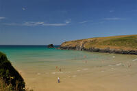
Porthcothan, Bedruthan Steps and Watergate Bay (via bus)
6.8 miles/11.0 km - Moderate-strenuous
A (bus-assisted) one-way walk along the coast with spectacular wildflowers and one of Cornwall's most photographed views over the volcanic rock stacks of Bedruthan Steps, which Victorians liked to think of as a giant's stepping stones.
-
6.8 miles/10.9 km - Moderate-strenuous
Porthleven to Rinsey Head

Porthleven to Rinsey Head
6.8 miles/10.9 km - Moderate-strenuous
A circular walk from Porthleven to the cliff-edge engine houses of Rinsey Head and Trewavas where the under-sea mine, set out with tables and food for the annual Tribute dinner, is said to have been breached by the sea just minutes before all the miners were due underground.
-
6.8 miles/10.9 km - Moderate-strenuous
Talland Bay to Looe

Talland Bay to Looe
6.8 miles/10.9 km - Moderate-strenuous
A circular walk along the coast from Talland Bay to Looe, passing the pilgrimage site of Looe Island which Jesus was said to have visited as a child, and returning via the ancient Giant's Hedge in Kilminorth Wood and Talland's mediaeval church.
-
7.3 miles/11.8 km - Moderate-strenuous
Coverack to Lankidden Cove

Coverack to Lankidden Cove
7.3 miles/11.8 km - Moderate-strenuous
A circular walk on one of the most remote parts of The Lizard from Coverack to the white sand beaches of Downas and Lankidden Coves, where the serpentine underwater landscape provides some of the best snorkelling in Cornwall.
-
7.6 miles/12.3 km - Moderate-strenuous
Mevagissey to Charlestown (via bus)

Mevagissey to Charlestown (via bus)
7.6 miles/12.3 km - Moderate-strenuous
A one-way coastal walk, made circular via an initial bus journey, from the fishing port of Mevagissey to Charlestown - one of the best-preserved Georgian ports in the world and an engineering masterpiece which included a seven-mile-long leat.
-
7.6 miles/12.3 km - Moderate-strenuous
St Buryan to Penberth Cove

St Buryan to Penberth Cove
7.6 miles/12.3 km - Moderate-strenuous
A circular walk along the granite cliffs and the valleys of St Loy's and Penberth Coves, where colourful gardens flourish in one of the mildest winter climates on the British mainland.
-
7.7 miles/12.4 km - Moderate-strenuous
Zennor to St Ives (via bus)

Zennor to St Ives (via bus)
7.7 miles/12.4 km - Moderate-strenuous
A fairly demanding but rewarding one-way coastal walk, made circular via an initial bus journey, along the rugged coast between St Ives and Zennor, passing Seal Island which may have given rise to the legend of the mermaid of Zennor and - thanks to some imaginative naming - ice cream (Moomaid of Zennor). The walk is in the optimal direction to remove time pressure and for panoramic views across St Ives bay.
-
9.9 miles/15.9 km - Moderate-strenuous
Port Isaac to Polzeath (via bus)

Port Isaac to Polzeath (via bus)
9.9 miles/15.9 km - Moderate-strenuous
A one-way coastal walk, made circular via an initial bus journey, from Port Isaac to Polzeath along the Rollercoaster Path to Port Quin, the golden beaches of Lundy Bay via the Iron Age hillfort on the twin headland of The Rumps.
-
12.1 miles/19.4 km - Moderate-strenuous
St Ives to Zennor

St Ives to Zennor
12.1 miles/19.4 km - Moderate-strenuous
A fairly long and demanding but rewarding circular walk along the coffin path and rugged coast between St Ives and Zennor. The walk is organised so that the coastal section is in the optimal direction for panoramic views across St Ives bay.
-
3.6 miles/5.8 km - Strenuous
Poundstock to Millook

Poundstock to Millook
3.6 miles/5.8 km - Strenuous
A circular walk from Poundstock through bluebell woods along the river to the pretty pebbles and chevron-folded cliffs of Millook Haven and along the coast path with panoramic views from Bridwill Point.
-
4 miles/6.4 km - Strenuous
Tregardock to Dannonchapel

Tregardock to Dannonchapel
4 miles/6.4 km - Strenuous
A circular walk from Tregardock, passing the long, remote sandy beach, to the ruins of the mediaeval manor of Dannonchapel, and includes one of the steepest and most spectacular sections of the North Cornish Coast path with vibrant wildflowers in spring and summer.
-
4.4 miles/7 km - Strenuous
Morwenstow to Marsland

Morwenstow to Marsland
4.4 miles/7 km - Strenuous
A circular walk from Vicarage Cliff along the coast path to Marsland Mouth at the Devon border, returning through fields to Morwenstow rectory, church and the Rectory Tearooms - the last stand of the Cornish cream tea before the Devon border.
-
4.5 miles/7.3 km - Strenuous
St Gennys Church to Dizzard

St Gennys Church to Dizzard
4.5 miles/7.3 km - Strenuous
A circular walk at St Gennys from the mediaeval church, via the smuggling routes though bluebell woods along the stream and an Iron Age clifftop fort crumbling into the sea, to some of North Cornwall's most remote coastline.
-
4.7 miles/7.6 km - Strenuous
Barrett's Zawn and Dannonchapel

Barrett's Zawn and Dannonchapel
4.7 miles/7.6 km - Strenuous
A circular walk including some of the more remote parts of the coast path around Port Isaac Bay, passing the Donkey Hole at Barrett's Zawn and returning through the abandoned hamlet of Dannonchapel.
-
5 miles/9 km - Strenuous
Porthpean to Black Head

Porthpean to Black Head
5 miles/9 km - Strenuous
A circular walk from the sandy beach at Porthpean, past the brilliant white shingle beaches at Silvermine to the Iron Age fort on Black Head, returning via the site of an Iron Age metal works with spectacular views over St Austell Bay.
-
6.4 miles/10.3 km - Strenuous
Crackington Haven to Widemouth (via bus)

Crackington Haven to Widemouth (via bus)
6.4 miles/10.3 km - Strenuous
A one-way coastal walk, made circular via an initial bus journey, along the Shipwreck Coast from Crackington Haven to Widemouth Bay passing the bluebell woodland of ancient twisted oaks at The Dizzard, chevron folded rocks and honeycomb reefs of Millook Haven and fossil beds of Wanson Mouth.
-
6.6 miles/10.6 km - Strenuous
Pentewan Valley and Black Head

Pentewan Valley and Black Head
6.6 miles/10.6 km - Strenuous
A circular walk from the lost port of Pentewan along the coast to the remains of the Iron Age fort overlooking St Austell Bay on Black Head, returning via the nature reserve that was once the King's wood and the trackbed of the horse-drawn tramway used for china clay and Sunday School outings.
-
7 miles/11.2 km - Strenuous
Crackington Haven to Boscastle (via bus)

Crackington Haven to Boscastle (via bus)
7 miles/11.2 km - Strenuous
A one-way coastal walk, made circular via an initial bus journey, along the Shipwreck Coast from Crackington Haven to Boscastle passing the highest cliff in Cornwall and the long, sandy beach at The Strangles.
-
7.1 miles/11.5 km - Strenuous
Polperro to Lansallos

Polperro to Lansallos
7.1 miles/11.5 km - Strenuous
A circular walk along the rugged coast from Polperro, where a bell buoy rings out across the waves from the treacherous reef known as Udder Rock.
-
7.3 miles/11.7 km - Strenuous
Portreath to Wheal Tye

Portreath to Wheal Tye
7.3 miles/11.7 km - Strenuous
A circular walk along the rugged coast from Portreath towards Porthtowan passing small coves and remnants of the clifftop mines beside the old RAF base, and returning via the horse-drawn tramway that brought fortune to Portreath harbour, where its "lighthouse" and "monkey house" remain from the shipping activity.
-
9.7 miles/15.6 km - Strenuous
Port Isaac to Tintagel

Port Isaac to Tintagel
9.7 miles/15.6 km - Strenuous
A one-way walk from Port Isaac to Tintagel along towering cliffs, past the long, sandy beaches of Tregardock and Trebarwith, the slate pinnacles of the coastal quarries and via the mediaeval cliff-top church to the castle of Arthurian legend.


")


Download the iWalk Cornwall app and use the QR scanner within the app to find out more about any of the walks above.
